South Florida is heading into the Independence Day weekend with a familiar Summertime forecast: hot, humid conditions and daily afternoon storms.
Today, scattered to numerous showers and storms will develop during the afternoon, first across the interior before spreading toward the metro areas later in the day. The atmosphere remains very moist, allowing storms to produce frequent lightning, heavy downpours, and gusty winds. Because storm movement will be slow, some neighborhoods could see multiple rounds of heavy rain, increasing the risk of localized flooding in urban and poor drainage areas.
Temperatures will climb into the low 90’s, while humidity pushes heat index values between 103 and 108 degrees. Moderate HeatRisk remains in place, so be sure to stay hydrated, take frequent breaks if you’re outdoors, and never leave children or pets in a parked vehicle.
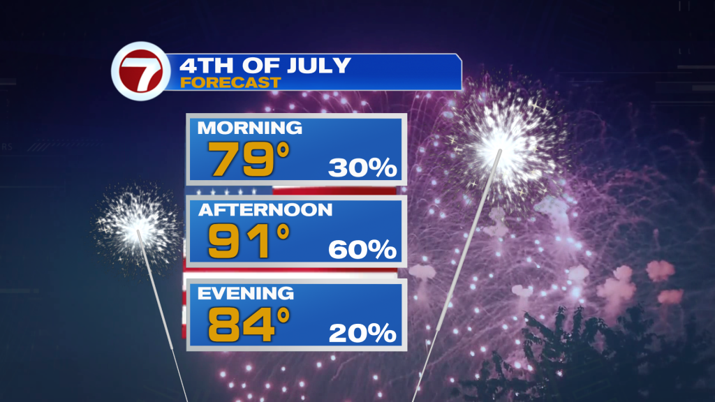
Looking ahead to the Fourth of July weekend, expect a return to a more typical summer weather pattern. Saturday and Sunday will start with a mix of sunshine and clouds before scattered afternoon storms develop, mainly across the interior and Southwest Florida as sea breezes collide. East coast communities should see the best chance to enjoy outdoor plans during the morning and early afternoon before storms become more likely later in the day.
Holiday Weekend Tips
- – Plan outdoor activities early in the day.
- – Keep an eye on the radar if you’re heading to the beach, pool, or barbecue.
- – Remember: When thunder roars, go indoors.
- – Stay hydrated as heat index values will continue to top 100 degrees each afternoon.
- – Remember: When thunder roars, go indoors.
- – Keep an eye on the radar if you’re heading to the beach, pool, or barbecue.
Today in the Tropics
The Atlantic Basin remains quiet, and the National Hurricane Center is not tracking any tropical systems.
Have a wonderful and safe 4th of July weekend South Florida.
Vivian Gonzalez
Meteorologist, AMS Certified
WSVN Channel 7