There are 2 main weather features as we continue through the midweek: Hot temperatures (hotter than usual) and hazy skies. The layer of haze is mainly due to the arrival of Saharan Dust. It’s creating a milky looking sky, as shown below, just before sunset Tuesday.

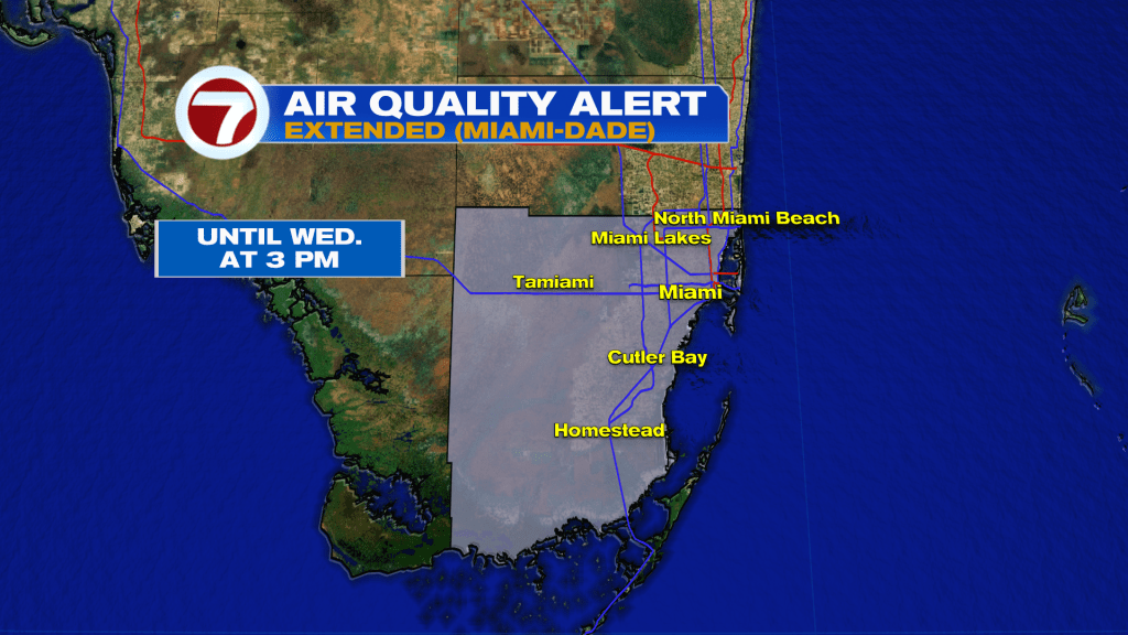
The Air Quality would be an issue with just the Saharan Dust, but we also have lingering smoke from Brush Fires. Some Fires have been ongoing for over a week now. With light winds, pollutants remain “most problematic” near the source, or site, of these fires located west of the Miami metro area. Smoke could drift in multiple directions (or simply fan-out) to include more areas across Miami-Dade. As of this writing, an Air Quality Alert has been extended until Wednesday at 3 PM for the entire county.
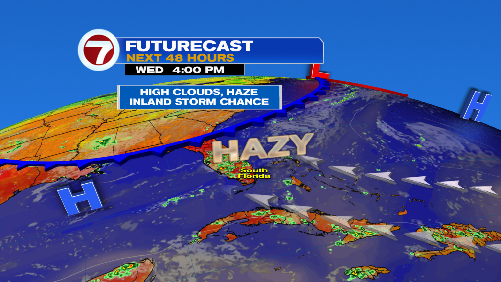
So, our Wednesday weather isn’t looking ideal (but could be a lot worse in June)! Weak High Pressure extends across the Gulf waters as well as in the distant Atlantic. For us, it’s a light and steamy air flow that continues. You’ll see in the map below that there’s a Front nudging into north Florida. That weak boundary, though, will suddenly stall then fall apart.
While the south Florida weather won’t be “a winner” the forecast for the FIFA world cup, hosted in Miami once again, looks pretty favorable. For Watch Parties (ahead of the match between Scotland and Brazil) you can expect typical summer steam and only isolated showers or a stray storm. Then, Game time (6 PM Wednesday) will be cloudy and humid with a minor risk for short-lived rain.

If you’re thinking ahead to the upcoming weekend, conditions are forecast to be very similar. Another round of Dust may arrive late-week with lower than usual rain chances overall.

Copyright 2026 Sunbeam Television Corp. All rights reserved. This material may not be published, broadcast, rewritten or redistributed.