

Happy Tuesday, South Florida!
Dylan FedericodfedericoEdit Profile
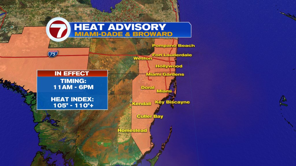
A heat advisory has been issued for Miami-Dade and Broward counties from 11am to 6pm today. The heat index will climb up to 110 degrees. Please stay cool & hydrated!
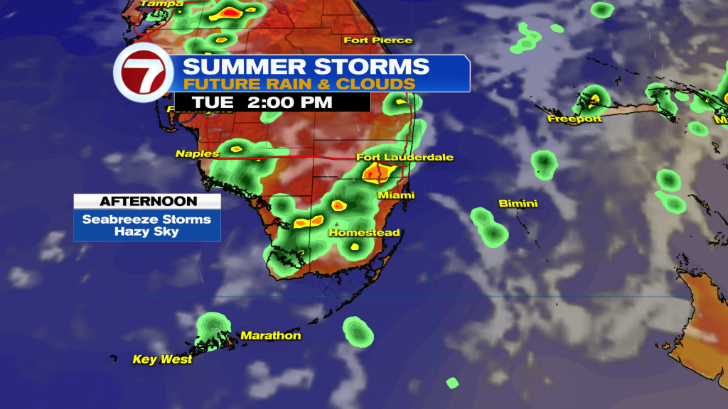
Scattered showers and storms are back in the forecast today. The best chance will be along the sea breeze early afternoon before storms push inland later in the day. I don’t see storm coverage being as high as Monday. A few could be strong — with heavy rain, gusty winds, and dangerous lightning being be main threats.
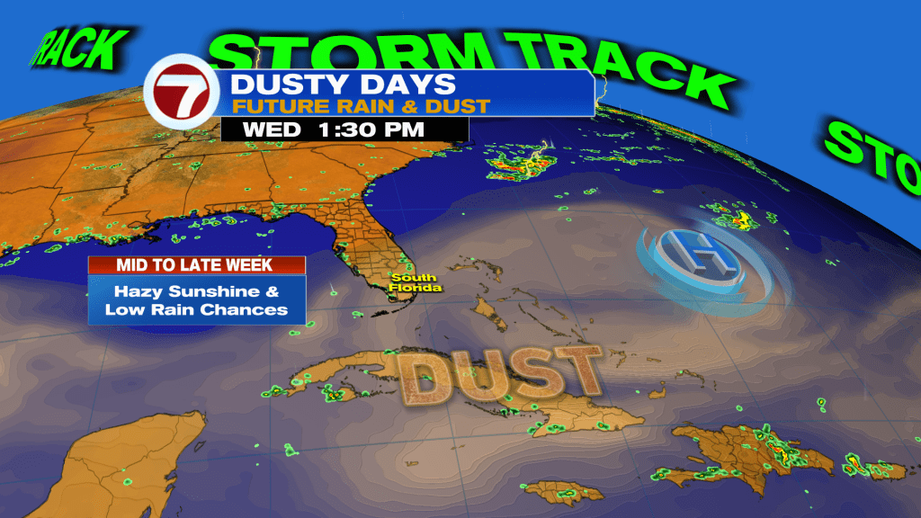
A huge plume of Saharan dust will move across Florida starting today and will continue for much of the week. Our rain chances will go down dramatically starting tomorrow — with lower rain chances continuing through the weekend as a second round of dust impacts the area.
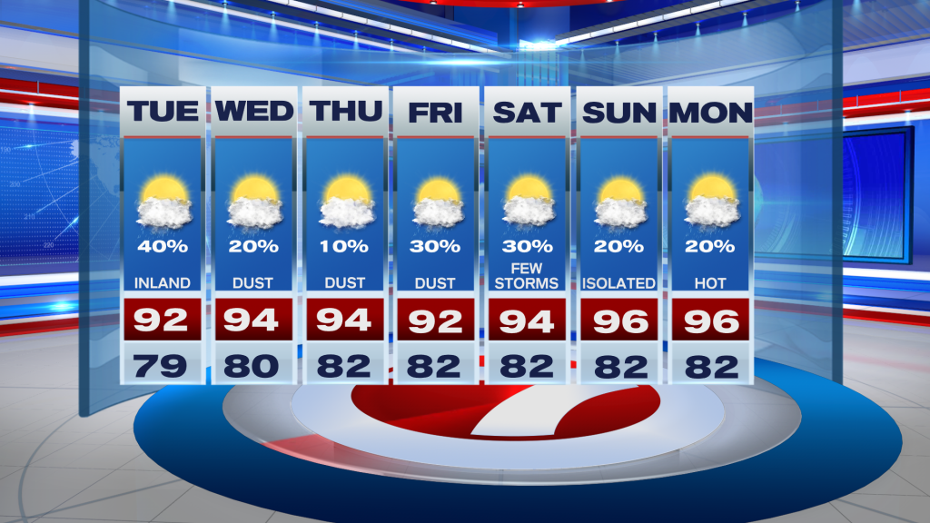
The combination of lower rain chances and high pressure nosing in from the Atlantic will send our temperatures soaring into the mid-90s for the second half of the week. The heat index will easily climb to dangerous levels in the 105 – 110+ range — which means Heat Advisories maybe required any given day.
TROPICAL UPDATE: All is quiet in the Atlantic as Saharan dust, dry air, and wind shear dominate the Basin — thanks to El Niño flexing its muscles. The National Hurricane Center calls for no development over the next seven days. I don’t see any signs of tropical mischief in the long range models either. Next name on the list is Bertha.
