(WSVN) - The last weekend of June will sure feel like it as a hazy, hot and humid couple days are on tap for South Florida.
The most robust plume of Saharan dust to reach South Florida will make its appearance Saturday through Monday, leading to hazy skies and eventually low rain chances.
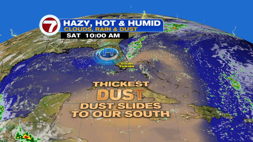
This layer of dust won’t be thick enough to completely cutoff rain chances, however, and air quality isn’t expected to be impacted.
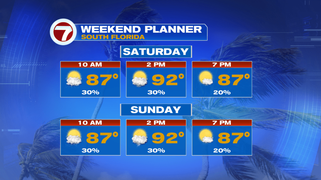
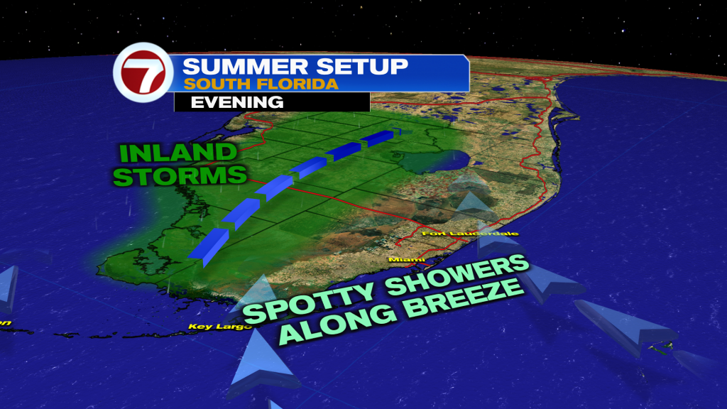
As a result, expect times of clouds and hazy sunshine Saturday with isolated showers and storms, especially during the morning and midday hours.
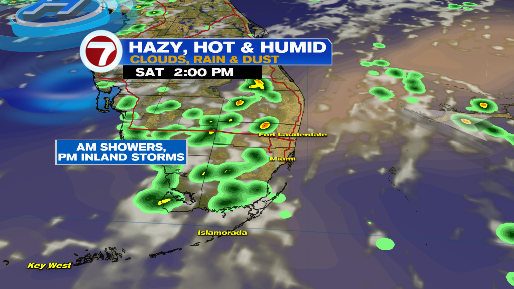
That’s before the increasing, Atlantic breeze pushes most of the afternoon storms to our west.
Then on Sunday, expect basically a copy-and-paste forecast with high temperatures in the low 90s for most locations.
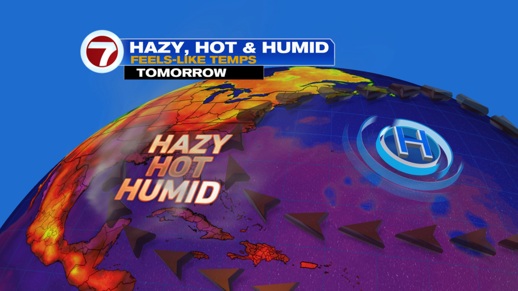
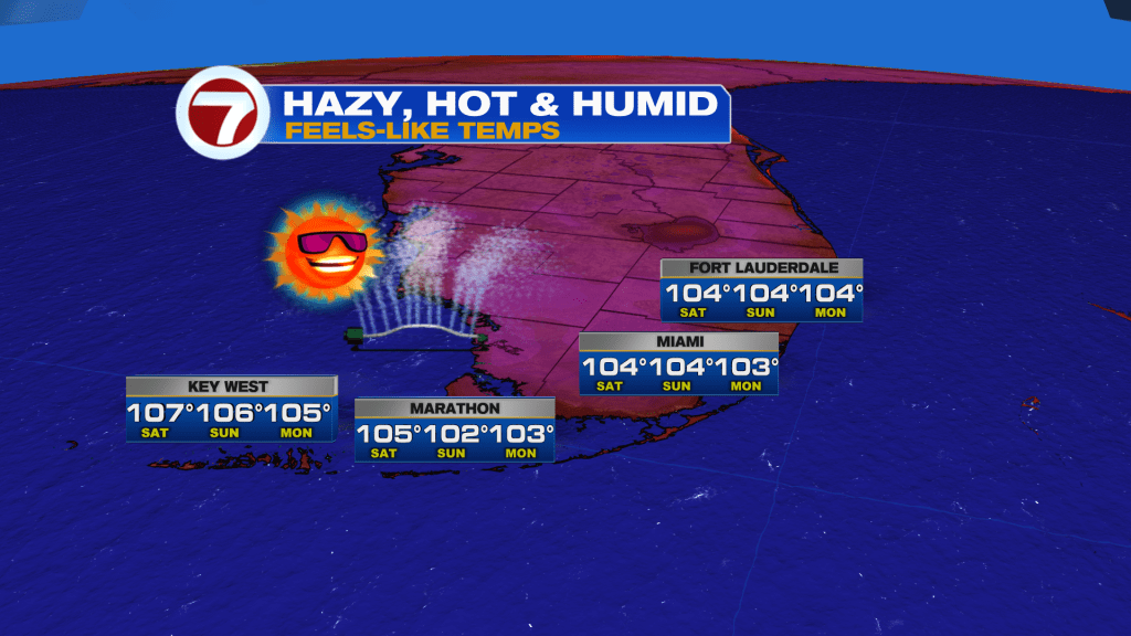
Feels-like temps will generally be in the 100-105F range both afternoons this weekend.
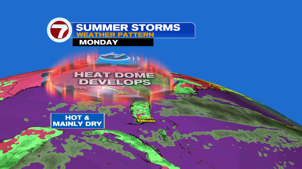
It will remain quite hot — if not hotter — early next week as a heat dome builds in to our north. This will also coincide with low rain chances.
Chances for showers and storms are forecast to then increase somewhat for the second half of next week as moisture flows in from the north.
Copyright 2026 Sunbeam Television Corp. All rights reserved. This material may not be published, broadcast, rewritten or redistributed.