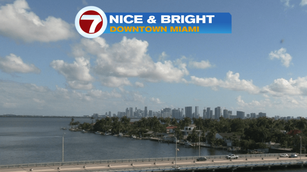
A lot of us would like to have a “pause button” for the weather, considering how nice the weekend started! Here’s a look at Saturday afternoon (below) featuring plenty of sunshine, lower humidity, and a nice ocean breeze. It was also helpful to have a dry day after a string of wet and stormy ones.
The better weather is the result of High Pressure off the SE coast of the United States and its associated drying.
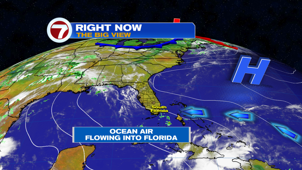
As much as we’d like to have the High hold its position, it’s slowly going to head away. That means weather changes are coming, albeit gradually.
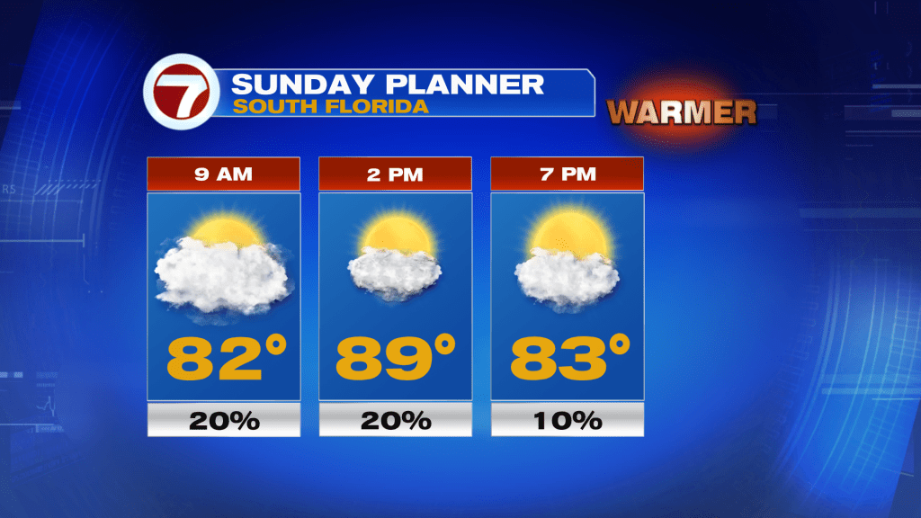
The Sunday forecast (above) indicates a slight rain chance with more clouds arriving. Still, we’ll continue to have an onshore flow, yet lighter winds. Temperatures will peak close to 90-degrees with more humidity detected (especially later in the day). Basically, winds will begin to veer more out of the southeast than east. More steamy conditions are forecast by the middle of the week.
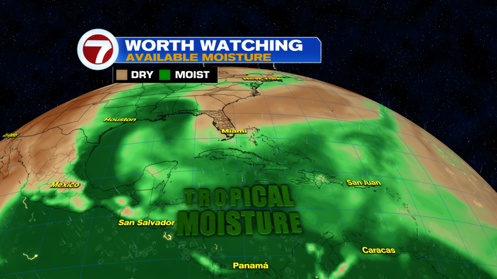
Notice the tropical “steam” with deep moisture over the Caribbean at the moment. Over time, it’s likely to expand northward with plenty of fuel for future downpours. We’ll also get more widespread rainfall, once the shield of moisture grows during the middle of the week.
Copyright 2026 Sunbeam Television Corp. All rights reserved. This material may not be published, broadcast, rewritten or redistributed.