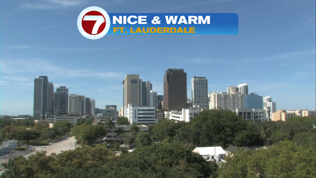
There’s no doubt about it, temperatures are heading higher across south Florida this week. We’ve been on an upward trend since Monday (when we had more clouds and areas of rain). On Wednesday afternoon, the Ft. Lauderdale sky looked beautiful with only some thin, high cirrus clouds over us.
Another notable change is the lack of ANY activity on the radar. We’re now very dry.
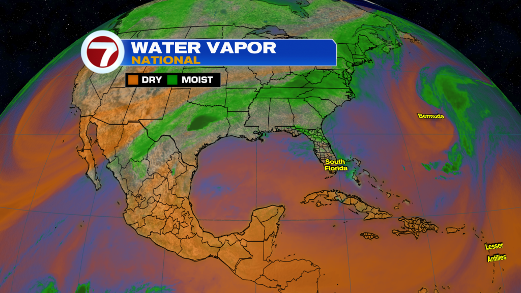
At the heart of our drying and heating? A substantial ridge (or bubble) of High Pressure is building from the west. Notice, below, the deep drying across the Gulf region, extending from the Yucatan towards Cuba. South Florida is now on the western periphery of this High Pressure aloft and it’s the “early innings” of a hot weather streak.
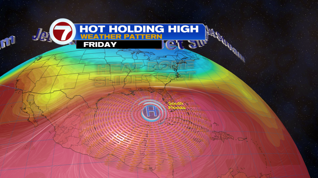
Here’s another view, below, of the plotted High Dome that centers close to south Florida on Friday.
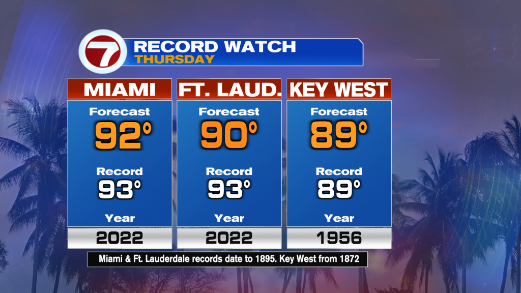
Even before we get close to the weekend, we’ll be dealing with near-record temperatures (starting Thursday). The best chance of reaching record highs, potentially, will be Miami and Key West.
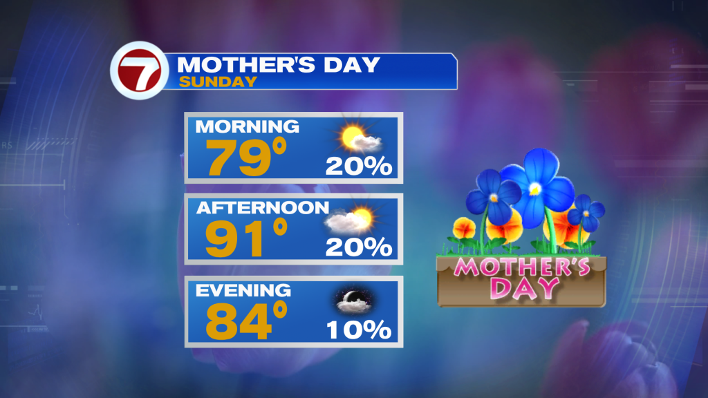
The goal over the next several days is to try and stay as cool as possible during peak heating times. With humidity elevating, too, the “feels like” temperatures (heat index values) will be near triple digits. The peak will probably come during the upcoming weekend so it will be important to see that all the “Mom’s” are as comfortable as possible this Mother’s Day weekend! Here’s the latest forecast for the holiday, Sunday (shown below).
Copyright 2026 Sunbeam Television Corp. All rights reserved. This material may not be published, broadcast, rewritten or redistributed.