

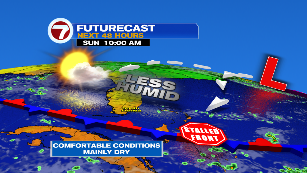
After a soggy stretch, South Florida is finally getting a break. A weak front is bringing drier air, northerly winds and lower rain chances through the weekend.
Quieter Weekend
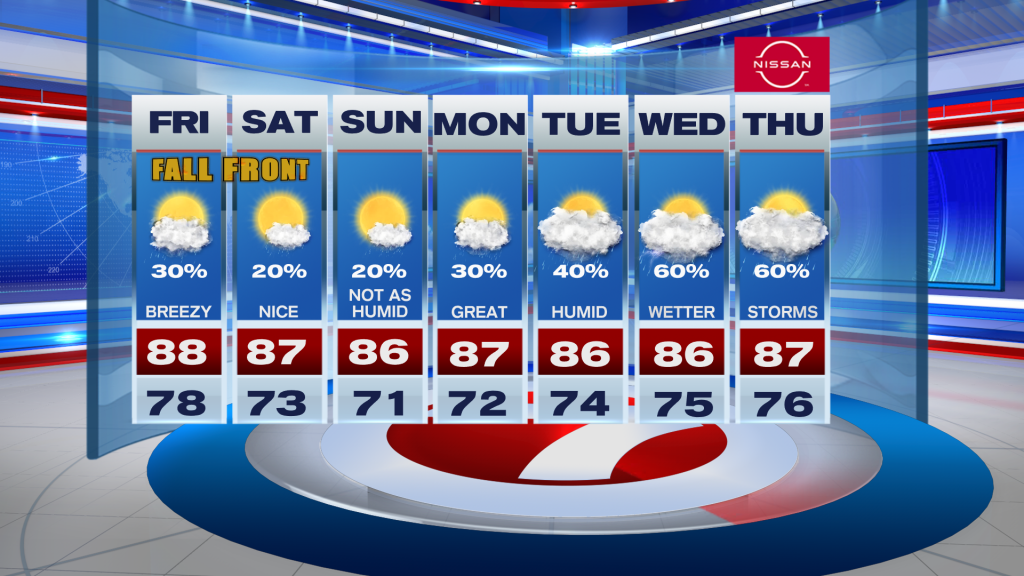
A few scattered showers are still possible today, mainly across Southeast Florida, but widespread heavy rain and flooding are no longer a concern. The quieter pattern continues through Sunday with highs in the upper 80’s.
King Tides & Rough Surf
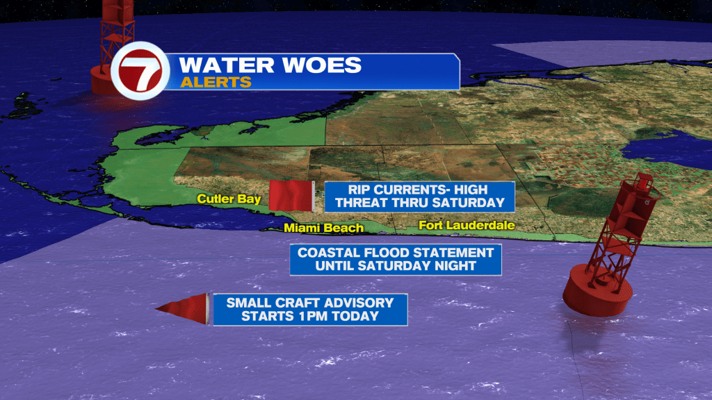
While conditions improve on land, hazards increase along the coast. Atlantic seas could build to 7–10 feet. A high risk of rip currents is also in effect.
King Tides combined with the full moon and elevated swell could produce minor coastal flooding around high tide today and through the weekend.
Tracking Fay & Gonzalo
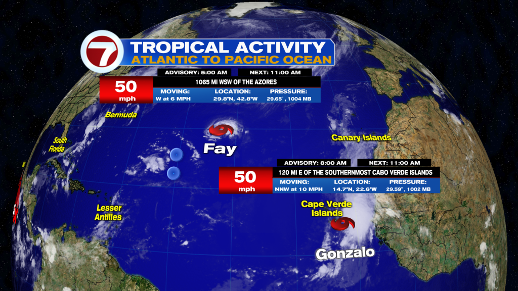
We’re tracking two tropical storms in the Atlantic. Gonzalo has strengthened to 50mph near the Cabo Verde Islands, where tropical storm conditions are spreading across the region.
Farther west, Fay also has 50mph winds as it moves slowly westward over the central Atlantic. Fay currently poses no hazard to land.
Rain Returns Next Week
Enjoy the drier weekend while it lasts. Tropical moisture returns early next week, with rain chances potentially climbing to 60–80% by Tuesday into midweek.
Have a wonderful weekend and make it a safe one!
Vivian Gonzalez
Meteorologist, AMS Certified
WSVN Channel 7