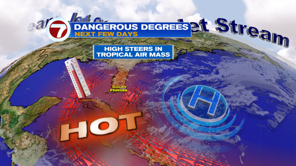
The dangerously high combination of temperatures and humidity will continue this Thursday across South Florida, prompting the National Weather Service to issue a Heat Advisory for the area.
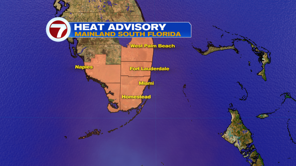
In Miami-Dade and Broward Counties, the advisory is in effect through Friday 7PM with feels-like temperatures up to 105-110F during the afternoon and evening hours.
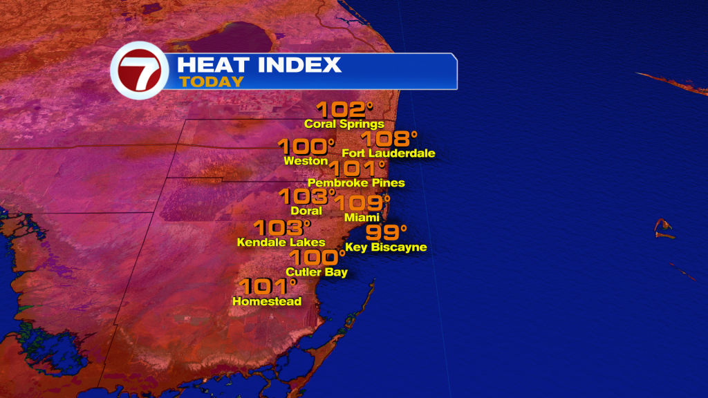
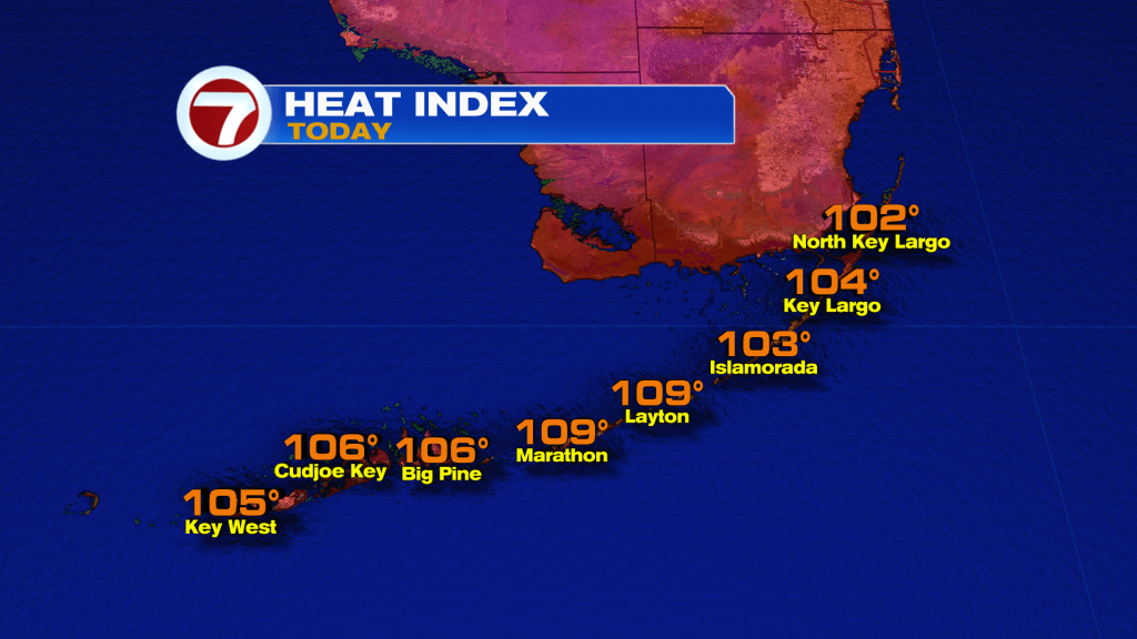
The advisory in the Florida Keys is in place through 5PM this Thursday due to peak heat indices in the 108-112F range for at least two consecutive hours.
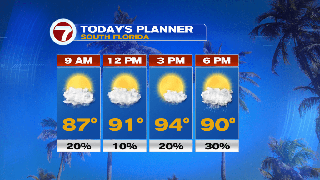
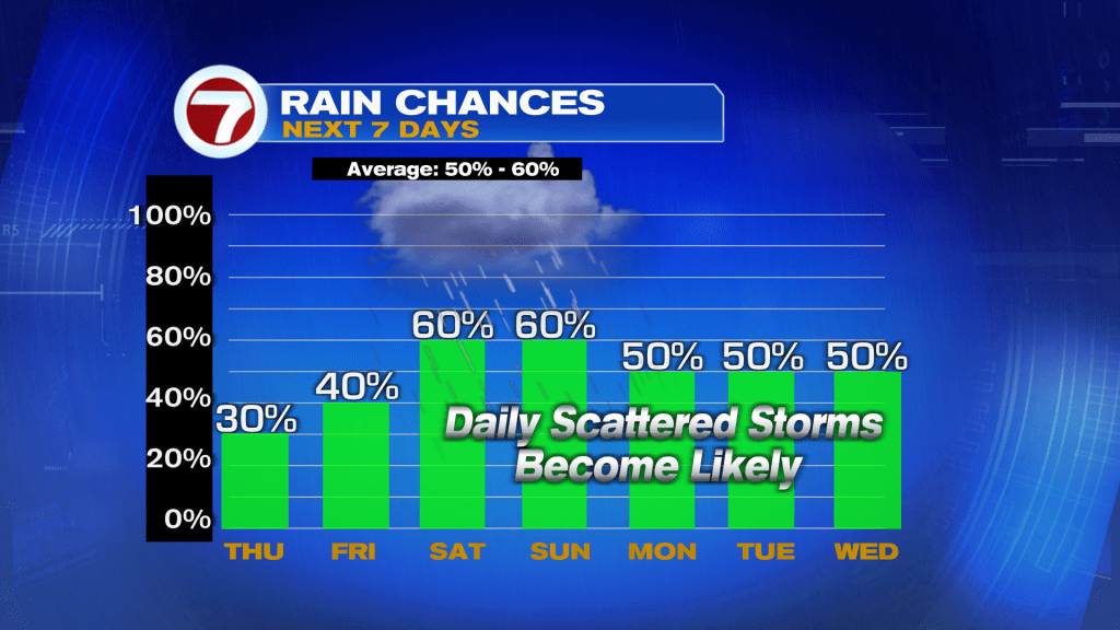
The day overall should be drier with only a 30% chance for seeing late-day showers and storms. Otherwise the day will be dominated by a good deal of sunshine with a steamy, southerly breeze.
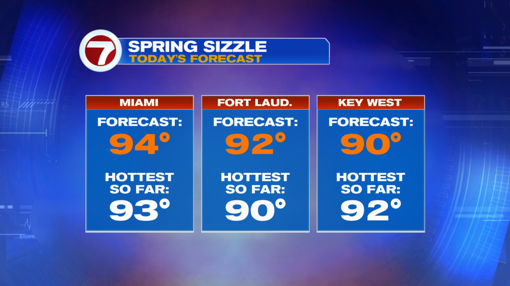
Actual high temperatures will be in the low to mid 90s this afternoon, which would make it the hottest day so far this year in Miami and Fort Lauderdale.
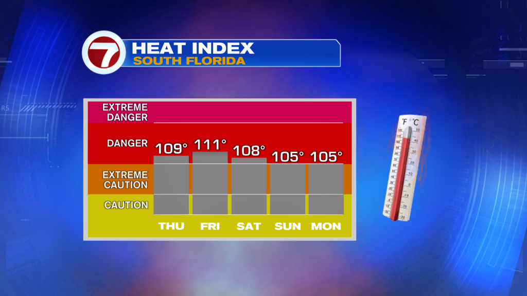
The heat will continue on Friday with temperatures actually forecast to be a degree or two higher. Some locations could experience feels-like temperatures in excess of 110F.
Friday will feature morning sunshine then scattered showers and thunderstorms at times during the afternoon and evening hours.
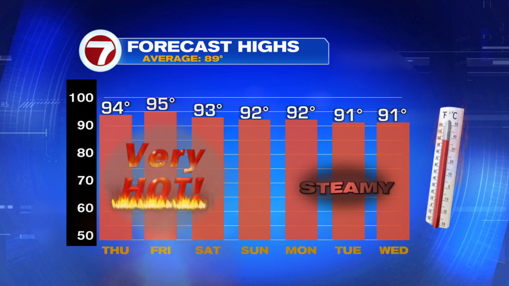
By the weekend, our pattern will change as the storm track shifts farther south and back across Florida. This will lead to a better chance for showers and storms on both Saturday and Sunday, meaning it will be wet at times on Father’s Day. Despite the wetter weather, temperatures will remain hot and above average into the upper 80s to low 90s.
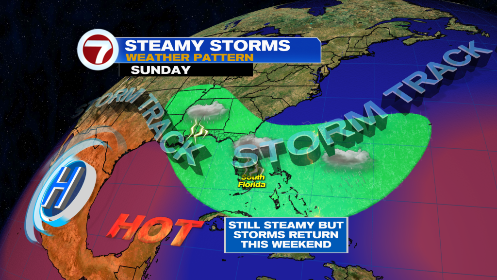
The pattern next week will continue to feature moderate to high rain chances along with temperatures closer to normal.
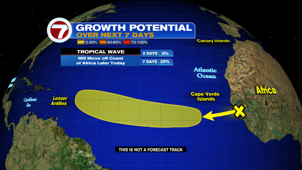
In the tropics, a tropical wave moving off the coast of Africa has a low, 20% chance of tropical development over the next week. Conditions appear favorable for at least some development as it tracks west across the Atlantic Ocean.