(WSVN) - After a soggy and unsettled stretch of weather, our weather pattern is about to take a turn for the better — just in time for the first weekend of June.
Those gradual changes have already been noticed this Thursday as the bulk of the activity has been focused across southern Miami-Dade and parts of the Florida Keys. This will be the area where downpours will be most likely tonight while most of the South Florida metro should be dry.
This trend of activity shifting farther south will hold true into Friday, with scattered showers and storms most likely for the Florida Keys while much of the mainland South Florida should be dry.
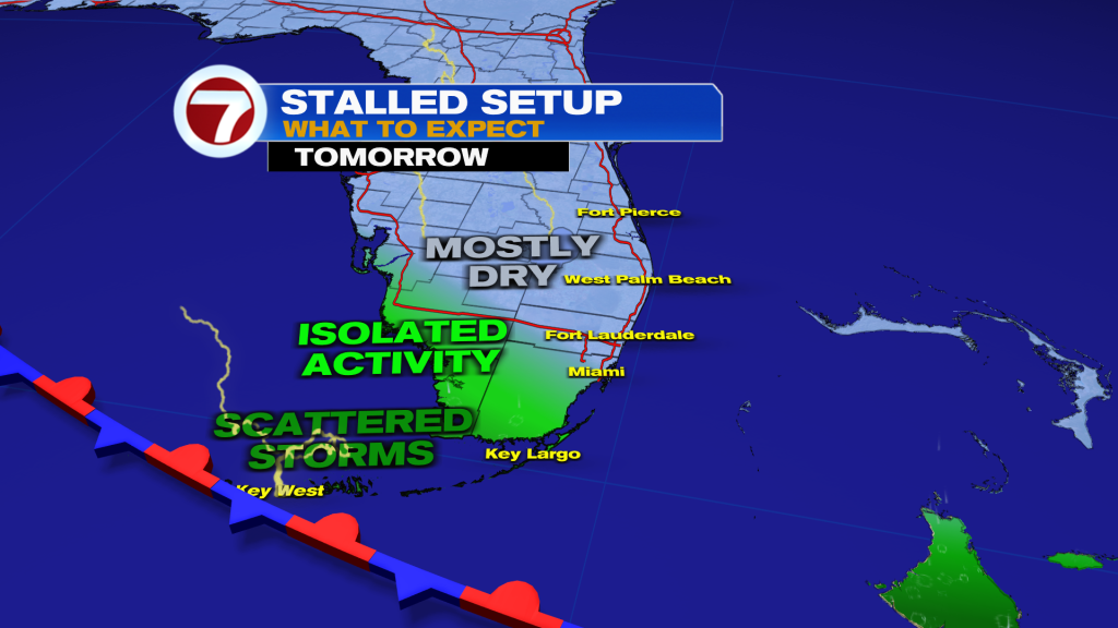
Unfortunately, clouds should remain stubborn but some peeks of sunshine are still expected, especially in the afternoon, Friday.
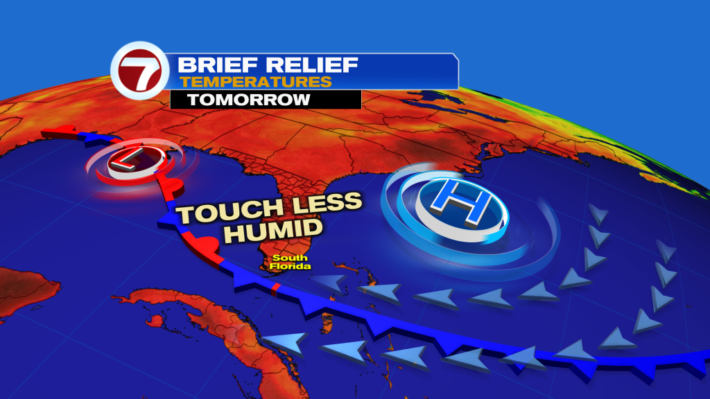
High temperatures will remain mild and below average in the mid 80s as an onshore breeze draws in this less hot air mass. The added bonus will be less humid air, too, which will linger into Saturday!
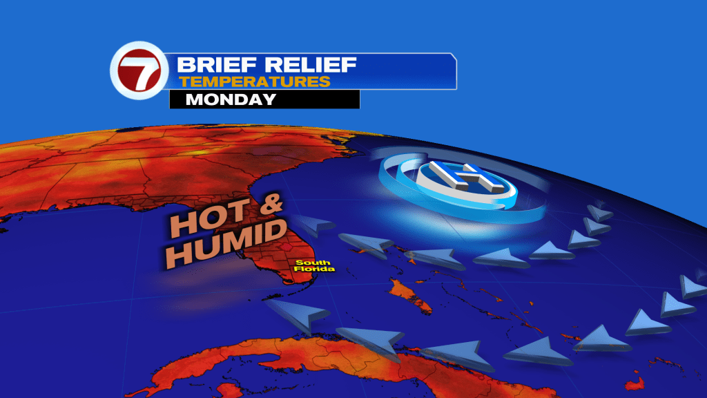
As the weekend progresses and we get to the start of next week, temperatures and humidity will rise once again with highs around 90F by Monday courtesy of a southeast wind direction.
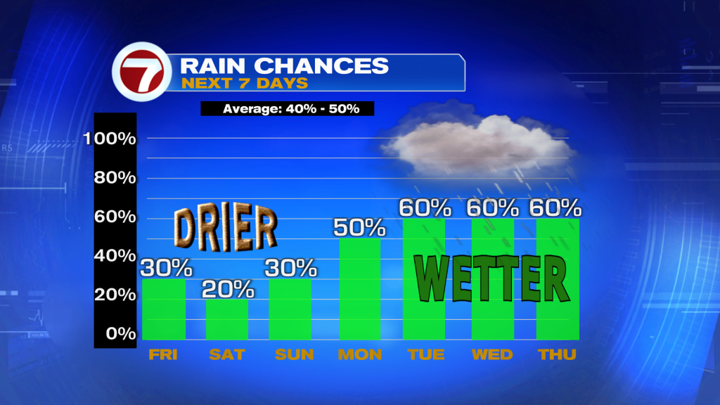
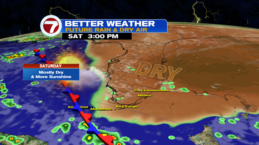
Besides that, lots of dry time is on tap for the weekend. Saturday is forecast to be mostly dry and sunny. Then on Sunday, isolated showers and storms will be possible — mainly during the first half of the day — as moisture levels begin to rise.
Those moisture levels will continue to rise heading into next week, resulting in higher rain chances.
Copyright 2026 Sunbeam Television Corp. All rights reserved. This material may not be published, broadcast, rewritten or redistributed.