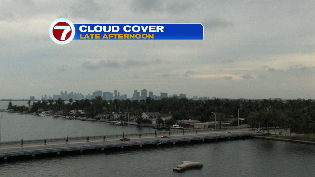
A high deck of clouds and some haze made for a gloomy end to the work week. The cloud cover may prove stubborn to break as the weekend begins and our current weather pattern holds.
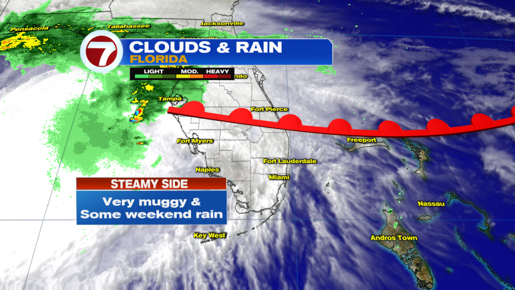
We have a warm southerly air flow, and it’s giving us access to plenty of moisture. As Friday was coming to an end, most of the rain was concentrated over the Gulf of Mexico in association with Tropical Storm Nestor.
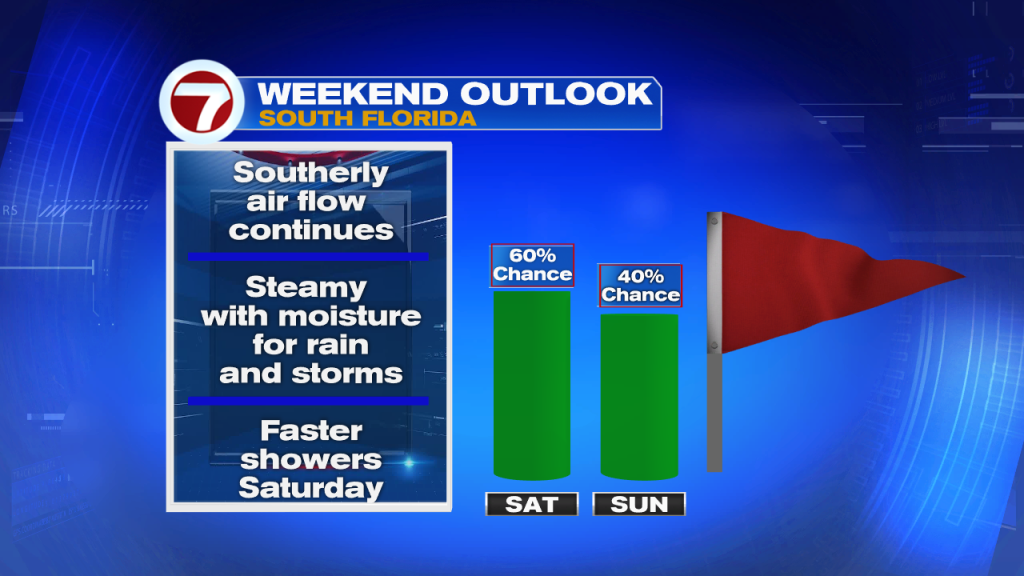
Rain chances will be running quite high for the weekend, but there’s at least one difference in the days ahead. Showers that are expected on Saturday (from time to time) will tend to be fast-movers, and therefore brief in duration. Like a water faucet, these will be ‘on and off’ type areas of rain. Then, on Sunday, showers will be both scattered and slower moving. We’ll call them “drifters” with the potential for bringing down heavy amounts over favored areas.
Weekend temperatures will remain hot (in spite of clouds and occasional rain bands). Typically this time of year, we’d have highs in the middle 80’s instead of near 90-degrees with stifling humidity.

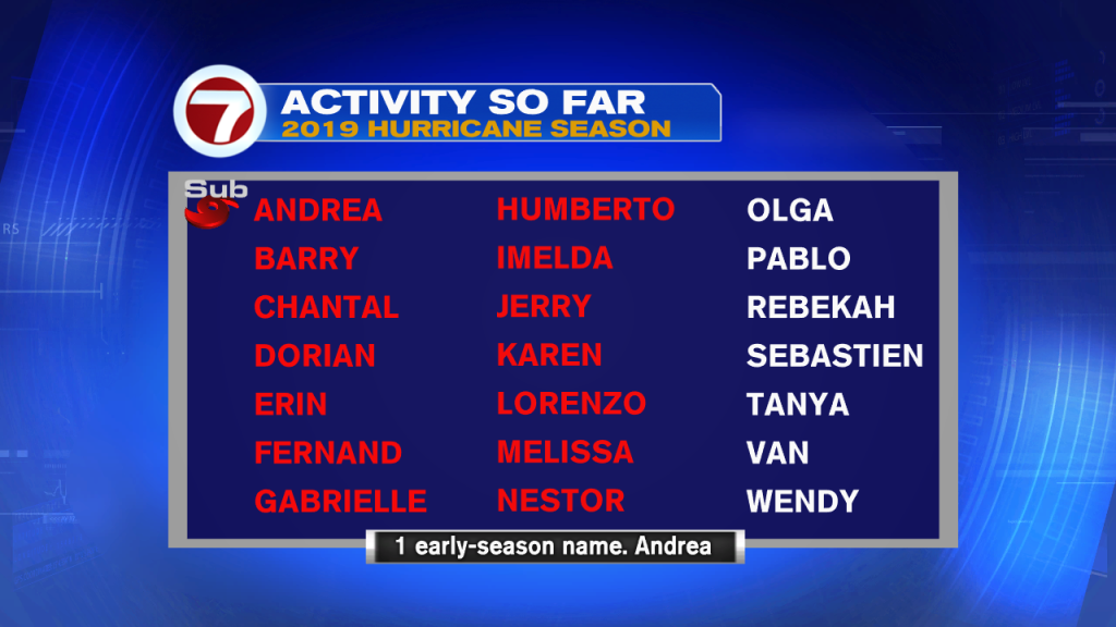
Tropical Storm Nestor will have a short life line, but it makes the list as the season’s 14th named storm. Officially, it’s a busy tropical year considering 12 is the average number of storms in any given season (for the Atlantic basin).