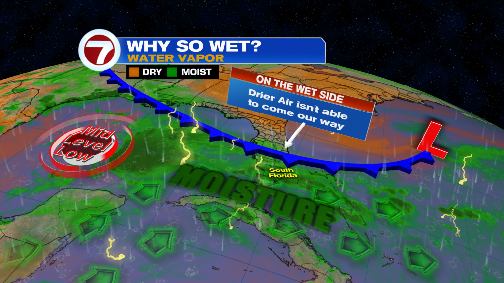
(WSVN) - It sure has been a wet Wednesday with cloudy skies giving way to a widespread rain across South Florida. The saving grace is that heavy rainfall totals have been scare, reducing the risk for flooding.
With that said, it won’t take much additional heavy rainfall in a short period of time to lead to isolated areas of flooding the rest of the day Wednesday and then again on Thursday.
Expect rain to gradually decrease in coverage after sunset Wednesday with only isolated showers lingering.
A stronger breeze out of the northeast will keep it warm but fairly comfortable in the mid to upper 70s overnight.
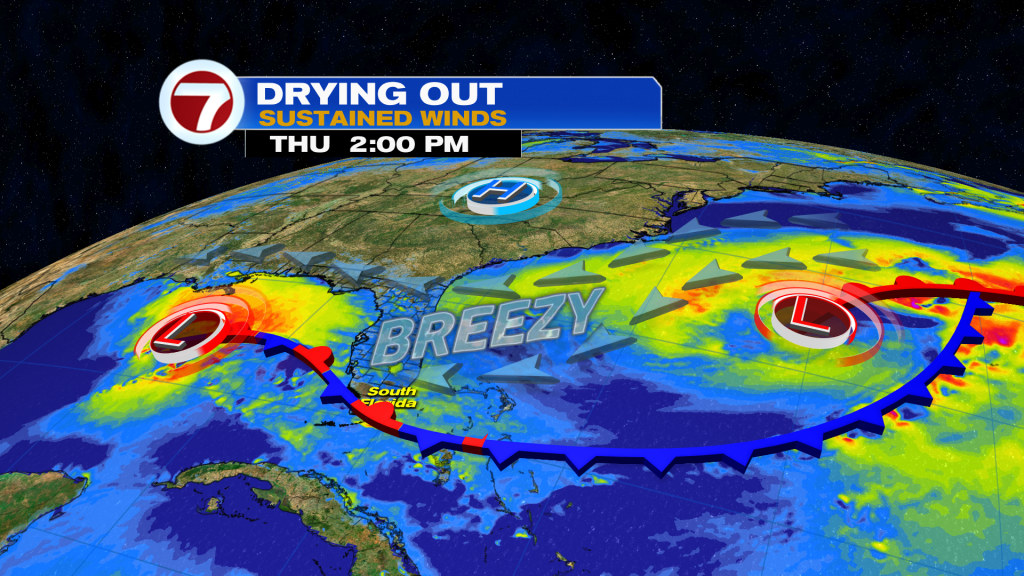
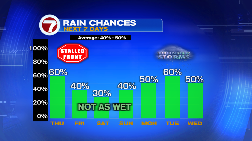
Thursday will be another unsettled day across South Florida but areas that see rain should start to shrink in coverage as a front slowly sags south throughout the day. Therefore, the farther north you are, the more likely you are to avoid much rain.
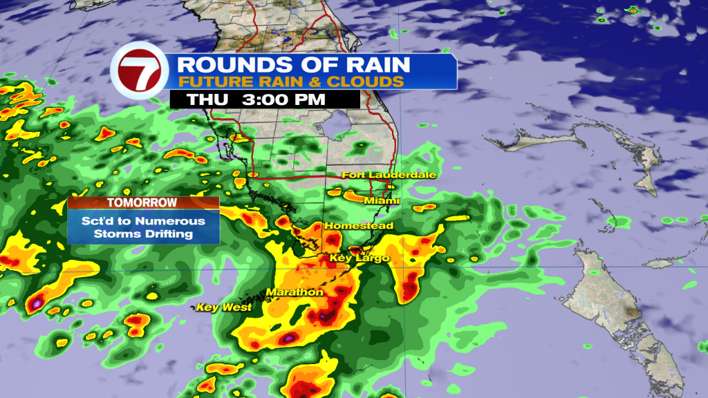
Overall, scattered showers and thunderstorms are likely at times paired with mostly cloudy skies, breezy conditions and highs only in the low to mid 80s.
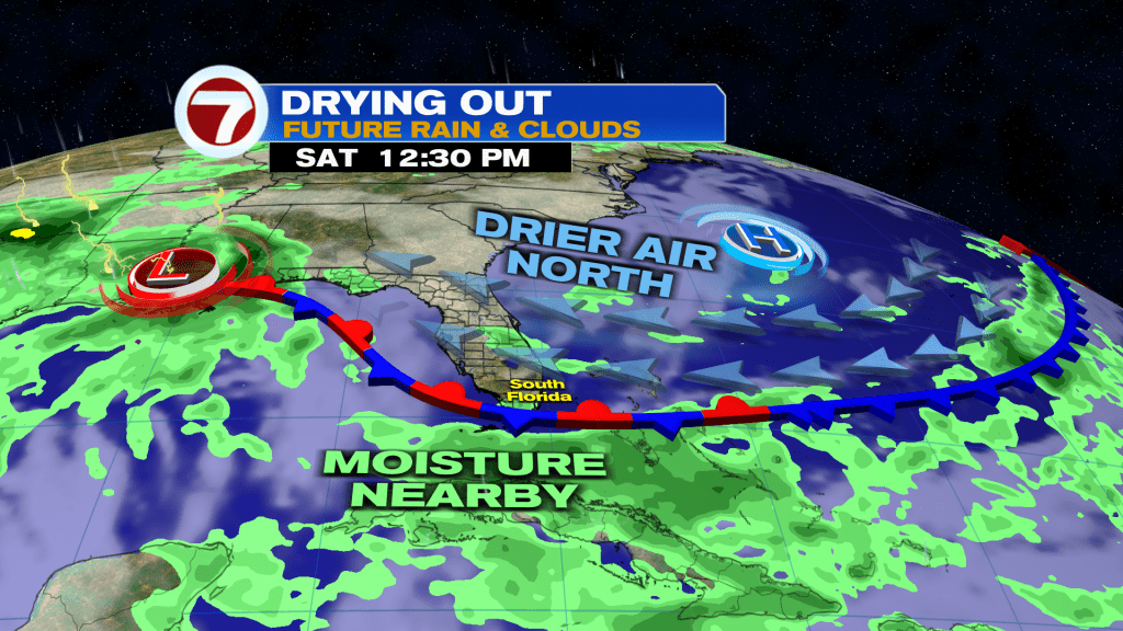
This rare June front is poised to stall just to our our south — either across the Florida Keys or Straits — Friday into Saturday, allowing for drier air to filter in.
While completely dry conditions are unlikely, fewer showers and storms are expected to end the week and begin the weekend. That will come with more sunshine overall and seasonably mild conditions.
Unfortunately for fans of the drier and less hot weather, it won’t last long because temperatures and rain chances are forecast to rise by the start of next week as winds veer out of the southeast.
Copyright 2026 Sunbeam Television Corp. All rights reserved. This material may not be published, broadcast, rewritten or redistributed.