

Happy Tuesday, South Florida!
The big story is the stormy stretch across Florida through Labor Day Weekend. We will see more typical sea breeze storms through tomorrow, however, a plume of deep tropical moisture associated with Dolly’s remnants will send our rain chances even higher heading into the holiday weekend.
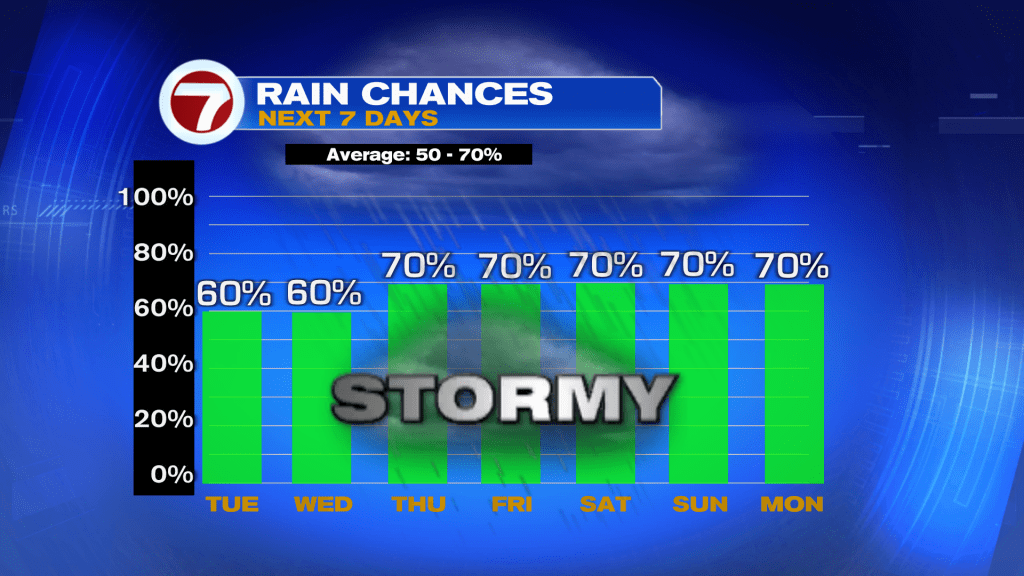
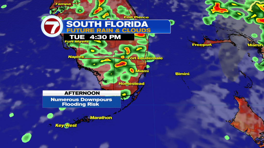
As for today, scattered showers and storms will be around throughout the day, with the best chance being in the afternoon.
The remnants of Dolly — which is now a tropical wave — will push across Florida on Thursday into Friday, which will send our rain chances even higher heading into the weekend.
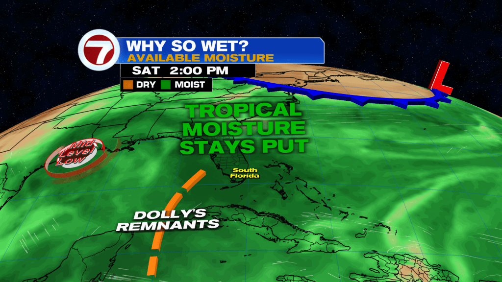
A Fall front sweeping across the eastern United States will trap even more moisture over Florida, which will keep us very wet through Labor Day.
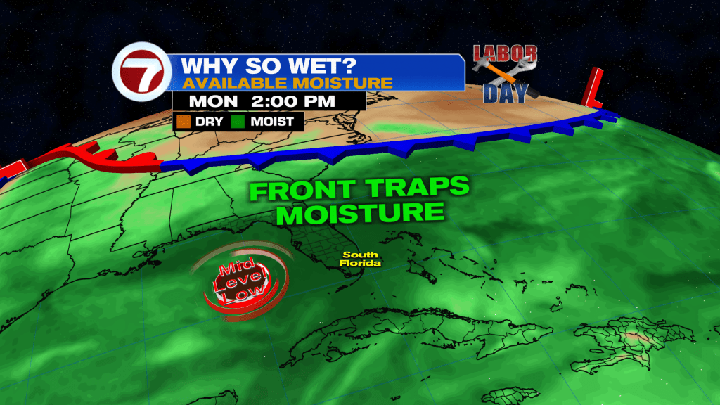
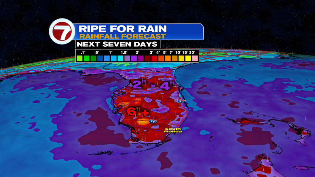
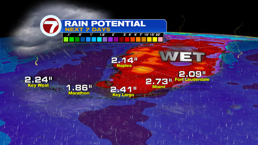
Once it’s all said and done, Florida will see widespread rainfall totals of 2 – 4″ with isolated totals much higher. Flash flooding could occur any day through Labor Day weekend.
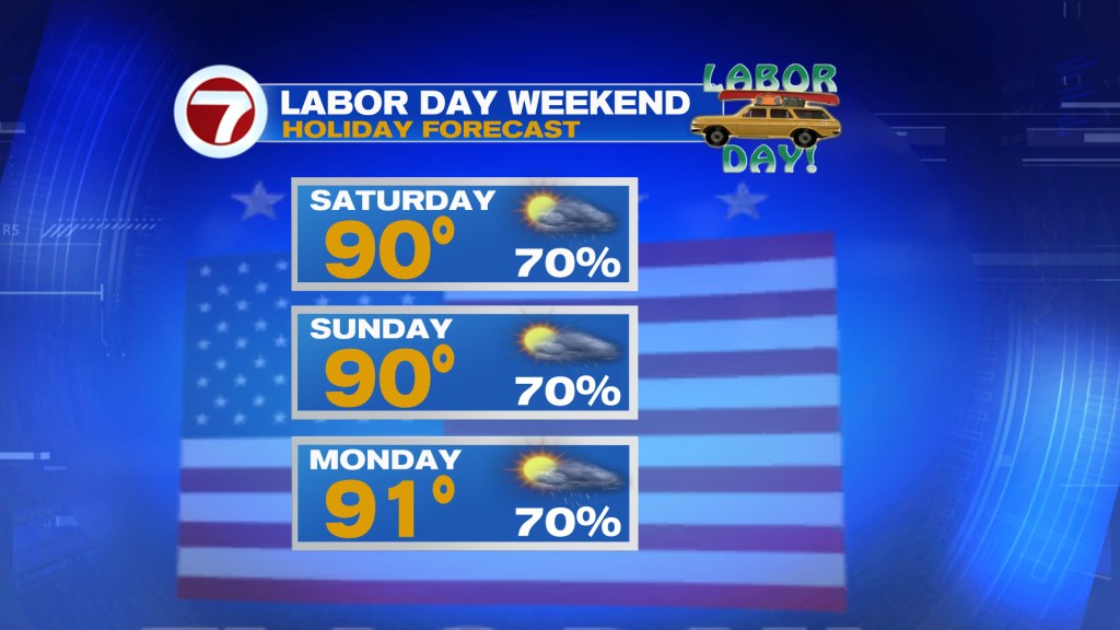
Overall, the Holiday weekend is looking wet with storms likely each day and highs around 90. I would have backup plans indoors.
TROPICAL UPDATE:
Tropical Storm Edouard formed in the Northern Gulf yesterday evening.
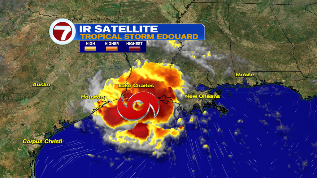
The National Hurricane Center calls for Edouard to make landfall near the Texas and Louisiana border this afternoon.
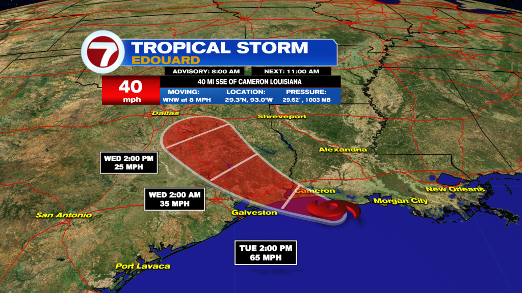
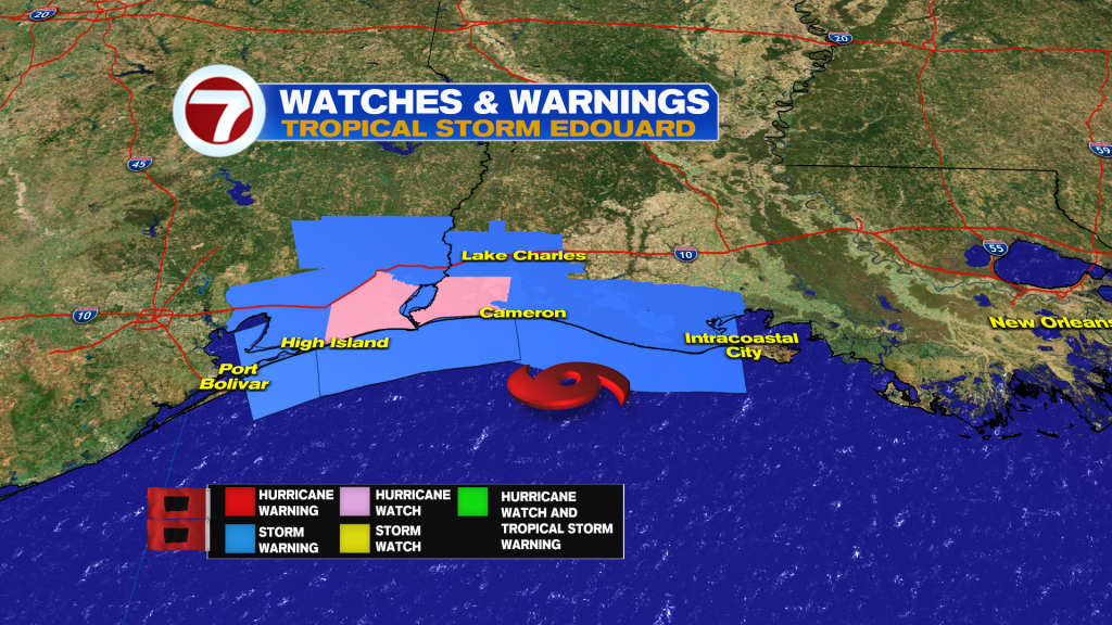
Edouard is in a very favorable environment with water temps near 90 degrees and very low shear, significant strengthening to near-hurricane intensity is possible. A hurricane watch has been issued from High Island, Texas to Cameron, Louisiana. Edouard will quickly weaken after moving into Texas tomorrow.
Otherwise, the tropics look quiet through Labor Day Weekend.