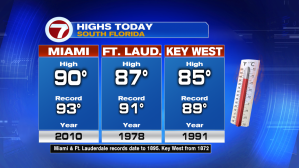
“We’re picking up”, where we left off last week! There’s plenty of heat and humidity hanging around. On Monday, Miami reached 90-degrees before a round of storms rolled-in during the early and mid afternoon.
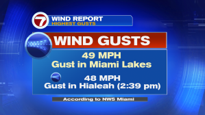
Central Miami-Dade was hit hardest with the stormy weather. Strong wind gusts included a 49-mile per hour gust in Miami Lakes, and gusts nearly as significant measured in Hialeah (with numerous reports of wind damage over a large area). Additionally, lightning was a primary concern over most of mainland south Florida.
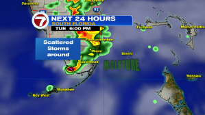
Heading into Tuesday, there’s enough lingering tropical air and instability that daytime storms will pop-up again, during the afternoon. These could tend to drift slowly (and possibly erratically) into the first part of the evening.

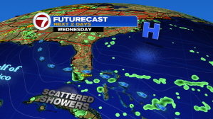
The general weather pattern takes a minor turn on Wednesday. High pressure from the north should take charge (instead of a lingering front and tropical moisture). While there will still be some scattered bands of rain, and possibly a few thunderstorms, they’re likely to be more inland focused. Fewer downpours are expected through Thursday and Friday as well.