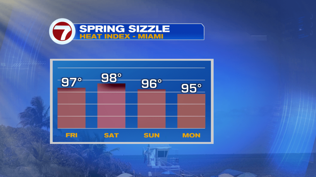
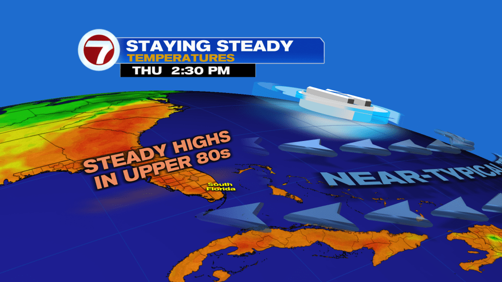
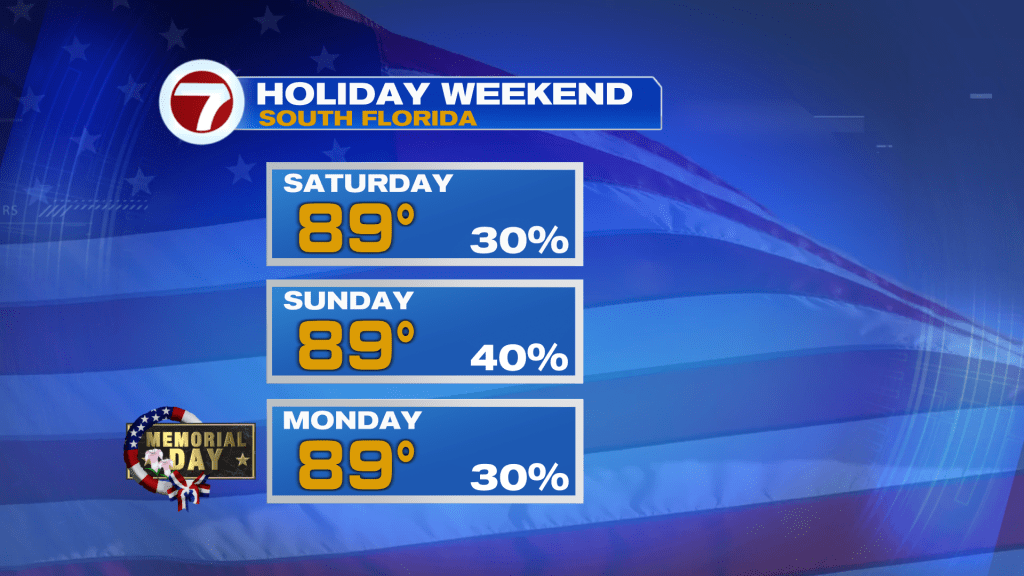
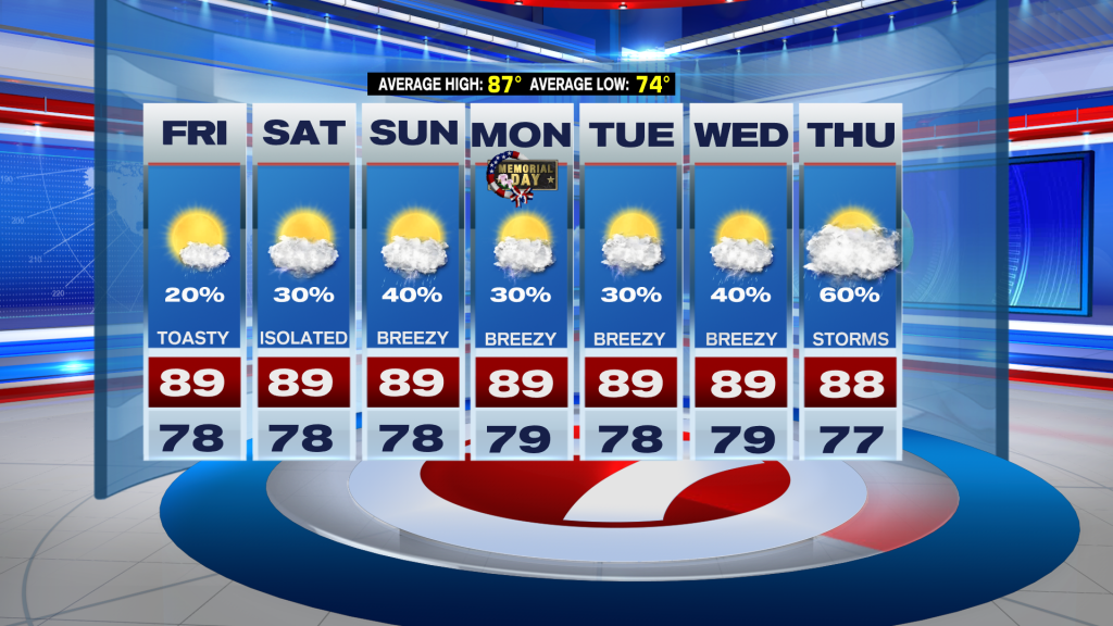
(WSVN) - The heat has taken somewhat of a backseat this week compared to last week when highs were in the 90s. Heading into the holiday weekend, it will still remain fairly hot and humid though with highs holding steady in the upper 80s and peak feels-like temperatures climbing into the mid to upper 80s.
Before we get there, expect similar conditions on Friday as to what we had this Thursday. That means we should see a good deal of sunshine and just the chance for a passing shower in spots.
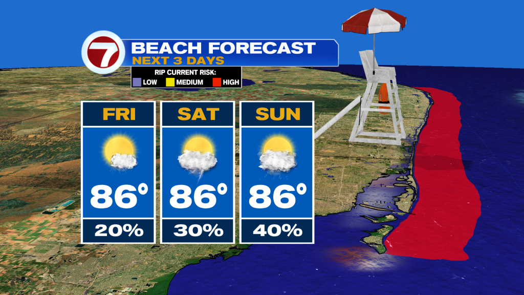
Now for the weekend, the heat will definitely be one of the themes as well as that persistent breeze. In fact, that onshore breeze will pick up in speeds through Memorial Day on Monday with sustained winds up to 10-20 mph and gusts up to 25-30 mph on Monday.
This will continue to fuel a high risk for rip currents all weekend long so if you have beach plans, it’s best to avoid going in the water!
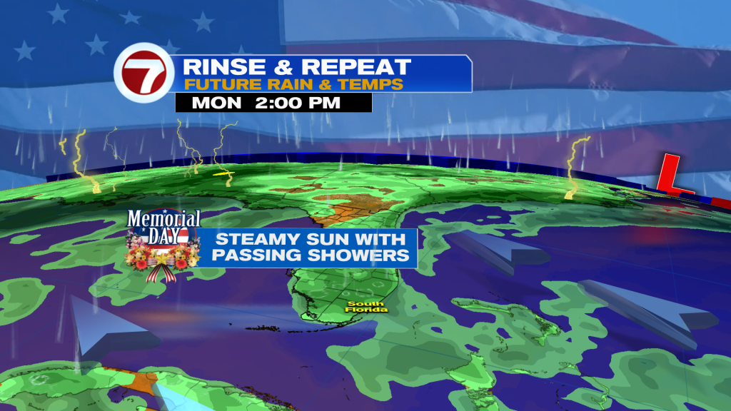
As far as rain chances are concerned, we’ll be watching for moisture levels to increase once again. The best chance for seeing any rain out of the 3-day weekend will be on Sunday when scattered showers and isolated storms are possible throughout the day.
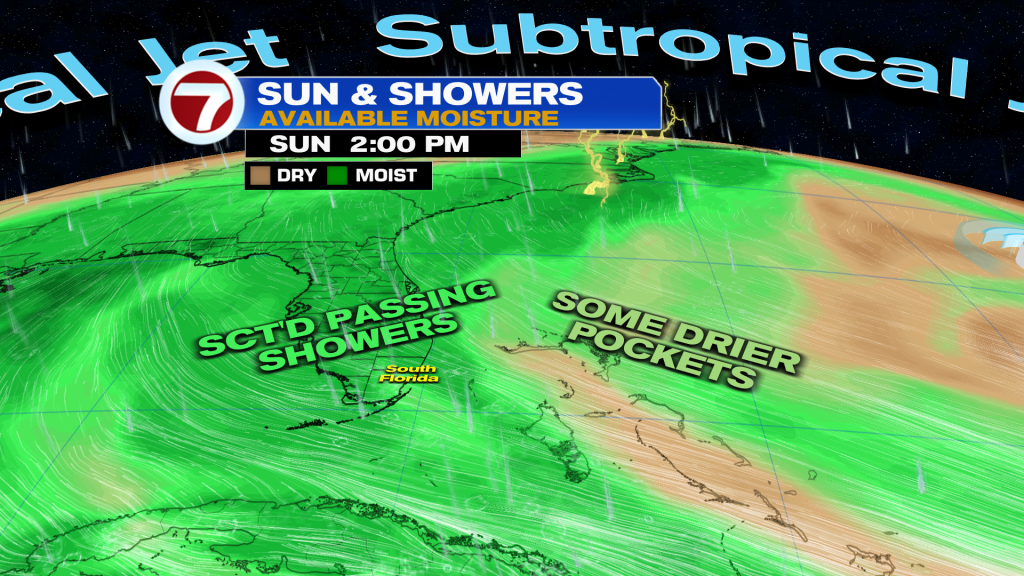
Saturday and Monday should feature fewer showers but the possibility you run into the occasional, passing shower will still exist.
Overall, lots of dry time is in store this holiday weekend but don’t be surprised if you have to dodge swift, passing showers from time-to-time.
Beyond Memorial Day, we will be watching for a potential surge in moisture occurring late next week, leading to a higher risk for showers and storms. Until then, early to mid next week will feature very similar conditions as to what’s ahead this weekend.
Copyright 2026 Sunbeam Television Corp. All rights reserved. This material may not be published, broadcast, rewritten or redistributed.