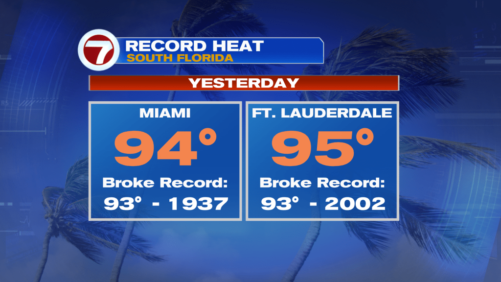
Following Saturday’s record heat across South Florida, when Miami and Fort Lauderdale soared into the mid 90s, a very different story is ahead Sunday.
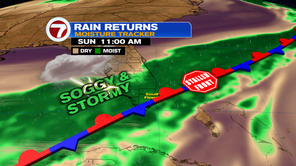
A front is stalling near South Florida with plenty of moisture flowing in, leading to soggy and stormy conditions.

The rain is expected to come in two main rounds: one happening in the mid to late morning hours and another during the mid to late afternoon into the evening hours.

Therefore, the best opportunity for any dry time will be during the middle of the day. It will be cloudy and milder day otherwise with highs only in the mid 80s.
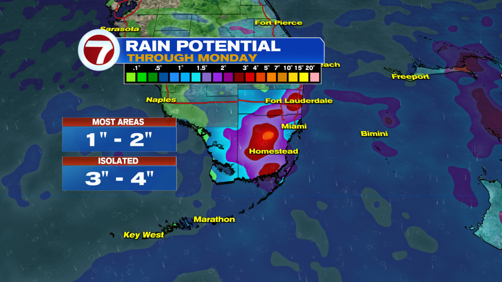
Isolated areas of flooding cannot be ruled out in addition to a stronger, gusty thunderstorm. A widespread 1-2 inches of rainfall is forecast with higher amounts upward of 3-4 inches.
By the start of the work week, rain chances will drop a bit but it will still be unsettled behind this front as moisture lingers.
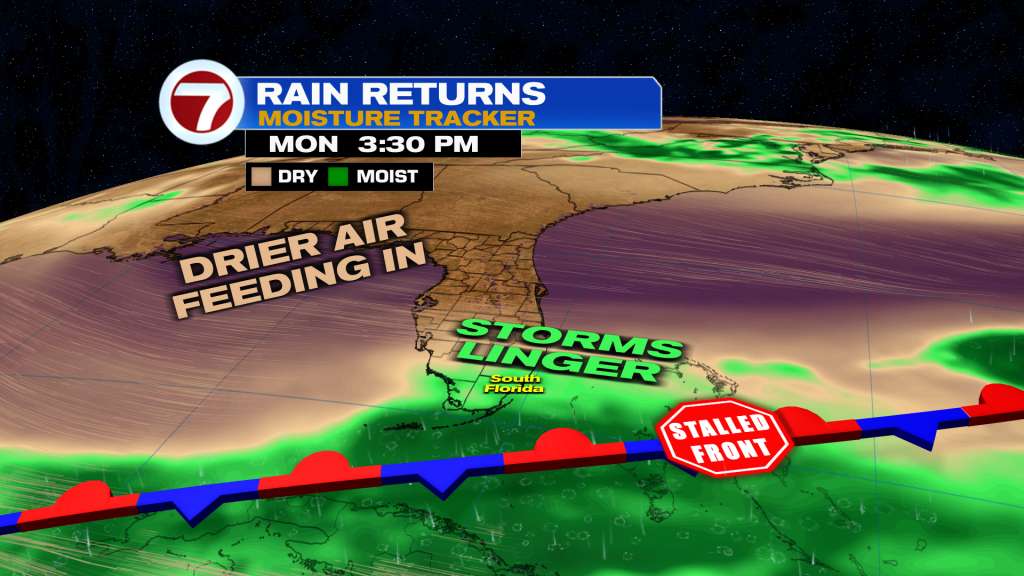
Expect scattered showers and storms on both Monday and Tuesday, with Monday expected to be the wetter day versus Tuesday but both days will feature a decent amount of dry time.
Then starting Wednesday, it turns drier and brighter and therefore hotter with highs soaring back up to around 90F.

Copyright 2026 Sunbeam Television Corp. All rights reserved. This material may not be published, broadcast, rewritten or redistributed.