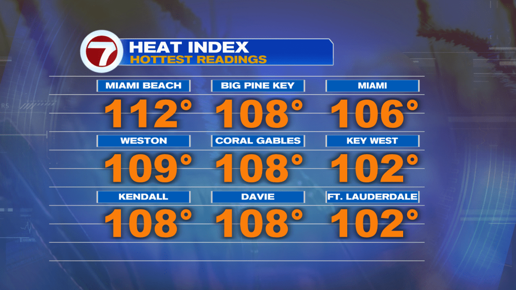
Our steamy and stormy (occasionally smoky) pattern continues across south Florida. For the third consecutive day, most of Miami-Dade and Broward counties were under Heat Advisories. Here’s a look at the peak heat index values including a whopping reading of 112º as the “feels like” temperature in Miami Beach.
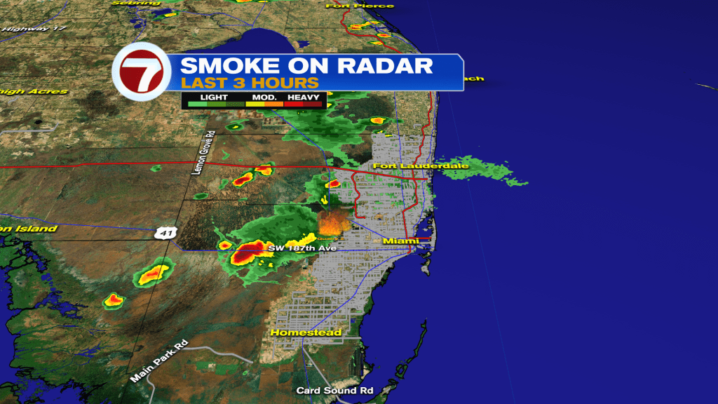
Meanwhile, we had another smoky sky due resulting from Brush Fires located west of the Florida Turnpike (Miami-Dade). Much of the day focused on two separate fires (both close in proximity) with plenty of smoke transported north into Broward County. By Wednesday evening, it was evident that another Brush Fire had formed farther west along US-41 the Tamiami Trail. Unfortunately, storms from Wednesday afternoon generated Lightning which, in turn, sparked another grass fire.
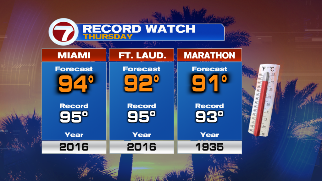
As we look to Thursday’s weather, the heat streak continues. Temperatures will continue to run between 3 and 5-degrees above average so Miami will again flirt with a record high. The forecast and record numbers are shown below.
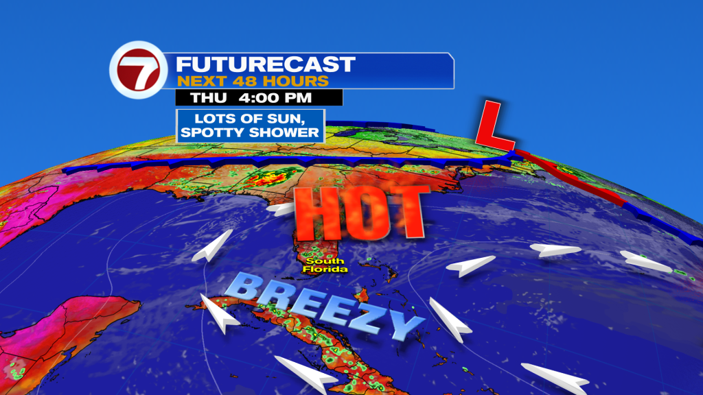
The weather map shows south Florida at the western periphery of High Pressure from the Atlantic. It’s still allowing for the flow of tropical air into our region. There’s one difference from previous days, though. Instead of a direct wind from the south, winds will veer out of the southeast. That’s important. While it won’t curb our heat and humidity, it should be enough to shift smoke westward (specifically toward the NW most of the day). Residents in Broward County may catch a small break and “breathe easier” due to the difference. At the same time, developing afternoon storms are likely to remain over inland areas as new steering winds drive storms away.
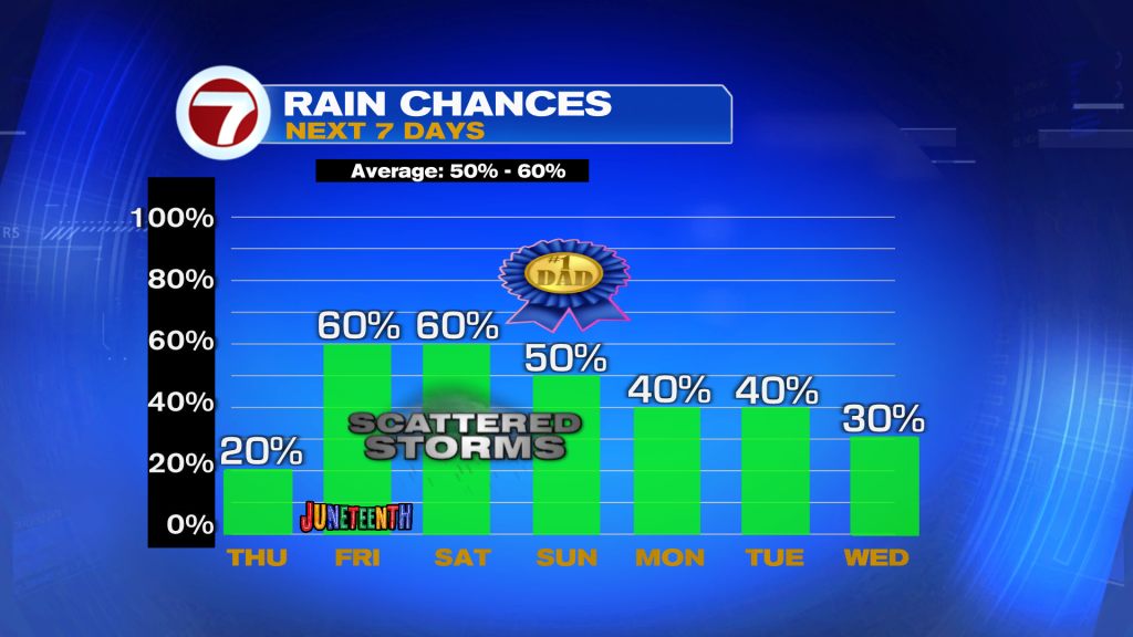
The somewhat drier times aren’t expected to last, though. Notice on the 7-day rain trend, below, chances ramp higher to close out the week. Active thunderstorms will likely be forming, mainly during the afternoon, over the Holiday weekend. A washout? No, but be aware that plans could temporarily get derailed during the upcoming holiday weekend.
Copyright 2026 Sunbeam Television Corp. All rights reserved. This material may not be published, broadcast, rewritten or redistributed.