Happy Thursday, June 25, 2026, South Florida!
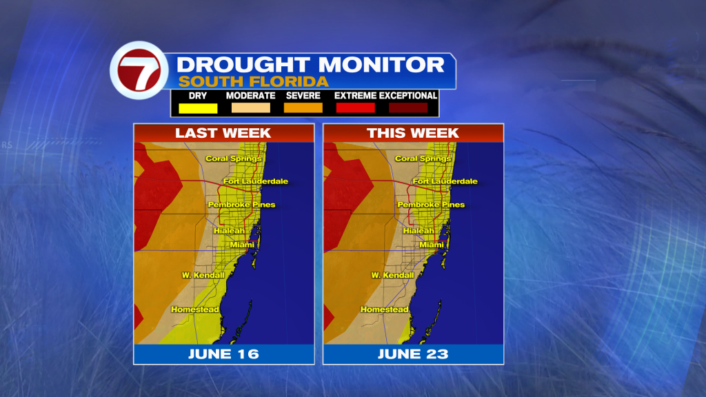
Hopefully everyone dealt with Wednesday’s severe thunderstorms okay. The rain and thunderstorms helped keep the temperatures in check. And with worsening drought conditions across South Florida, we will welcome any rain we can get. This morning conditions across South Florida were similar to yesterday as we started off in the 70s and low 80s and a few showers across South Florida waters. No heat alerts were issued but the Air Quality Alert that was issued for Miami-Dade earlier this week was once again extended through 3pm today.
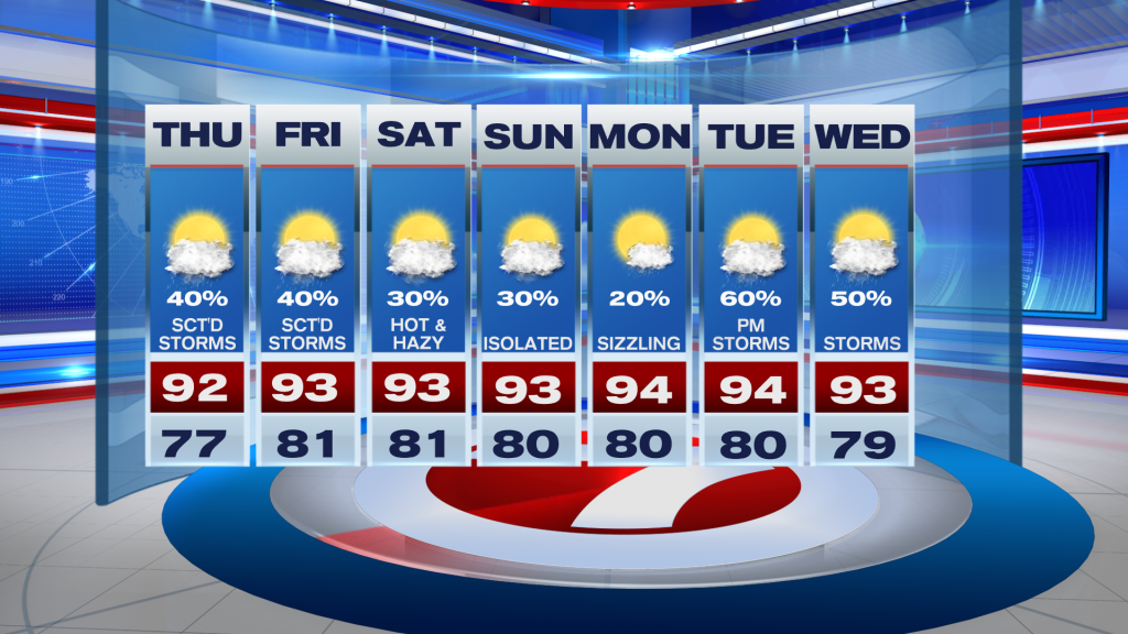
Today will be a lot like what we saw on Wednesday except that showers and thunderstorms should move a bit more inland than yesterday. High temperatures will reach into the middle to lower 90s and feel like the triple digits. The hazy skies we were dealing with earlier in the week should begin to clear up some as the thin layer of Sahara and dust that was over South Florida continues to thin out through the second half of the work week.
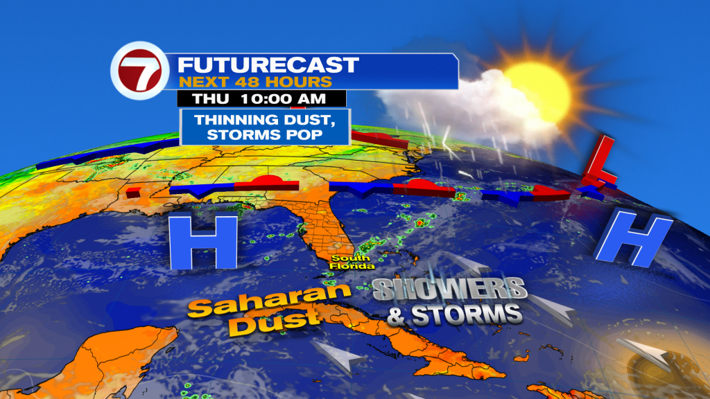
While showers and storms remain present late week, rain chances will be just below what is normal this time of year. Whatever showers & storms develop will shift farther inland away from the East Coast Metro. Heading into the weekend, South Florida looks slightly drier as a thicker plume of Saharan dust spreads across the region. It will feel much more steamy and is highly possible that we see a few heat alerts issued. The drier air associated with the dust will help lower our rain chances to more isolated chances.
Have a great day!
Erika Delgado
Meteorologist
WSVN / ABC Miami
Copyright 2026 Sunbeam Television Corp. All rights reserved. This material may not be published, broadcast, rewritten or redistributed.