Happy Monday, June 1, 2026, South Florida!
Hopefully everyone had a great weekend despite the showers and thunderstorms we saw. South Florida is stuck in a soggy and stormy weather pattern and it looks like we will continue with this trend through the first few days of June. Today is the start of the Atlantic hurricane season, but luckily, all remains quiet. What is *not* quiet is South Florida weather as we will see more showers and storms in the forecast today. And this morning it was a stormy start across the Florida Keys while Miami-Dade and Broward Counties saw a few showers. It was quite cloudy as well with a hint of haze across the South Florida sky due to a batch of Saharan Dust across the region.

Today South Florida can expect limited sunshine in the forecast. Any sunshine that South Florida does manage to see will look hazy as a batch of Saharan dust remains across the region. And while a few showers will be possible through the morning, the bulk of the shower and thunderstorm activity will reach the East Coast Metro later on this afternoon as, similar to Sunday, storms return to the forecast while skies remain mostly cloudy. Despite the cloud cover, high humidity and a warm southwest wind may actually help temperatures reach into the upper 80s and lower 90s for those areas that stay drier longer.
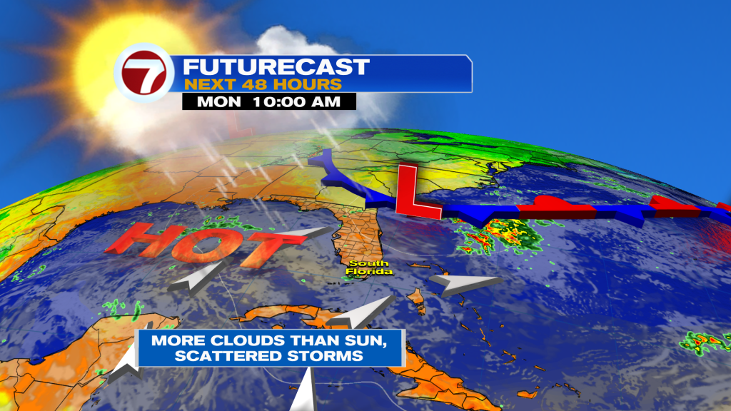
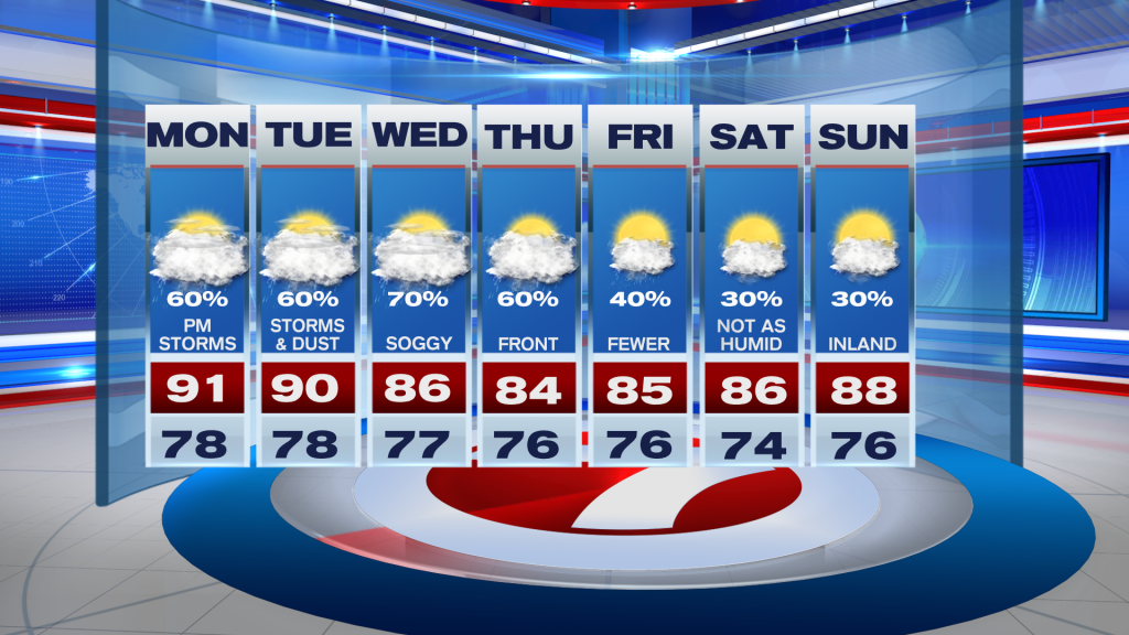
Looking ahead, the weather pattern will not improve much throughout the week. Moisture from the Caribbean will continue to be funneled towards South Florida, keeping the region ripe for rain each day. And with a steering flow (the winds that steer thunderstorms) out of the southwest, showers and storms will push in our direction each afternoon. High temperatures will reach into the upper 80s but with better rain chances heading into the middle of the work week, temperatures will struggle to warm and will remain in the mid 80s. Speaking of mid week, South Florida turns soggy by the middle of the work week as a front begins to slide into the region. No cool down is expected with this front but it should provide brief relief from the high heat and humidity we have been experiencing since the weekend. Drier air will begin to move in late Friday into the start of the weekend and that should make things feel much more comfortable for South Florida as we enjoy your break from the heavy rain and thunderstorm thunderstorms.
Keep that rain gear with you this week!
Erika Delgado
Meteorologist
WSVN / ABC Miami
Copyright 2026 Sunbeam Television Corp. All rights reserved. This material may not be published, broadcast, rewritten or redistributed.