

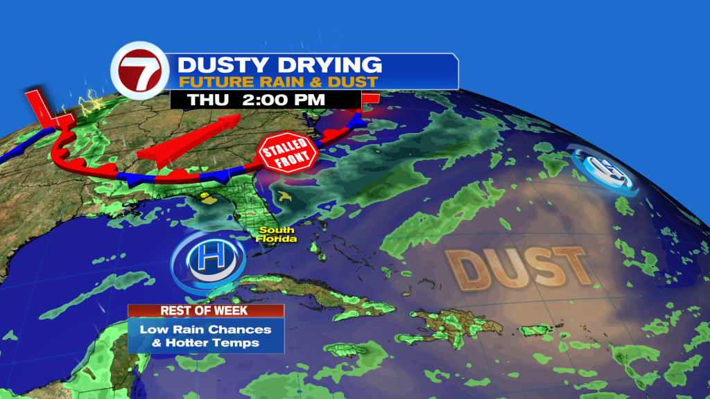
(WSVN) - Hotter and drier conditions have been the overall setup this Wednesday and similar scenes are on the way for the rest of the work week as moisture levels decrease and therefore temperatures increase.
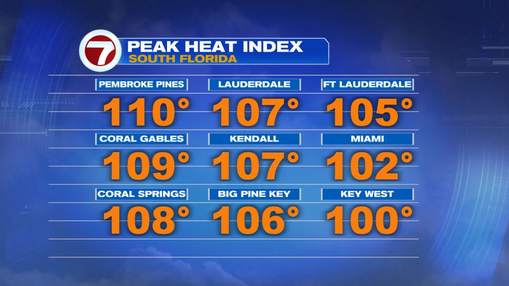
Feels-like temperatures this Wednesday topped off in the 105-110F range for many locations, prompting a Heat Advisory for Miami-Dade and Broward.
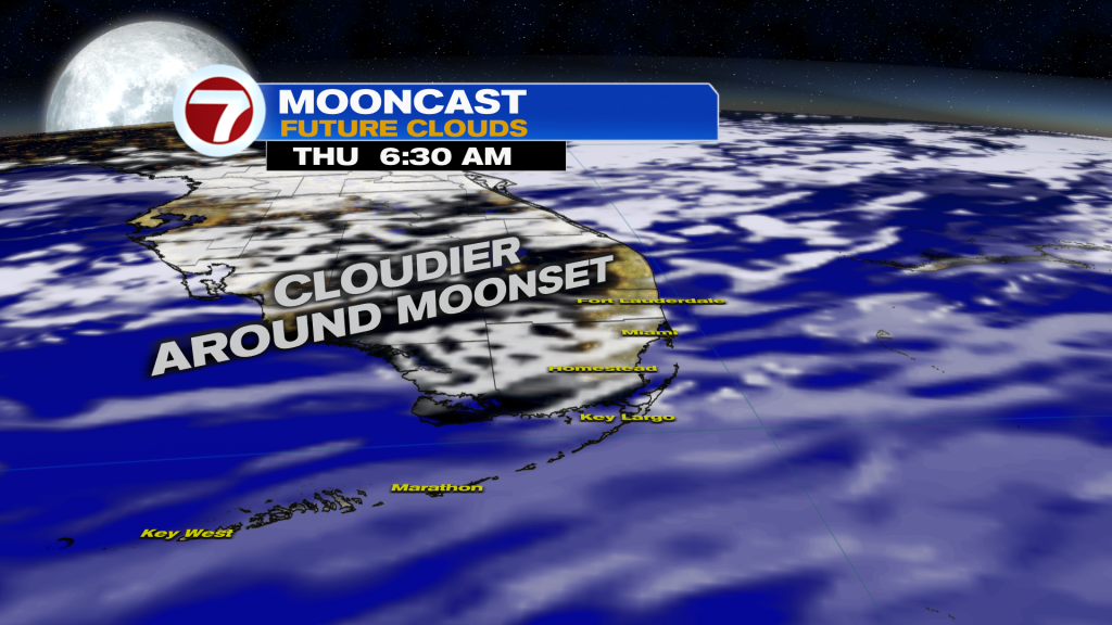
It will be another warm and humid night but at least there will be a bit of a breeze. Expect a layer of wispy, upper level clouds to increase throughout tonight, so if you’re hoping to catch the Full Buck Moon — the earlier, the better to see it.
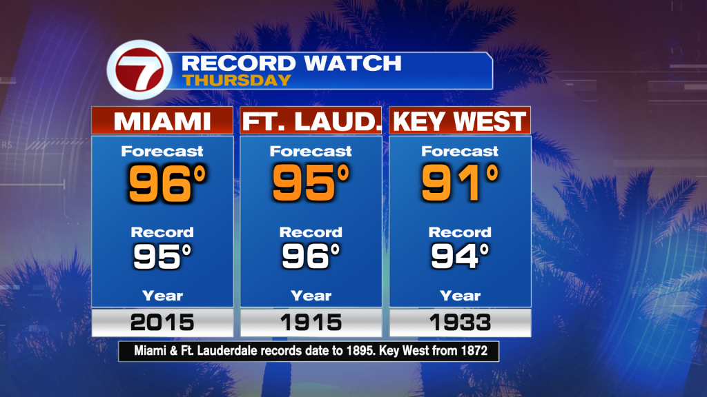
By Thursday, expect even hotter temperatures with widespread heat indices in the aforementioned range forecast along with highs in the mid 90s along the east coast, which will flirt with records.
The culprit? A hot and humid flow out of the southwest, helping to maximize those temperatures.
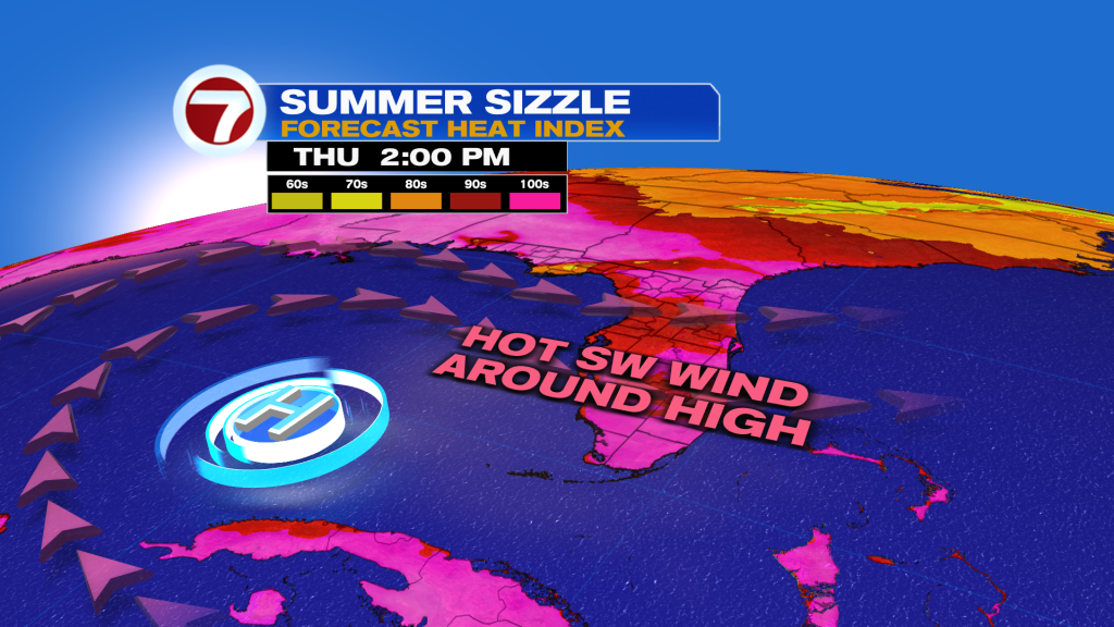
That heat will be paired with hazy, filtered sunshine and only spotty showers.
Expect very similar conditions on Friday too with very little change. There will also be a very thin layer of Saharan dust overhead Thursday into Friday, helping to drop those rain chances.
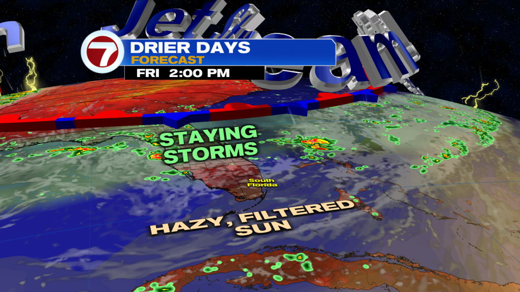
Unfortunately for the weekend, rain chances will start to rise as a new front and storm system get closer to Florida from the Southeast US. This will cause moisture levels to increase and therefore rain chances.
It won’t be a washout but scattered afternoon showers and storms will be a better bet, especially on Sunday.
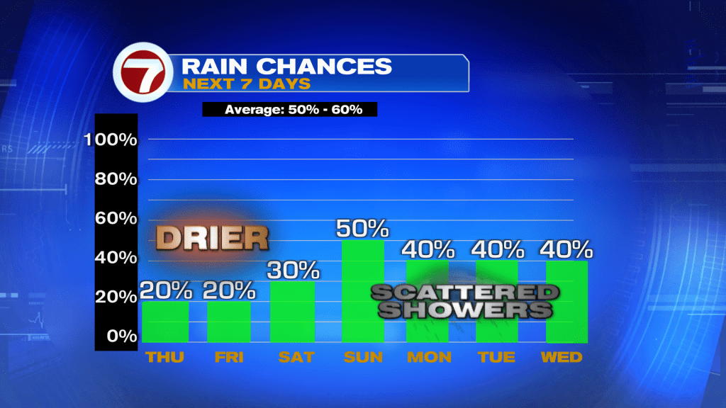
Otherwise, it will still be a hot and steamy weekend with those feels-like temps in the triple digits.
Rain chances will remain elevated looking forward to next week, making for a typical summer pattern with times of sunshine and times of storms.

Tropical update
No activity is expected in the Atlantic basin over at least the next 7 days.
Copyright 2026 Sunbeam Television Corp. All rights reserved. This material may not be published, broadcast, rewritten or redistributed.