Happy Fourth of July, South Florida!
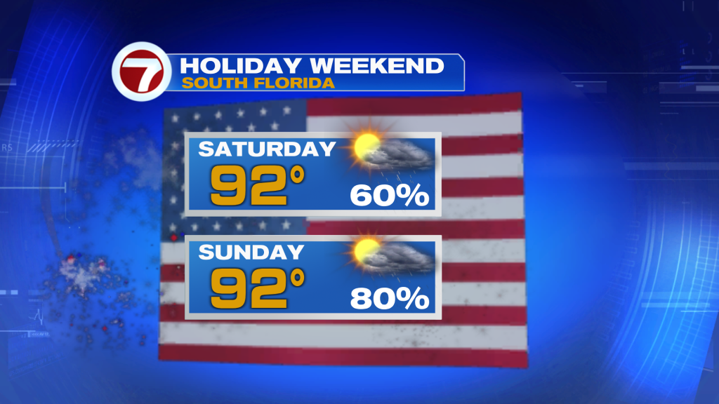
The big story this weekend is dangerous heat across the area along with the potential for storms each afternoon.
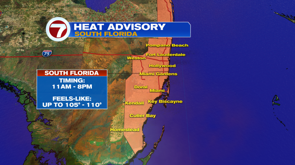
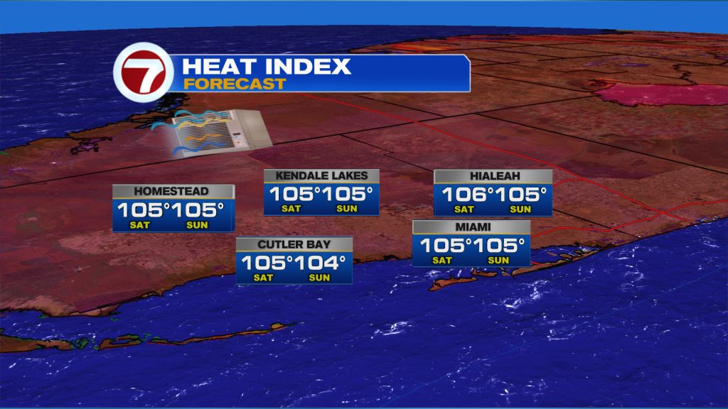
The National Weather Service has issued a heat advisory for metro Miami-Dade & Broward from 11AM – 8 PM today. The heat index is expected to soar to 105 – 110 degrees across the area for your Saturday and Sunday. Make sure to drink lots of water and take frequent breaks from the heat. This is especially important on a holiday weekend with many of you have outdoor plans.
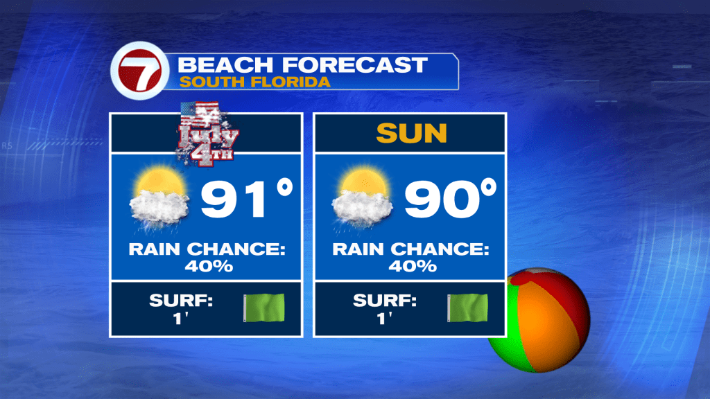
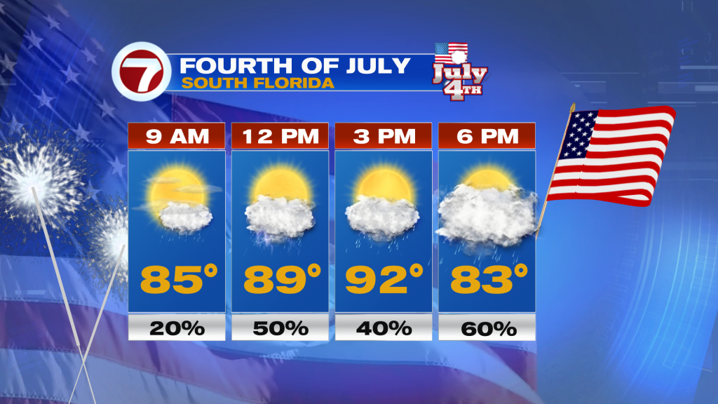
Otherwise, your July 4th will feature high temperatures in the lower 90s with scattered storms this afternoon. Storms will fire along the sea-breeze closer the coast early afternoon, before building inland. Storms should be mostly gone tonight for the fireworks.
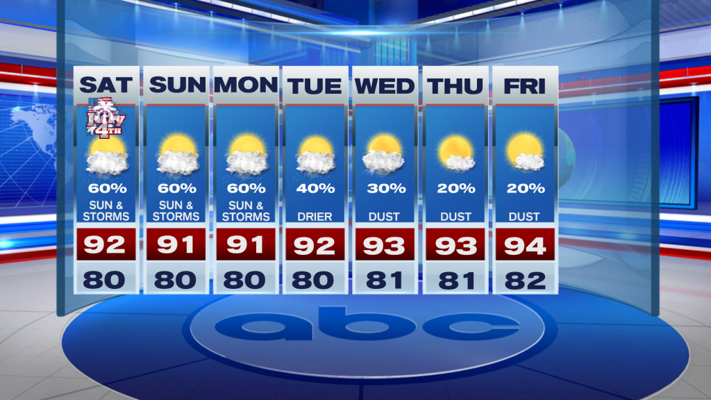
Looking ahead, we will see a drying trend next week. The culprit is building high pressure over the state and a surge of Saharan dust by the middle of the week. This will send our rain chances down to 20% and our highs soaring into the mid-90s which is bad news for our worsening drought across the area.
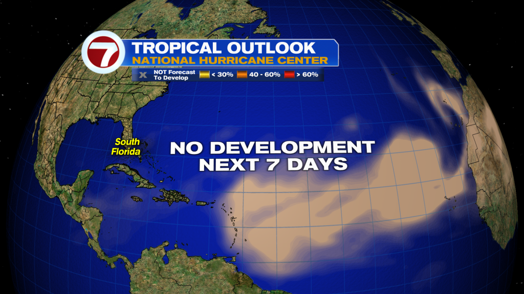
TROPICAL UPDATE:
There’s usually something out there to watch on 4th of July weekend — but not this year! The Atlantic is in it’s deep slumber with no development expected over the next seven days. I don’t see any signs of tropical mischief in the long range models either.