South Florida’s quiet weather is about to change as a cold front moves closer, bringing a better chance for rain and storms through today.
Clouds will continue to build today, and with more moisture in place, a few scattered showers and thunderstorms could develop around East coast metro areas and Southwest Florida. It won’t be a total washout, but keep the umbrella handy just in case.
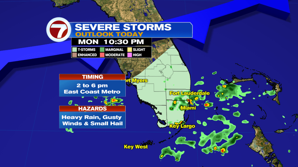
Periods of rain could come and go especially between 2- 6pm, especially along the East coast. Most areas will see around an inch of rain, but a few spots could pick up higher totals. By tonight, conditions begin to improve as the front pushes South.
Temperatures stay warm today, reaching the low to mid 80’s, but there will be noticeable change on Tuesday. Expect cooler, drier air and breezy Northeast winds through the middle of the week. Highs dropping to the upper 70’s, with overnight lows dipping into the mid to upper 60’s near the coast.
However, those breezy winds will create rough hazardous marine conditions, especially in the Atlantic waters, where seas could build significantly midweek.
Looking ahead, the forecast becomes a bit uncertain later in the week. There’s a chance for another round of showers if a system develops nearby, but for now, rain chances remain on the lower side. Temperatures will gradually warm again heading into the weekend.

Have a wonderful day South Florida and make it a safe one!
Vivian Gonzalez
Meteorologist, AMS Certified
WSVN Channel 7