A tropical wave a couple hundred miles East of the Windward Islands is already soaking Trinidad and Tobago and based on satellite imagery it is trying to get better organized, but battling shear to the North. This one has been designated Invest 98-L and most models are in agreement that it will have a better opportunity to form once it moves into the Caribbean Sea and especially Central portions. The National Hurricane Center has a Recon mission set for tonight to investigate this area.
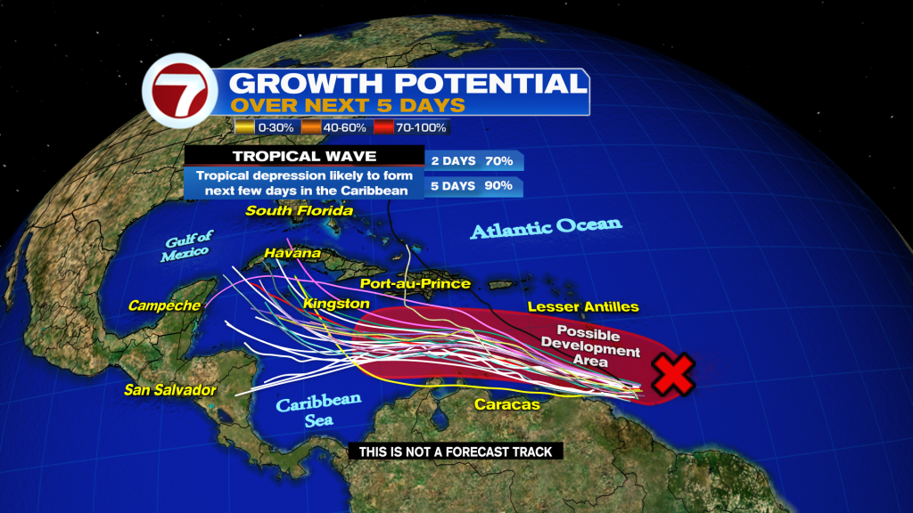
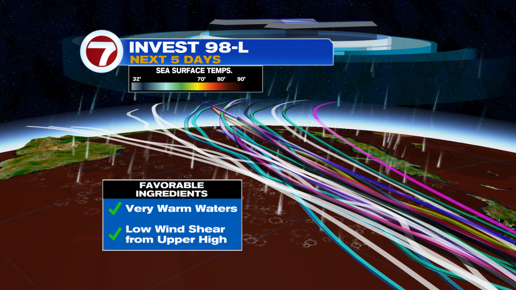
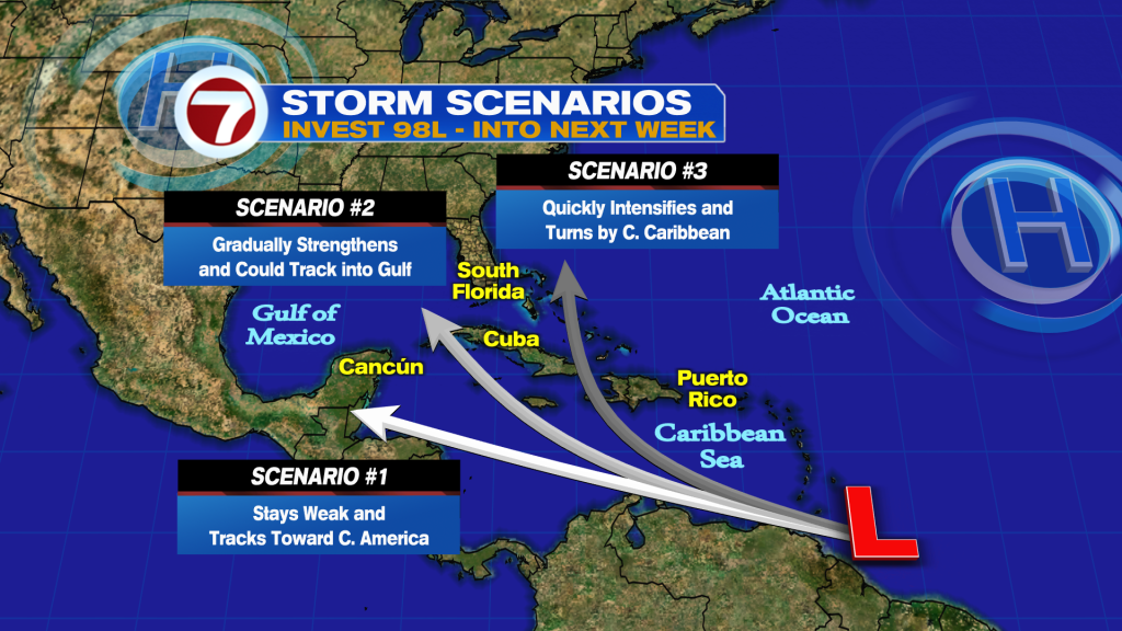
Invest 98-L is forecast to enter an environment of low wind shear and water temperatures in the Central and Western Caribbean Sea running in the upper 80’s. This is fuel tropical systems need to grow. Now the track it takes depends on how fast it forms. Typically a weaker system tracks more to the South versus a stronger system tracks more to the North.
Where is it headed? Models insist on a Florida event, but a lot of things can change. There is significant spread in the runs on day 5 and 7, so if the models don’t have a good starting point, they won’t have a good endpoint. However, a turn to the North is forecast to happen and the U.S. needs to watch.
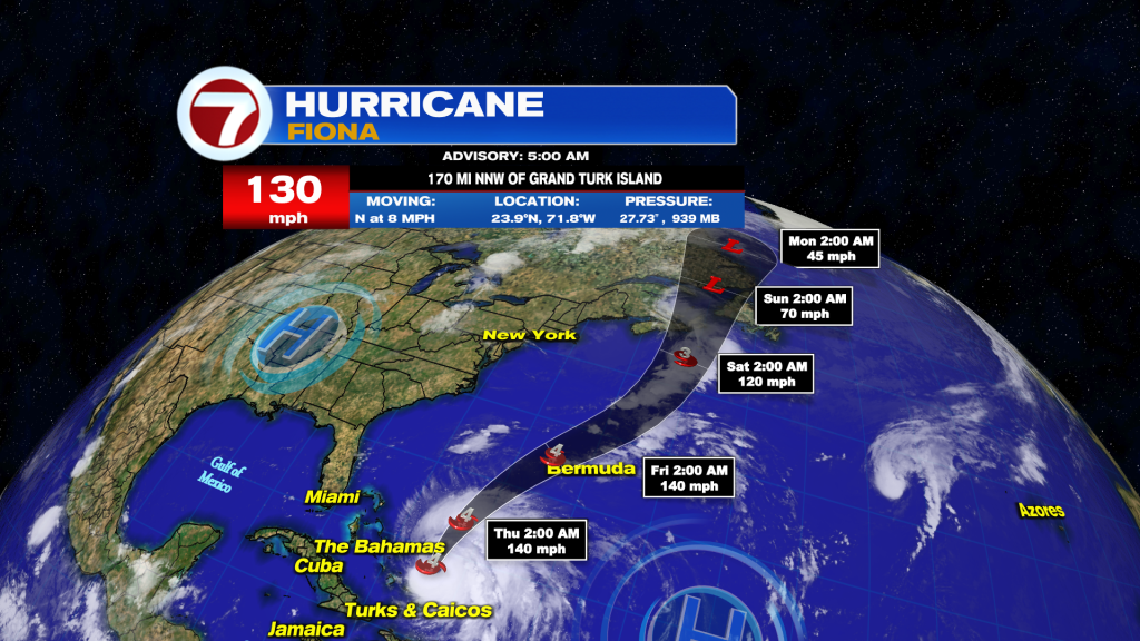
Fiona remains a monster storm pulling away from the Turks and Caicos. It is the first major storm of the season. Tropical Storm conditions possible on Bermuda late Thursday.
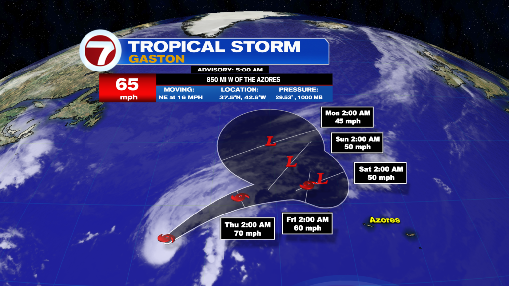
Gaston is a strong Tropical Storm in the North-Central Atlantic. It is no threat to land areas and will bring some swell to the Azores into the weekend.
Here is the latest on the 2 other waves we are monitoring:
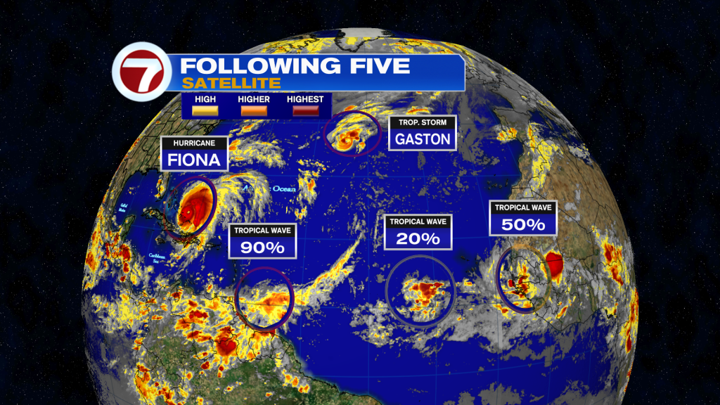
Tropical wave Southwest of the Cape Verde is small and compact and showing signs of organization. For now, NHC maintaining a low potential for development.
Vigorous wave over Africa has a medium chance to form once it moves into the Eastern Tropical Atlantic. Models almost immediately show this one forming.
Keep it tuned to your Storm Station for the latest!
Vivian Gonzalez
Meteorologist, AMS Certified
WSVN Channel 7