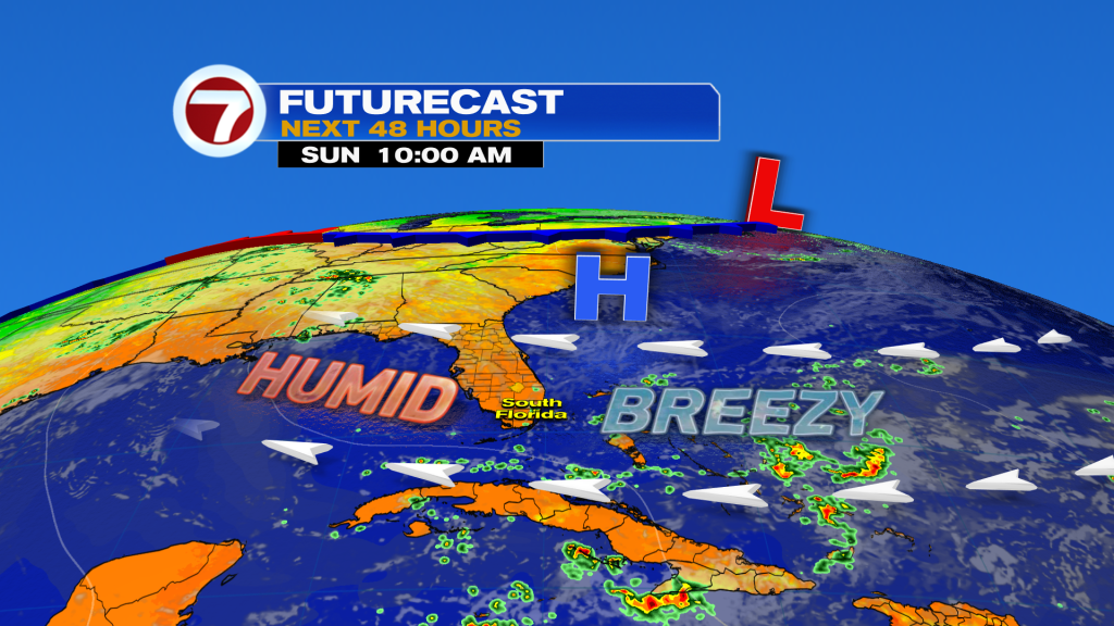
(WSVN) - After a gorgeous Saturday with sunshine and rarely low humidity for June standards, the heat and humidity are back for Sunday — and likely for the rest of the summer.
As humidity levels continue to climb over the next few days, eventually will those rain chances.
In the meantime, Sunday and Monday will continue to feature low rain chances overall with only spotty showers expected.
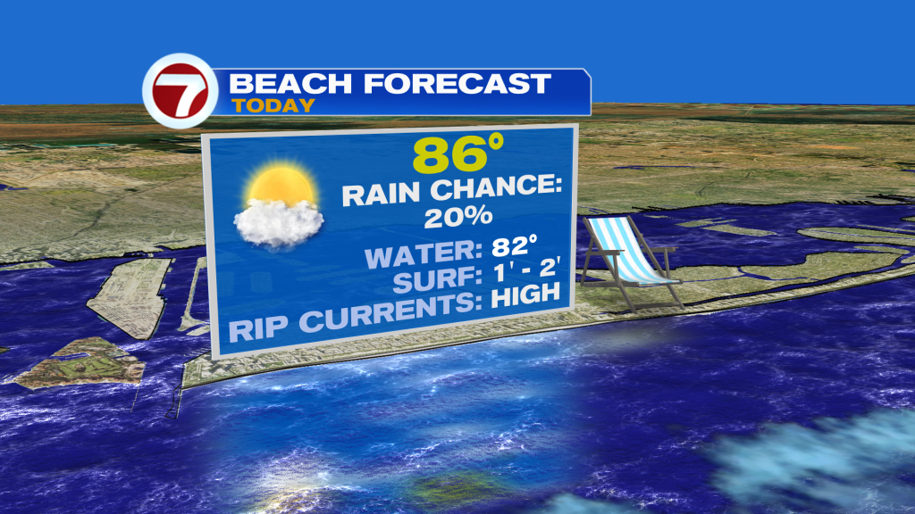
Expect a blend of sun and clouds Sunday with high temperatures warmer in the upper 80s.
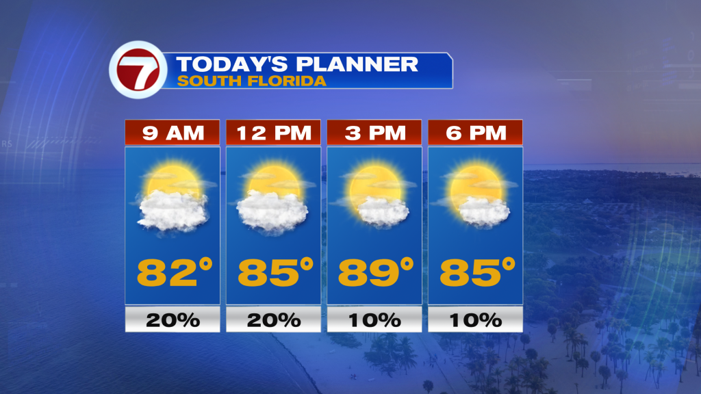
The breeze remains rather strong, especially by the coast, so the rip current risk will remain high through this evening.
Clouds will also be on the increase going forward as wispy, upper level clouds continue to filter in from the north, leading to a faded blue color to the sky.
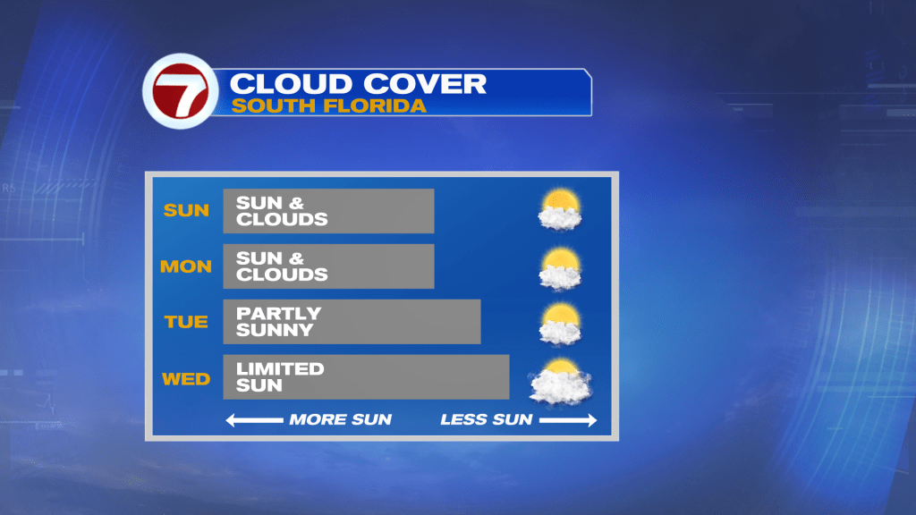
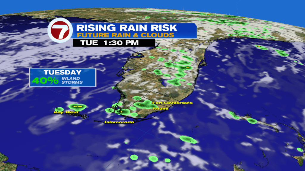
By midweek, moisture levels will increase some more with isolated to scattered showers and storms forecast. With that said, lots of dry time is still on tap for your outdoor, summer plans.
It’s not until the end of the week and next weekend when rain chances are poised to rise, but as usual, the forecast confidence becomes more uncertain this far out in time.
We’ll be monitoring tropical moisture sitting across the Caribbean Sea. The model guidance is in disagreement where the deepest of this moisture will head, which will have an impact on our rain chances.
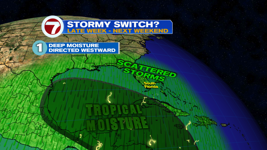
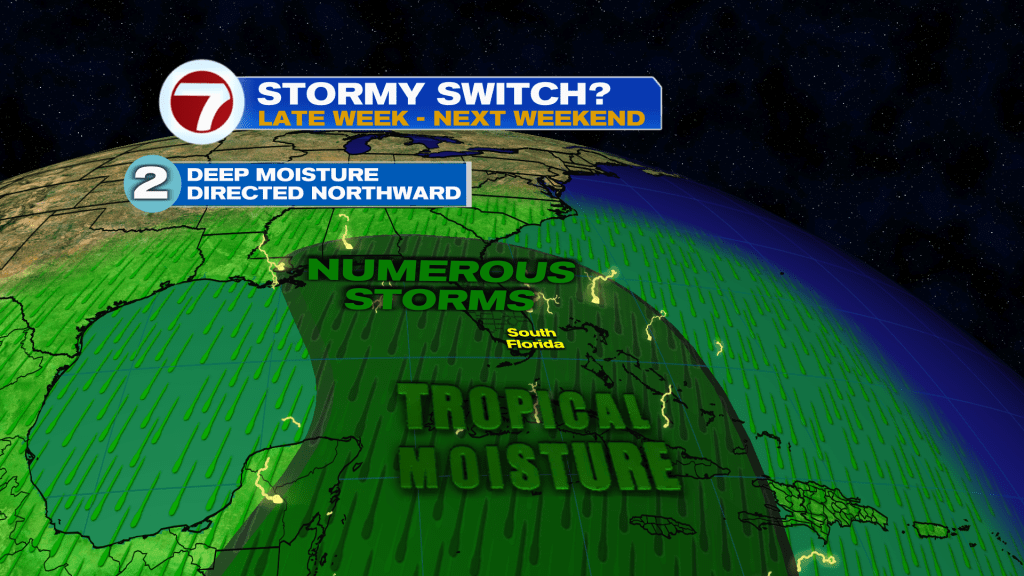
Does it stay to our southwest or head into Florida by next weekend? The answer is unknown at this time but stay tuned for further updates this week!
Copyright 2026 Sunbeam Television Corp. All rights reserved. This material may not be published, broadcast, rewritten or redistributed.