Ok, summ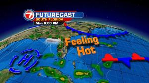
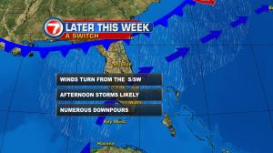 er hasn’t officially begun (it’s technically a week away) but we’re getting a break from the summer-like storms that have been in place for days on end! Moisture levels have come down, albeit slightly. Meanwhile, weak high pressure is now dominating our local weather. The high extends out of the central and southeastern Gulf of Mexico. Even as rain and storm chances remain “lower” through the early part of the week, daily sea breeze circulations could still trigger a few thunderstorms (favoring interior south Florida). As we look ahead, late week forecast maps show a changing situation that’s likely to bring back the active weather. Low pressure is expected to develop off the southeast coast of the United States. Attached to the low will be a trailing cold front that will almost certainly stall out over north Florida. The pattern will send us increasingly deep moisture (again) and switch our steering winds. Under this late week set up, we’ll need to prepare for afternoon storms that will drift eastward across south Florida. Locally heavy downpours will also be possible into the upcoming Father’s Day weekend. On a more positive note, there are currently no signs of tropical activity after such an earl y start to the season.