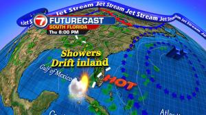
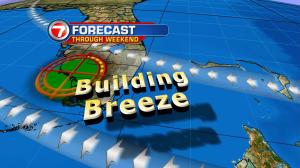
You might say we’re making slow and slight progress in our weather. A small turn in winds has taken place (finally). It comes after several days of tropical air streaming our way from the south. Even with ocean winds now in place, it hasn’t resulted in much drying yet. On Wednesday, more storms easily popped up along the sea breeze. Meanwhile, additional scattered showers were drifting toward south Florida from the ocean. The rain chance won’t drop down too much in the short term. That’s because we’re eyeing a weak disturbance shifting out of the northwestern Bahamas. If this feature holds together, it will create some “instability rain and storms” through Thursday. It’s just a minor bump in the weather road, though. Beyond this area, we’ll likely find high pressure getting more established. The high should lead to more substantial times of drying. Even though rain will still be possible on a daily basis, it will be more limited. Also the time frame for possible showers will be more geared for the late night and early morning hours. Even during the upcoming weekend, there will be plenty of dry hours for outdoor plans. Just plan on typical summer heat and stifling humidity!