Gusty winds were the rule on Monday. As gusts peaked between 30 and 40 miles per hour, a Wind Advisory was issued for most of Broward and all of eastern Miami-Dade. The winds also pushed along some extra cloudiness from the Atlantic Ocean.

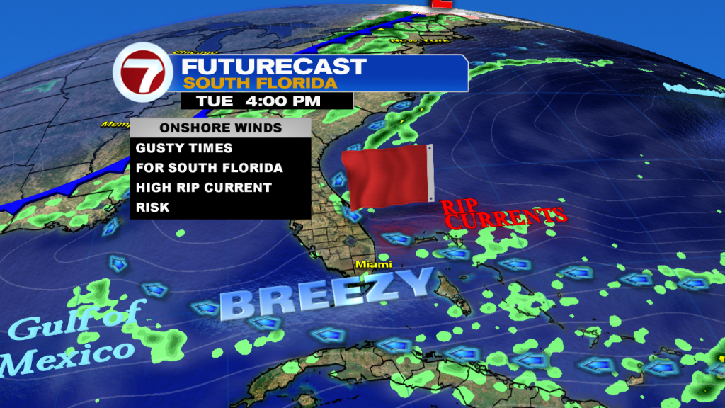
The onshore pattern is likely to send a few (more) isolated showers into south Florida. These will tend to be brief and mainly light.

Looking into Tuesday, forecast models show another breezy day in the making. What’s the reason? Sturdy and distant high pressure which is centered near Bermuda. Once again, mainly easterly winds will dominate the local forecast with gusty conditions near the beaches.
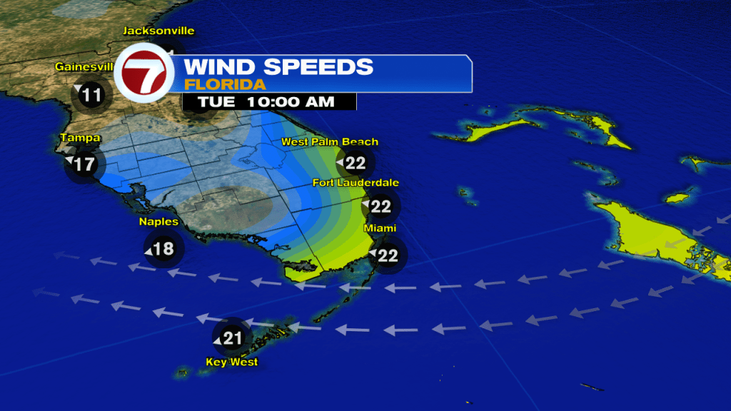
Overall, the weather set up is quiet and void of fronts getting near us. Still, winds will stir up trouble near coast and offshore. That means boating conditions will be rough (with choppy waters) and swimming involves rip current hazards. As the week continues, winds will decrease but the onshore flow will keep the ongoing threat for rip currents all week long.
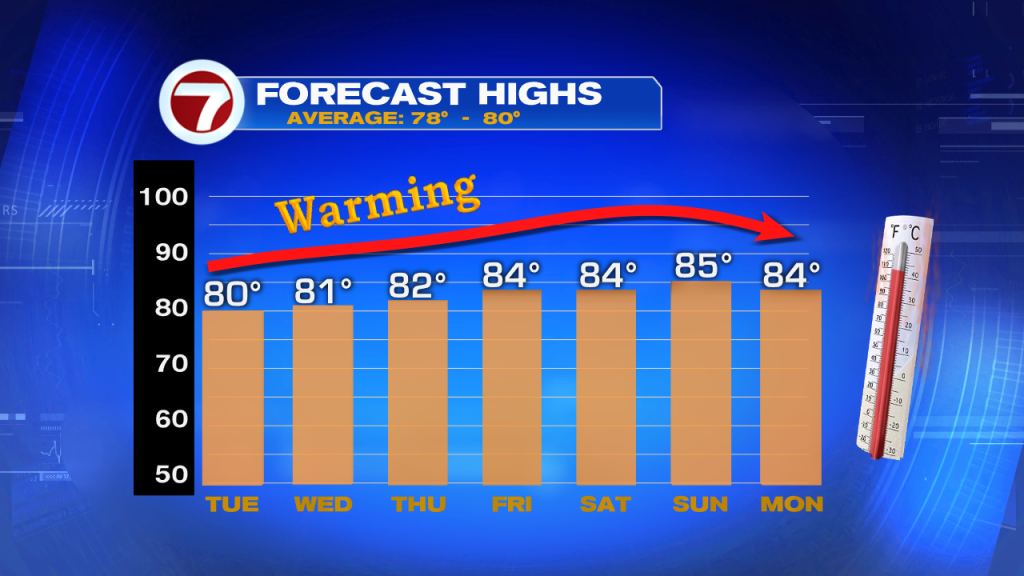
Just as winds gradually come down, temperatures will be on the rise. The typical high for early in March is near 80-degrees. By the end of the week, a southeasterly wind will have readings heading into the warmer middle 80’s.