Happy November, South Florida!
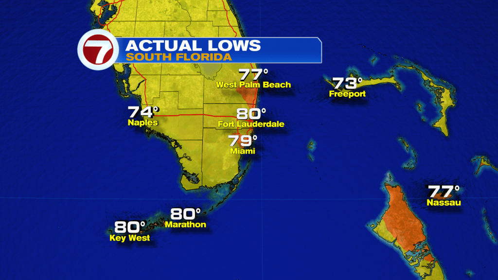
Hopefully everyone had a great Halloween and month of October. After a few comfortable days, South Florida ended the month on a warm one with above-average temperatures in the upper 80s, warm overnight lows in the upper 70s and high humidity. And as we head into the start of November, we hope to see more of those Fall-like South Florida days. This morning we once again woke up to warm and muggy conditions as temperatures for many started off in the upper 70s and low 80s once again.
High pressure is still in control of our weather pattern and luckily for us, we still have plenty of dry air in the mid and upper levels of the atmosphere. So, despite the fact that onshore winds could bring in a shower or two from time to time, we will once again see plenty of sunshine throughout the day today. That means that our afternoon high temperatures will once again reach into the upper 80s. And due to the high humidity over South Florida, our feels-like temperatures will reach the 90s across many areas and possibly low 100s across the Florida Keys. A slight shower chance remains in the forecast today.
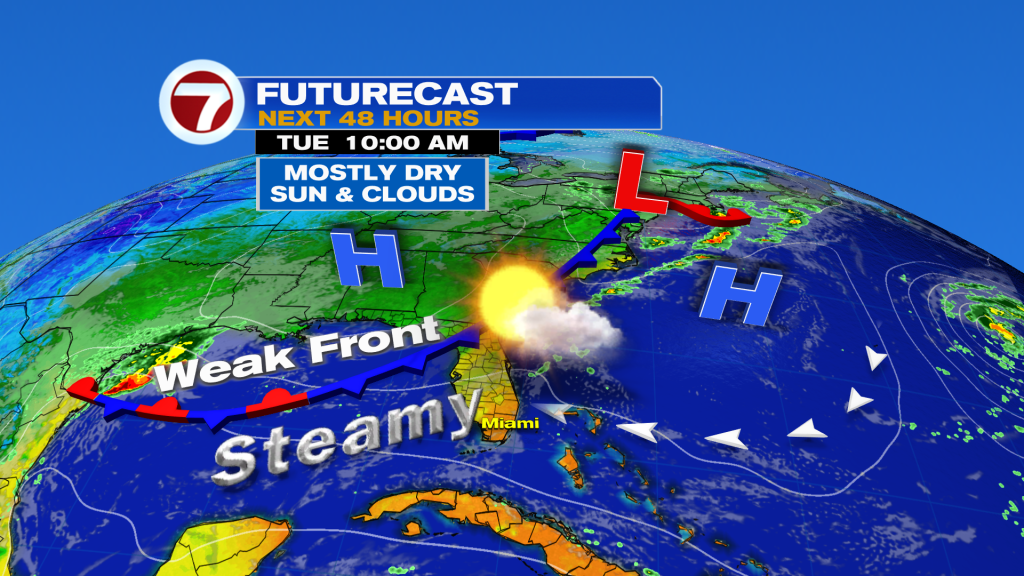
A weak front is moving closer to Florida and could trigger a few showers up and down our state for the next 24 hours. Unfortunately for South Florida, this front is forecast to stall nearby mid week. And while limited moisture will accompany this front, it could be enough to squeeze out a few showers by the middle of the work week. By the end of the week, the front will clear our area and will allow for Northeast winds to bring in slightly drier air across South Florida. This means that as we head into the end of the work week and closer to the weekend, South Florida may enjoy slightly lower humidity and more comfortable temperatures, even if it is for a brief period of time. And while we are on topic, the upcoming weekend does look like a breezy one. It could even turn windy from time to time. This means deteriorating marine conditions can be expected as we work our way into the weekend.

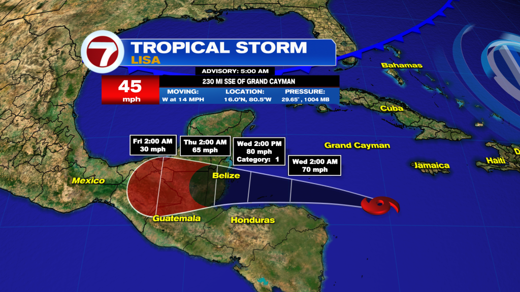
While South Florida starts off November on the warm side, this is a friendly reminder that hurricane season has not yet ended. And we currently have Tropical Storm Lisa moving westward across the Central Caribbean. Dry air will help keep this system in check, however, gradual strengthening is still expected. Latest forecast track shows Lisa possibly strengthening into a category 1 hurricane as it approaches Central America on Wednesday. A hurricane watch has been issued for Belize and the Bay Islands of Honduras. This system poses no threat to South Florida or anywhere in the U.S.
Have a great day!
Erika Delgado
Meteorologist
WSVN Channel 7 News
Copyright 2024 Sunbeam Television Corp. All rights reserved. This material may not be published, broadcast, rewritten or redistributed.