Happy Thursday, South Florida!
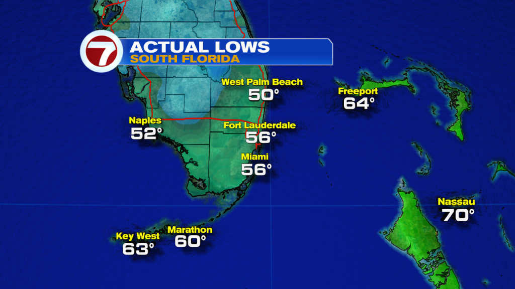
Hopefully everyone has had a nice week so far in the days leading up to the holiday weekend. As many of us will be out and about through the next few days, the weather will be as important as ever. After well over a week of above-average temperatures in the 80s each afternoon, a strong front came through our area and finally wiped away the heat and the humidity from South Florida. Since then, the air mass has cooled and temperatures across much of South Florida dropped into the 50s early this morning (some areas even reached the 40s!). This is exactly what we like to see during the holidays.
High pressure has finally settled in behind the front and has allowed winds to veer out of the north, which is what always brings the cooler and drier air towards our area. The good news is that this high-pressure system is expected to stick around through the next few days, which will leave very comfortable conditions across South Florida through the end of the week. Once high-pressure begins to shift farther east into the Atlantic, our wind pattern will begin to veer off the water and that will help our temperatures slowly rebound.
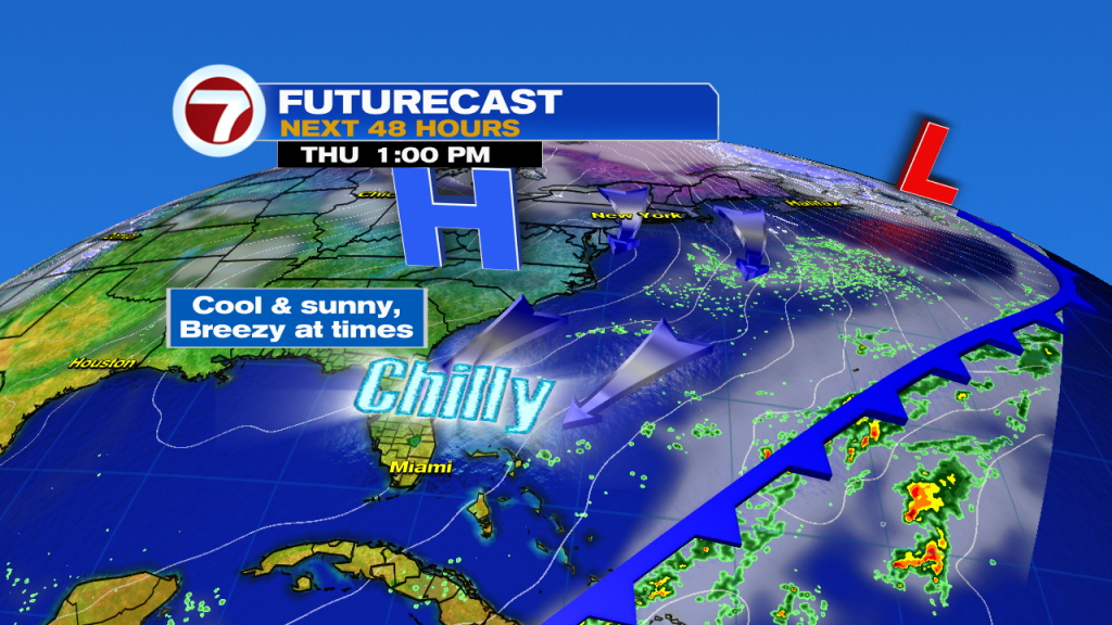
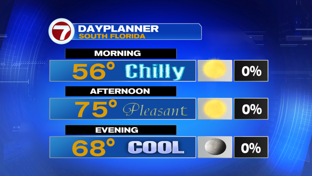
But in the meantime, today we can expect a comfortably cool afternoon after starting off in the 50s across South Florida. There will be plenty of sunshine to go around with very few clouds. Wind will be out of the Northwest, which will continue to bring in that cooler air across our area. Similar to yesterday, our winds may pick up from time to time however it shouldn’t be an uncomfortably windy day. Our afternoon high temperatures will reach into the mid 70s (which happens to be a few degrees BELOW average).
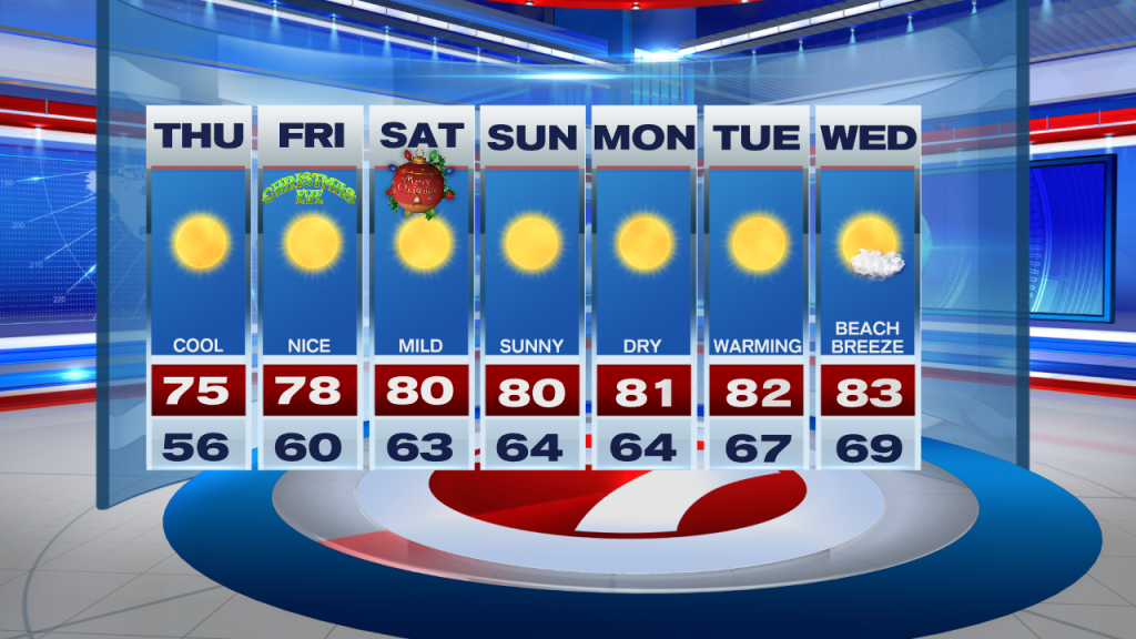
Looking ahead, South Florida will enjoy another cool morning on Friday (Christmas Eve) followed by a comfortable afternoon with high temperatures reaching into the upper 70s once again. For the start of the weekend, we may notice our winds beginning to veer off the water a bit as high-pressure moves farther East. This means Christmas morning won’t be AS chilly but should still be comfortably cool in the 60s while humidity levels across our area remain on the lower end as well. The air mass will continue to moderate during the weekend and our afternoon high temperatures will eventually reach near 80° by the end of the weekend. Not too bad of a forecast for the big holiday weekend!
Have a great week!
Erika Delgado
Meteorologist
WSVN Channel 7 News
Copyright 2024 Sunbeam Television Corp. All rights reserved. This material may not be published, broadcast, rewritten or redistributed.