Happy Friday, South Florida!
Hopefully everyone has been able to enjoy the holiday week across south Florida. The threat of an increase in shower activity has been lurking across the region but not much rain has actually materialized this week. Other than a passing shower, South Florida has remained more dry than wet. A weak front has been draped across the region and has helped trigger showers offshore from time to time. A wind pattern off the ocean has tapped into some of those showers and brought in our direction but the shower activity has been minimal and very spotty in nature through the last few days. This morning we saw a few showers push through South Florida – from the west instead of from the Atlantic! This is because a surge of moisture associated with a small disturbance in the Caribbean is finally moving into South Florida and will keep the chance of a few more showers in the forecast.
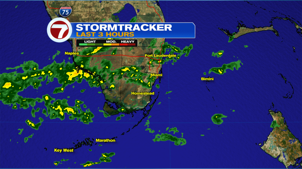
Today South Florida can expect a few showers in the forecast. And we already saw a few of those push through earlier this morning. More moisture will be available for rain and it will leave the potential for slightly higher rain chances today compared to earlier in the week. With that said, we are not expecting it to be an overly wet day for South Florida. It seems our most southern locations will have the best chance for seeing showers today. A few isolated thunderstorms might even be possible for the Florida Keys later this afternoon. We will have cloudy periods but at times, sunshine will help warm our temperatures up into the lower 80s while our breeze builds once again.
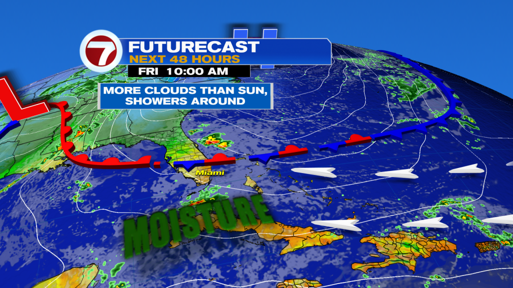
Looking ahead, South Florida will continue to experience an elevated rain risk as we move into the final weekend of 2024. There will be plenty of moisture available for rain so anytime showers will be possible. Our southernmost locations of South Florida look to be the wettest, especially across the Florida Keys where isolated storms cannot be ruled out this weekend. Cloudy skies will blanket South Florida until early next week until the 1st of 2 fronts moves into Florida on Monday. This will be a drying front, which means it will finally wipe away the cloud cover and moisture, however, it will not bring a temperature change. Front #2 arrives on New Year’s Day and brings cooler conditions for the first few days of 2025.

Have a wonderful last weekend of 2024!
Erika Delgado
Meteorologist
WSVN / Channel 7 News
Copyright 2025 Sunbeam Television Corp. All rights reserved. This material may not be published, broadcast, rewritten or redistributed.