Happy Wednesday, South Florida!
Hopefully everyone has had a nice week so far. We are halfway through the work week and conditions have been rather quiet for South Florida. After steamy temperatures and mainly dry conditions on Tuesday, South Florida woke up to warm temperatures in the upper 70s and 80s while we saw quiet conditions and hazy skies once again. We can thank a large area of high pressure over the Gulf of Mexico, dry air and a thin layer of Saharan Dust still over South Florida.

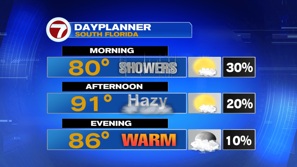
Today will be a lot like Tuesday where we saw low rain chances and steamy temperatures. But given the time of year, we won’t be completely dry all day as a few showers will still be possible, especially through the first half of the day. Our afternoon high temperatures will reach into the lower 90s once again but with the added humidity in place, our feels-like temperatures will reach well into the 100s. The good news is that we are expecting a nice beach breeze out of the ESE.
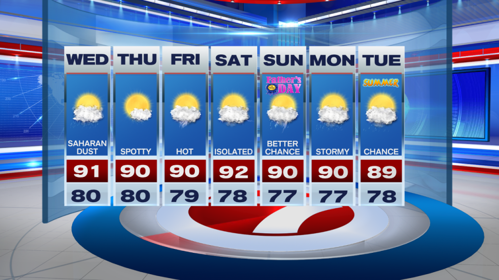
Looking ahead, drier days continue through at least the end of the work week as Saharan dust remains nearby for one more day and while high pressure and dry air remain in place. This means our wind pattern out of the East to Southeast will continue to push showers inland and out west towards the Gulf Coast of Florida. As we fast forward into the upcoming weekend, a weak front will enter Northern Florida, which will cause our wind pattern to veer out of the South to Southwest. This will help trap moisture across our area once again. This will help push any thunderstorms that do develop towards the East coast in the afternoon for the all important Father’s Day weekend.
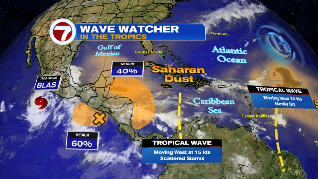
A quick check on the Tropics….the National Hurricane Center is keeping an eye on an area of low pressure in the SW Caribbean producing disorganized showers and thunderstorms. As the disturbance lifts to the Northwest, some development of this system will be possible through the rest of the week (especially if it stays over water). If so, a tropical depression may form late this week. Regardless of development, heavy rain is expected across Eastern Honduras and Eastern Nicaragua.
Remember to keep hydrated today!
Erika Delgado
Meteorologist
WSVN Channel 7 News
Copyright 2024 Sunbeam Television Corp. All rights reserved. This material may not be published, broadcast, rewritten or redistributed.