The Fourth of July holiday weekend is here as we celebrate Independence Day and the weather is looking very nice overall for July standards in South Florida!
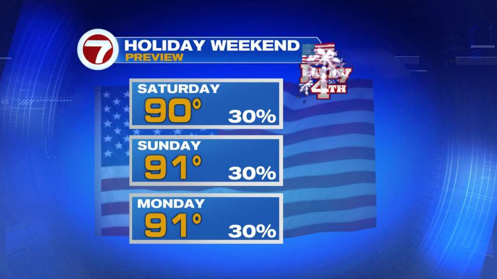
Each day this weekend — Saturday through Monday — will feature the same setup. Expect isolated showers near the coast in the mornings then scattered storms during the afternoon across inland areas. Rain chances will hold steady in the 20 to 30 percent range. Given the elevated winds blowing onshore at 10-20 mph, that should keep the afternoon storms pinned toward the west coast of Florida. But the breeze will also make for a high rip current risk for the east coast beaches this weekend so if you do plan on going in the water, be sure to swim at a guarded beach.
Otherwise it will be hot and humid with high temperatures rather typical for this time of the year with highs near 90 degrees, feeling more like the upper 90s in the afternoon, and lows near 80 degrees.
In the tropics, there are two active tropical storms: Bonnie and Colin.
Bonnie is currently located (as of Saturday morning) over Central America near southern Nicaragua and is expected to maintain organization so once it moves over the eastern Pacific Ocean, it is expected to remain as a tropical storm with the name Bonnie. Then by the middle of next week, Bonnie is forecast to intensify in a hurricane south of Mexico.
There is also Tropical Storm Colin, which formed early Saturday morning near the South Carolina coast with winds up to 40 mph. Colin is expected to maintain this intensity through its lifetime as it tracks up the coast of the Carolinas and hooks off to the east one it reaches the Outer Banks tomorrow. There are Tropical Storm Warnings in effect from the Georgetown, SC area through the Outer Banks as a result.
Have a great weekend!