April is coming to an end and with that comes May — off to the races with hot, above average temperatures for the next couple days.
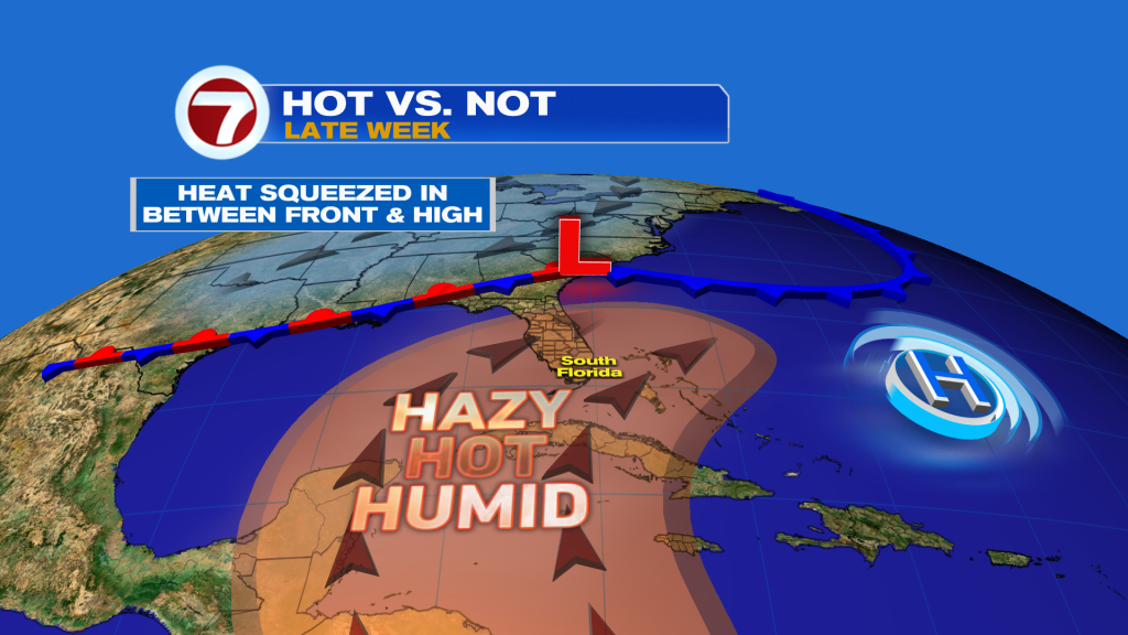
A southwest wind will persist Friday into Saturday, being funneled in around high pressure over the Atlantic and a stalled front draped across the Gulf Coast. The result will be hot and humid conditions with the potential for record heat.
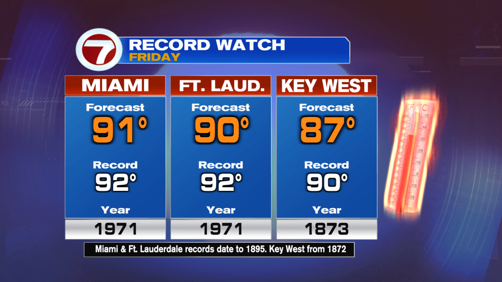
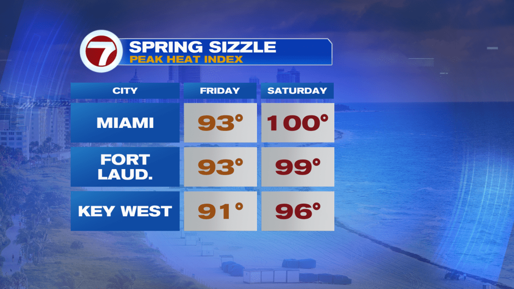
On Friday, Miami is forecast to be just 1F shy of the record high and Fort Lauderdale forecast to be 2F short of the mark.
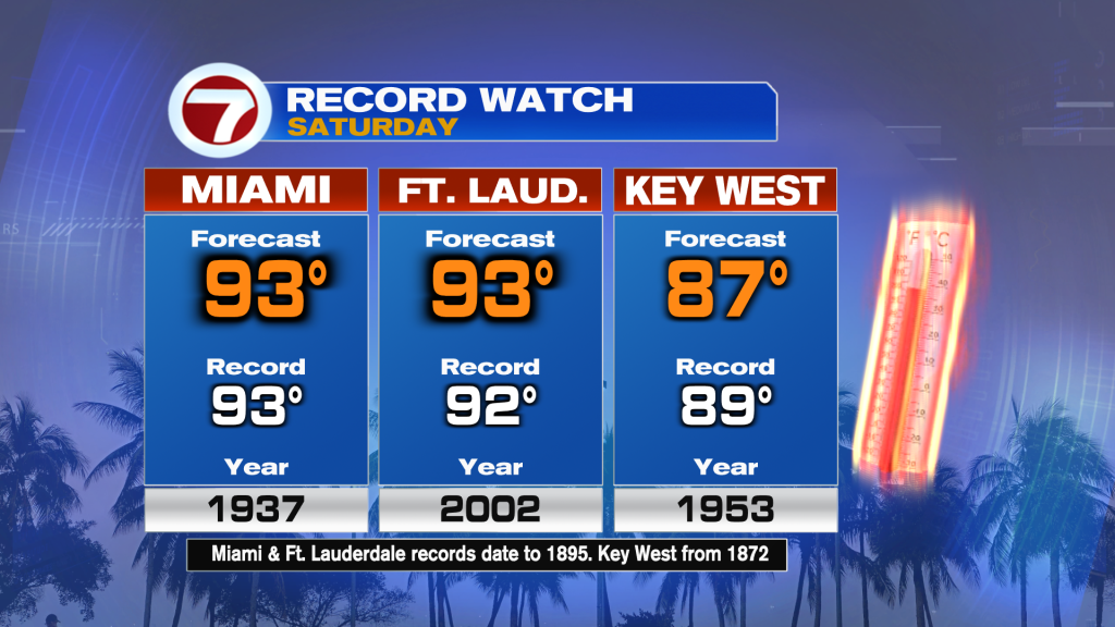
Then on Saturday, temperatures will be even hotter, with highs in the low to mid 90s, which are more likely to tie or break records.
Feels-like temperatures are projected to peak in the low to mid 90s on Friday and then upper 90s to around 100F on Saturday for most locations.
Both days will feature a good amount of sunshine, dry conditions and a gusty breeze by the coast both afternoons, although Saturday will be a breezy day for all of the area.
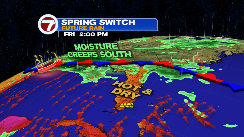
That’s because a front is on the way. This front arrives on Sunday and then stalls near or over South Florida, leading to an unsettled start to next week.
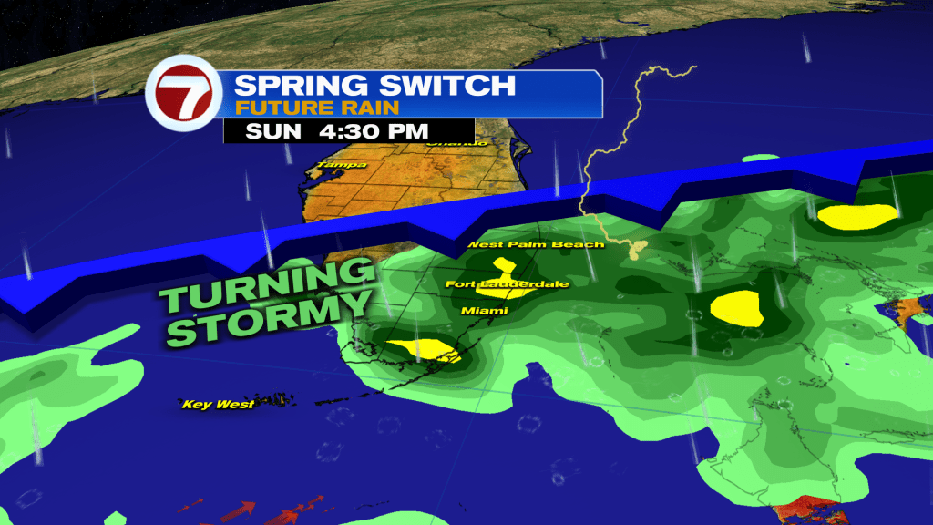
Rain chances will be the highest on Sunday out of the next 7 days with rounds of rain and storms likely throughout the day. Isolated strong storms and areas of flooding will be possible.
Then depending on the placement of the front, that will determine the ultimate outcome for our weather Monday and Tuesday. As of now, the risk for scattered showers and storms does exist.
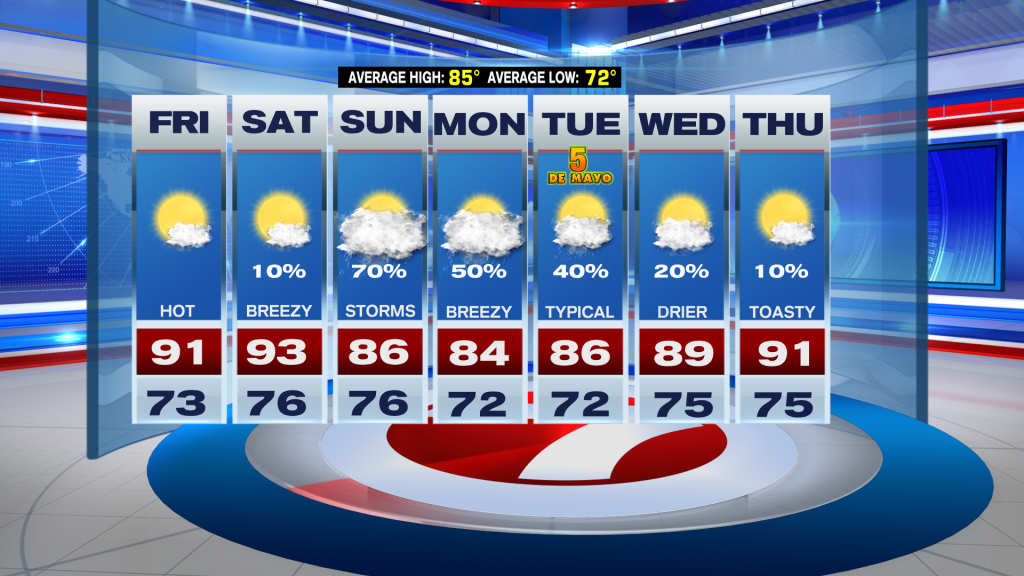
At least if you’re not a fan of the heat, temperatures will be milder Sunday into early next week!