
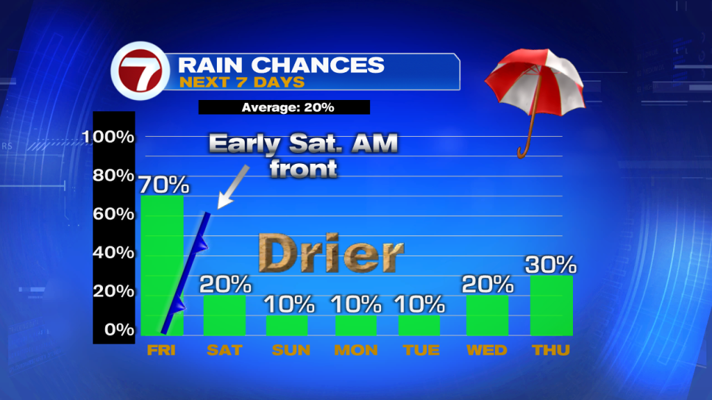
A cool front is approaching South Florida. If it does not weaken, it’s set to push in plenty of moisture across South Florida. Some model runs suggest early morning rain with the continued chances thru Saturday morning.
What to Expect
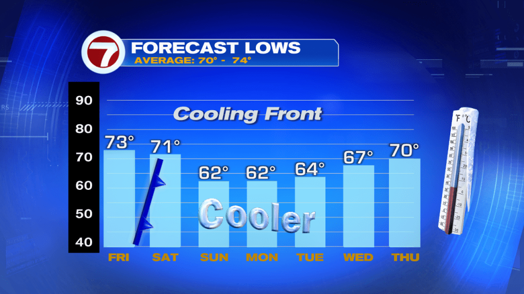
Many things can happen with this front. The cool air mass is traveling over the Warm Gulf of Mexico and that is making it lose some of its cooling punch. After the possibility of heavy rain on Friday, the cooler air should arrive by Saturday night / Sunday morning. Typical lows this time of year range between 70 and 74, the models suggest lows dropping into the low 60s with some over zealous models even calling for some upper 50s in the Western Suburbs. That may not happen as the Gulf of Mexico is heating the air with the front. Stay tuned to Meteorologist Erika Delgado Friday to bring you the latest status report on the strength of the front.