Happy Sunday, South Florida!
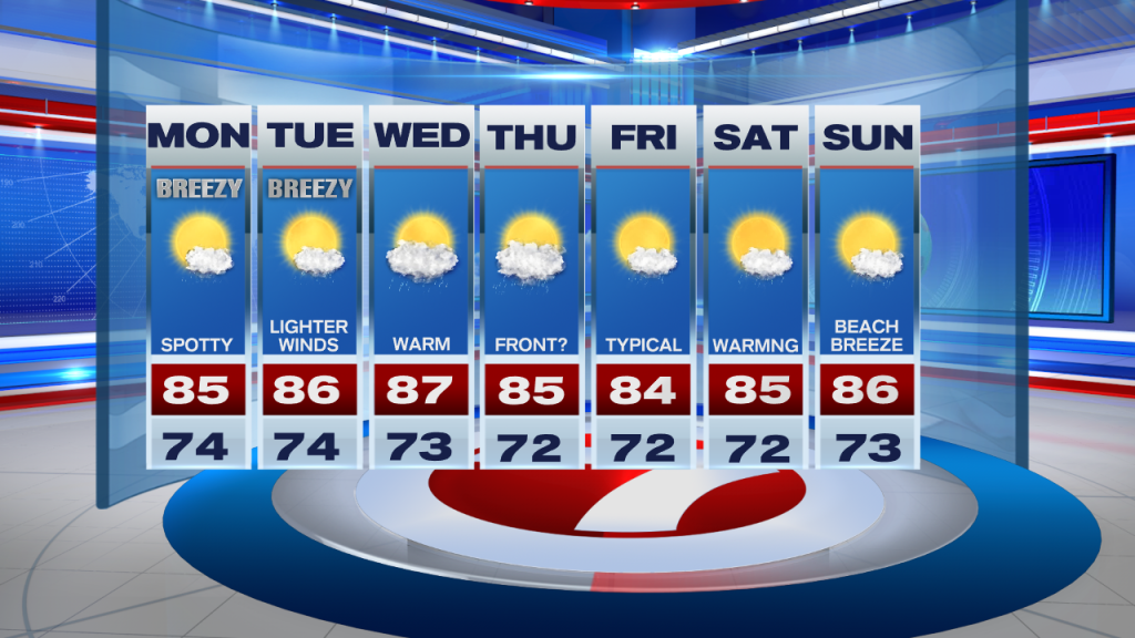
Hopefully everyone had a nice weekend as our conditions across South Florida have remained quite nice. Warm (but near-average) temperatures in the mid 80s, breezy conditions and low rain chances made for a nice end to the weekend. And although today we saw breezy to gusty conditions once again, our wind pattern is slowly beginning to change as our wind speeds are no longer AS strong as they were just a few days ago. It looks like we will finally enjoy comfortably breezy conditions for at least 1 to 2 more days before our wind pattern begins to change.
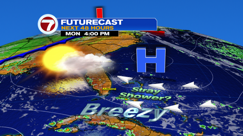
The start of the work week looks a lot like what we saw today. After a mild start in the mid 70s and possibly a few spotty showers to start the day, the focal point for any shower activity later in the day will be out towards the west coast. (And that’s IF the west coast of Florida sees any rain during the afternoon.) Our afternoon high temperatures will once again be in the mid 80s but some areas could be a degree or two warmer than what we saw over the weekend. While rain chances remain low throughout the day, we could still see a brief passing shower or two, especially across our southern locations where we see a bit more moisture than the rest of our state. Expect a breezy Easterly wind once again so the risk of rip currents will remain high across area beaches.
Looking ahead, the weather pattern will gradually change throughout the upcoming week, however, should remain about the same to start the week. Breezy conditions are still expected on Monday, however, a few showers may be possible through the first half of the week. One thing we will notice is that each afternoon will be just a touch warmer than the day before. Eventually afternoon high temperatures could be reaching in the mid to upper 80s by the middle of the workweek as our wind pattern begins to veer a bit more out of the south. This is all ahead of a weak front that could reach South Florida by Thursday. And while we will continue to have limited moisture surrounding Florida, a few showers will be possible through the second half of the work week as the front is expected to remain nearby. Even though we are not expecting any cooling with this front, temperatures behind the front could be a bit closer to average once again.
Have a great upcoming week!
Erika Delgado
Meteorologist
WSVN Channel 7 News
Copyright 2024 Sunbeam Television Corp. All rights reserved. This material may not be published, broadcast, rewritten or redistributed.