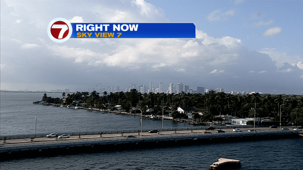
Happy Saturday, South Florida!
Hopefully everyone had a great first week of 2022. The weather pattern across our area has not exactly felt like the first week of the year as our afternoon high temperatures have reached into the mid to lower 80s through the last few days. A short-lived ‘cool down’ earlier in the week proved to be just that, SHORT-LIVED, as it only lasted one day. A weak front has been pushing through our area since Friday afternoon and is forecast to stall nearby today. Thus, South Florida woke up to clouds and showers moving from east to west especially across southern areas of the peninsula closer to where the front was located.
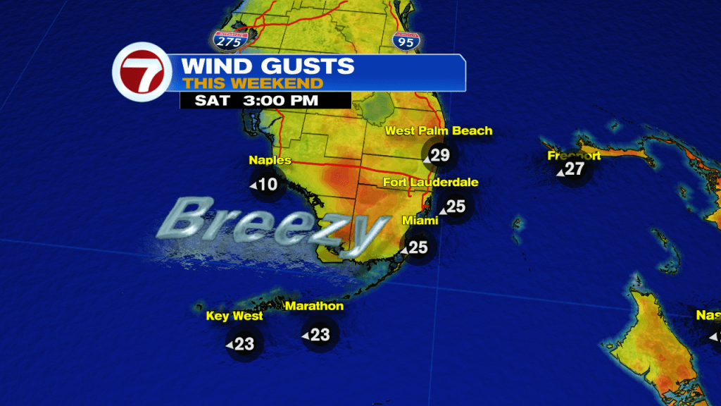
The above mentioned front looks to remain near South Florida through much of this weekend. At the same time, however, a high-pressure system will quickly begin to move into our area and this will help tighten the gradient across South Florida. This means that even though we are not expecting a cool down with this front, wind speeds will pick up beginning today and will remain on the strong side through the entire weekend.
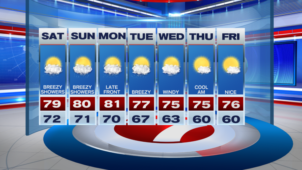
While we are on topic, let’s discuss your forecast for today. There will be times of sunshine and times of rain. Areas that do see rain could see it for a prolonged amount of time. The above mentioned front has stalled nearby so areas closest to the front will see the best chances for shower activity today. After starting off in the mid to lower 70s this morning, our afternoon high temperatures will hover around that 80° mark once again. And while it won’t be raining all day long, be sure to keep the umbrella with you especially if you are planning on being out and about.

Not much change expected for the latter part of the weekend as the stalled Front looks to remain near south Florida once again. The winter warmth continues as our afternoon high temperatures will once again reach the lower 80s on Sunday afternoon. And while the weekend is not expected to be a complete washout, some of the showers could be a nuisance especially if you’re out and about taking full advantage of your weekend. Breezy to gusty conditions will also be a part of your Sunday and with strong winds out of the east, showers will be possible at any given time.

Looking ahead, South Florida will still be looking for that cool down that we have been waiting for. Luckily for us, there is another [stronger] front already on its way! While scattered showers remain in the forecast on Monday, the breeze will begin to let up just a bit ahead of our next front that is forecast to move through South Florida at some point early Tuesday. Shower activity will still be possible throughout the day on Tuesday but then a high-pressure system will help usher in much drier air into our area by the middle to end of next week and that’s when we will finally begin to feel the cooler and enjoy drier conditions across South Florida. By the end of the work week, our overnight temperatures could possibly drop into the 50s across some spots!
Have a wonderful weekend!
Erika Delgado
Meteorologist
WSVN Channel 7 News
Copyright 2024 Sunbeam Television Corp. All rights reserved. This material may not be published, broadcast, rewritten or redistributed.