The cold is soon on its way out with up-and-down temperatures ahead today through early next week.
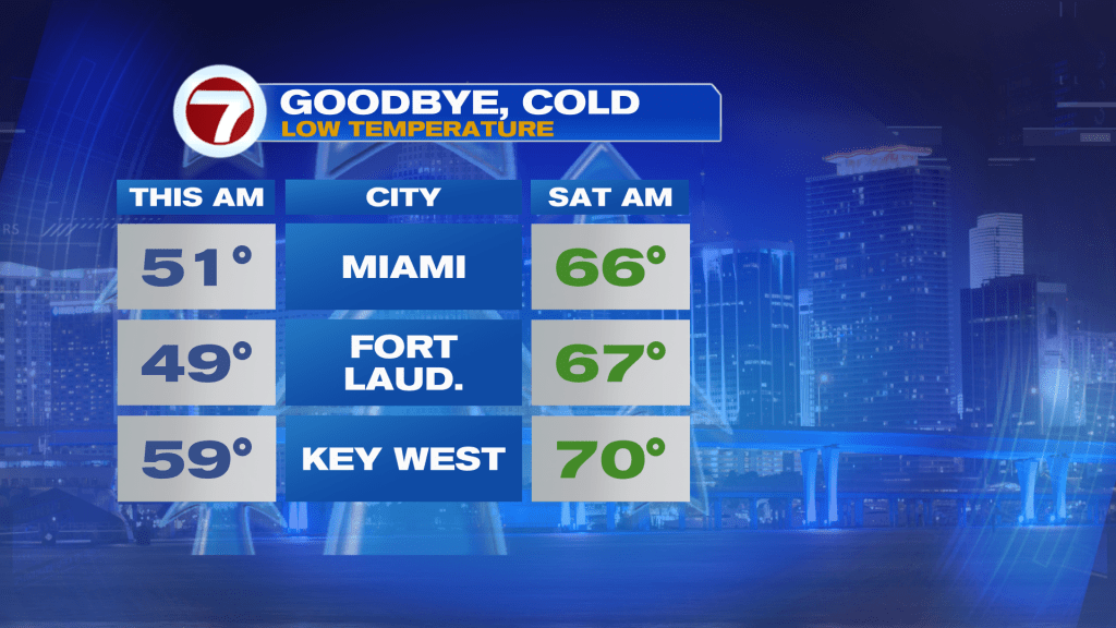
Before then, however, it’s been another chilly morning this Friday with widespread lows in the mid 40s to low 50s across Miami-Dade and Broward Counties.

Unlike yesterday when the wind was out of the north-northwest all day long, the land wind this Friday morning will shift to an onshore wind for the afternoon, leading to milder but still pleasant highs in the mid 70s.
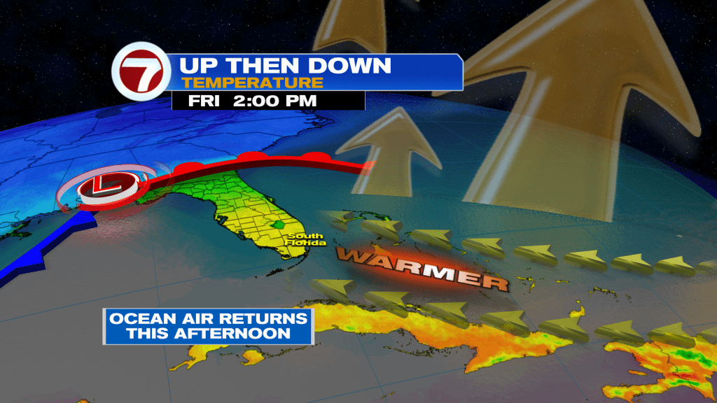
That southeast wind will also draw in some patchy clouds, so expect sunny to partly cloudy skies today.

Overnight tonight, temperatures will be dramatically warmer by about 15F.
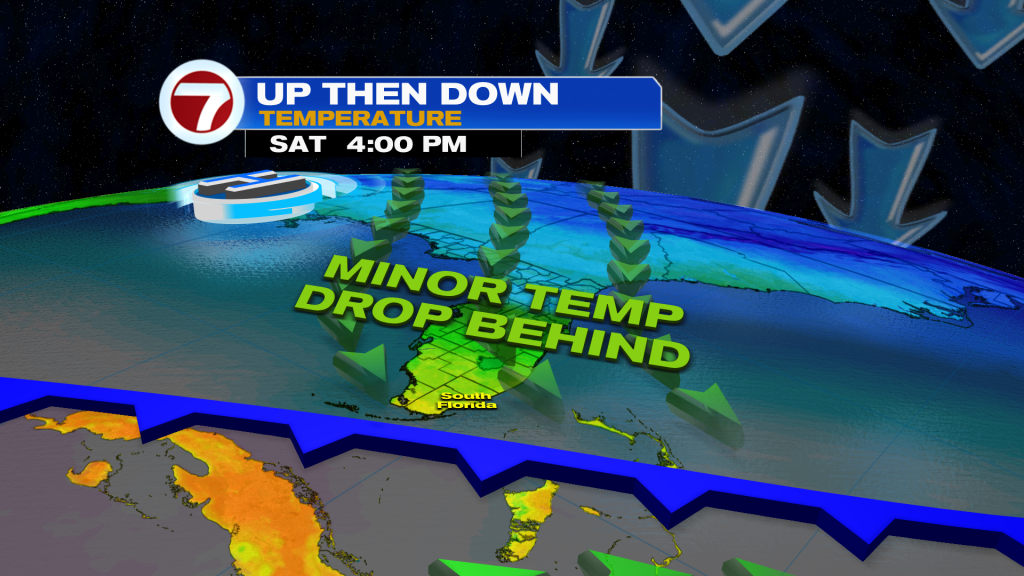
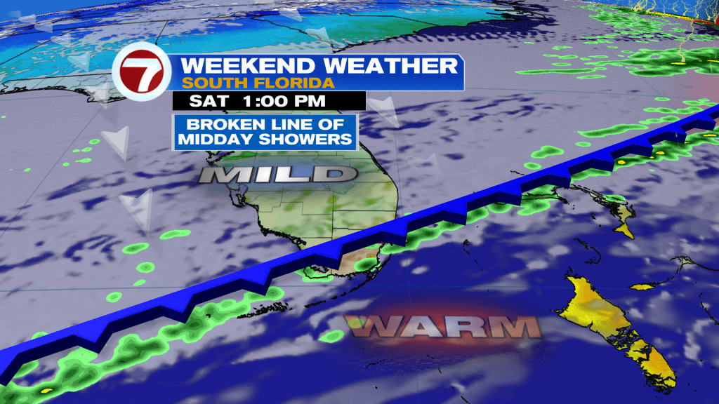
That will foreshadow warmer temperatures on Saturday with highs near 80F. Saturday will feature even more changes, however, with warm and bright conditions in the morning, a line of showers midday, then cloudy and milder conditions for the rest of the day courtesy of a weak front.
Temperatures then slightly drop again Sunday with lows near 60F and highs in the mid 70s before it warms back up for Monday and Tuesday.
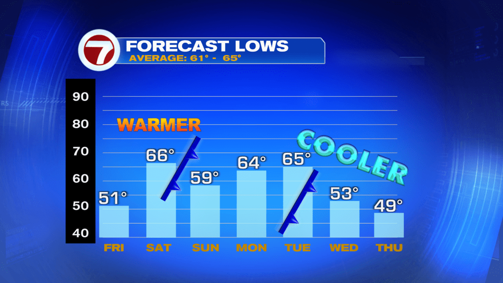
It’s not until mid next week when our next cold front arrives, leading to another push of chilly temperatures. Lows by Thursday could potentially fall back into the 40s!