Deep tropical moisture over South Florida will keep showers chances elevated for the weekend.
Expect scattered showers and storms with most of the activity favoring the inland areas by the afternoon and evening hours. We will see a little less of the shower activity on Monday, but it will be short-lived.
We'll be dodging scattered showers & storms today. Here's a look at our Saturday forecast @wsvn @7weather #flwx pic.twitter.com/spTR2OtOD2
— Miss Chavis (@karlenechavis) October 14, 2017
Models suggest a cold front will make its way towards South Florida by the middle of the week. Ahead of the front, rain chances will ramp up by Wednesday. The front is forecast to stall over us and lead to enough instability in the atmosphere for rounds of rain and storms each afternoon/evening into the end of the work week.
The front is expected to fade out by next weekend as drier days return.
TROPICS
An area of low pressure east of the northern Leeward Islands is producing gusty downpours. While conditions are not favorable for development over the next couple of days, some development will be possible by early next week as it moves west-northwest over the Atlantic waters. No direct threat to South Florida.
A low is producing gusty downpours as it nears the Leeward Islands. Medium chance for development @wsvn @7weather pic.twitter.com/zIF0SJLQO2
— Miss Chavis (@karlenechavis) October 14, 2017
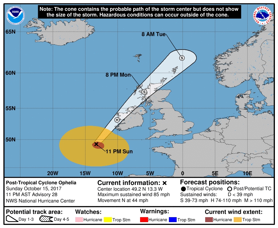
Hurricane Ophelia is still churning over the Eastern Atlantic. Interests in the Azores, Ireland and the United Kingdom should monitor the progress of this system.
Copyright 2024 Sunbeam Television Corp. All rights reserved. This material may not be published, broadcast, rewritten or redistributed.