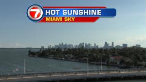
On the heels of a beautiful weekend, we’re about to get reacquainted with more clouds and times of rain. Winds are still very light, so whatever showers we see will be “drifters” that are slow to move away. Watch for heavy downpours with possible storms (especially during the prime heating of the day). The next few days will start steamy and quiet, followed by more active weather conditions. Moisture has been on a steady increase since Sunday afternoon and an expanding area of low pressure (in the upper sky) will create more numerous storms across much of the state. Of course, the typical sea breeze circulations will add to the instability too… keeping us with higher rain chances at least through the first half of the week. As the week continues, we’ll also pay attention to the tropics. Tropical Storm Karl is currently far from land and over the middle of the Atlantic Ocean. It’s expected to gradually get stronger while moving to the west and northwest. The latest forecast track has the system steering well north of the Lesser Antilles. Then, in the longer range, a stronger and more northward turn seems reasonable (due to a weakness in the guiding high). If that happens, Karl will not be a concern for the east coast of the United States…. while it may be a big threat to Bermuda. Regardless, things can change. Tropical systems often are tricky and involve the timing of many other weather features that can ultimately determine its path. We’ll be watching carefully as the week unfolds.