I want to mention the possibility of tropical downpours impacting South Florida by early next week.
For the time being, we’ll settle into our typical rainy season pattern of plenty of heat, humidity, and afternoon storms through the weekend. By the upcoming Monday and Tuesday, models are hinting at more rain across the area coming up from the Caribbean and Central America.
Forecast models:
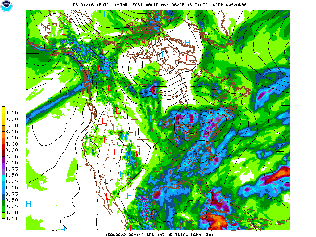
The GFS shows that by Monday, and area of low pressure develops bringing heavy rain with it.
As of the latest run, most of the big downpours remain offshore, but still with rain from I-75 and Tamiami Trail South.
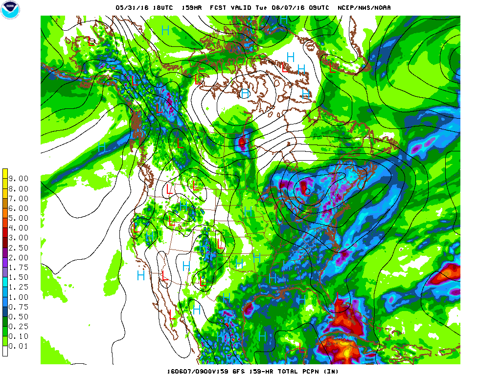
By Tuesday, it appears the rain sticks around for at least another 24 hours. The unsettled weather should improve by late midweek.
The European model also calls for the rain, but instead of keeping it offshore it draws it more over us.
We’ll be monitoring over the next few days.
Copyright 2024 The Associated Press. All rights reserved. This material may not be published, broadcast, rewritten or redistributed.