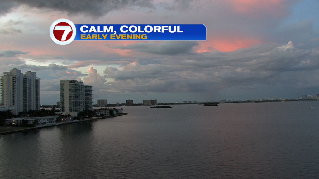
Much of the weekend was “touch and go” with periods of unsettled weather. At sunset, though, (Sunday) Biscayne Bay was smooth with some clearing overhead.
Over the past couple of days, Florida has been between a tropical disturbance east (Humberto) and an upper low spinning west in the Gulf. The end result has been frequent clouds and sudden showers.

Here’s the latest on Humberto, which was upgraded to a hurricane late Sunday evening.

Hurricane Humberto will not threaten any part of the United States as it turns away. The only land threat might be the island of Bermuda which could feel impacts during the middle of the week.

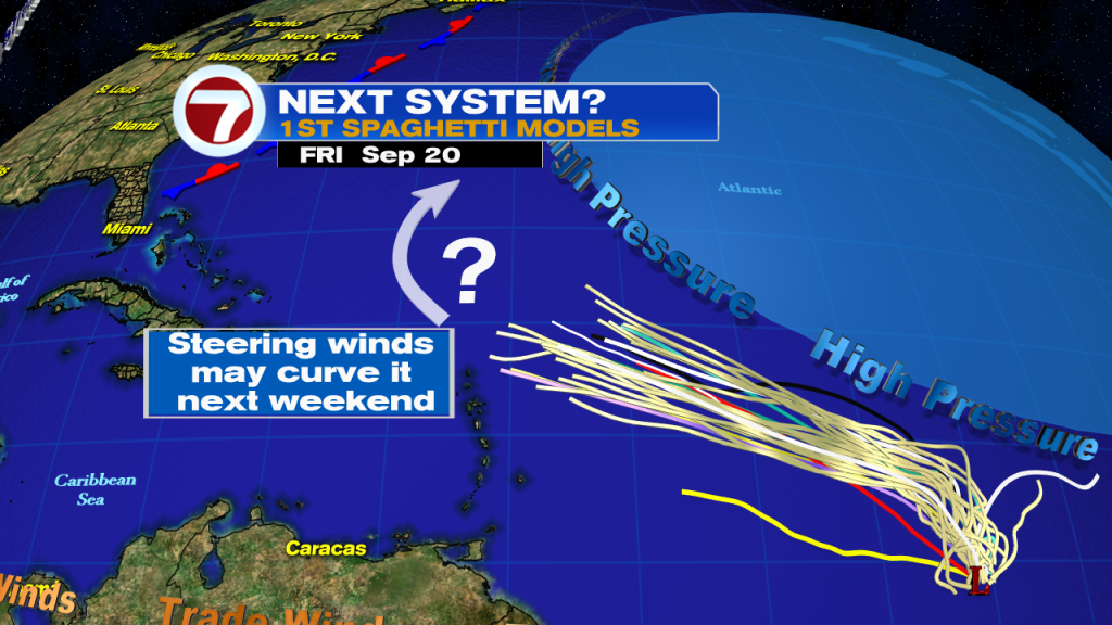
In the distant tropics we’re also keeping tabs on a disturbance (low pressure area) over the central Atlantic. It’s likely to be the next depression or storm as the week continues.

The disturbance will be steered by high pressure to the north of it. A general W to NW track is indicated by the recent “spaghetti model” forecast plot. At the end of the week, the potential system is probably going to be north and east of the Lesser Antilles. At this juncture we may start to see the system turn and make a curve. It would happen due to a weakness in currents. It’s obviously too far away to speculate whether it might ever impact land or just remain over the open waters.