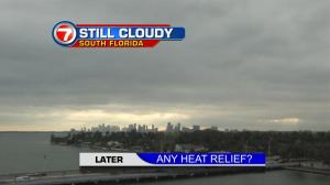
Winter is here. Well, at least the actual season has begun. As for temperatures, it sure doesn’t feel like the coldest time is now underway! South Florida temperatures are warmer than normal (as they have been almost the entire month, so far). Miami reached 80 degrees on Wednesday afternoon, even with plenty of clouds around. The cloud cover is associated with a nearby front. The so-called “cold front” has weakened and stalled over the region giving us stagnant weather conditions. The late week forecast involves a few minor changes, but the end result is quite familiar! As one front dissipates on Thursday, another cold front will rapidly approach Florida from the northwest. The boundary will eventually put on its brakes… probably around Lake Okeechobee. At this point, we don’t think the front will be much of a weather factor, locally, into the start of the holiday weekend. The forecast calls for the secondary front to nudge south and east, before Christmas. Once that happens, the most noticeable effect will come in the form of stronger winds. As high pressure gets more established (hovering over the northeastern states) onshore winds will become gusty. Still, the ocean air will feel mild and pleasant. The only worry with this pattern will be stronger surf with boating hazards, as well as rip currents increasing at the beach. In the long range, the last days of 2016 will stay warmer than normal. We’ll watch as yet another frontal boundary “teases” south Floridians during the final week of the year. The front isn’t likely to spread cooling our way. The big question will be whether or not the front will spark some rain showers ahead of New Year’s Eve. Finally, I’m including a graphical check of “Christmas past” in south Florida over the previous 5 years. The data proves that we’ve been getting more frequent “warm and wet” holidays, since 2012.