Much of Monday included stubborn clouds hovering over south Florida. A large batch, though, started breaking up as the sun was setting. Drier air was slowly returning to the region from the north and west (mainly).
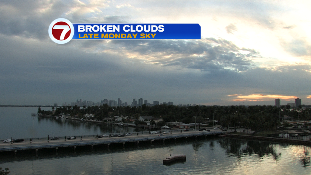
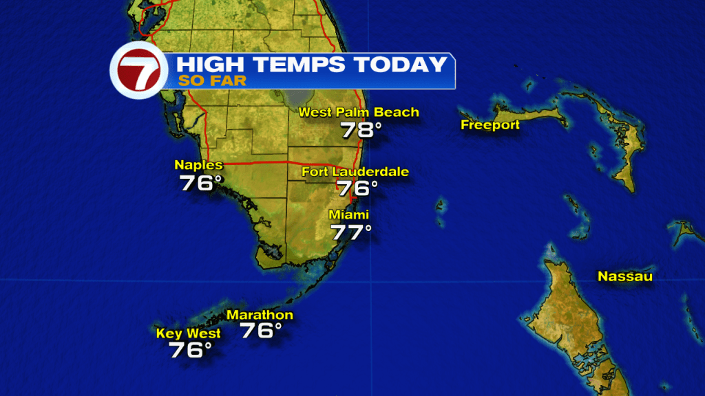
Interestingly, the cloud cover was “more bark than bite” and only included a few light rain showers near the Lower Keys. Meanwhile, temperatures remained pleasant with highs reaching into the middle 70’s.
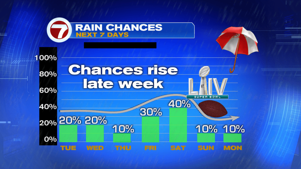
Here’s a check on the weather headlines as we continue through the last days of January (and leading up to this weekend’s Super Bowl). Temperatures will stay comfortable, not too warm and not too cool. Also, despite dealing with a couple pesky showers, much of the time will be dry. Mostly importantly, that’s the forecast for Super Sunday!

The Tuesday weather map looks fine as a weak disturbance heads east (pushing toward the Bahamas later in the day). Local winds will be out of the north with more sunshine building. Still, there could be an isolated shower near the beaches and especially offshore.

Rain chances, according to the latest forecast models, remain low through Thursday. Then, from Friday through Saturday, we may see a growing moisture surge. We’ll be watching for unsettled weather as the weekend begins, due to low pressure (another one) heading out of the Gulf of Mexico. Depending on the track and intensity, Saturday could be soggy. Regardless, the system is expected to move out by Sunday morning. That would provide us with a dry Super Bowl with increasing sunshine. Temperatures, though, would be cooler as winds veer out of the north. In fact, highs may struggle to get very much above 70-degrees.