Happy Sunday, South Florida!
Hopefully everyone has had a nice weekend so far and has been able to finish any last-minute holiday shopping or traveling. The weather pattern began to change on Saturday and it was evident that changes were coming. The weekend started off with more cloud cover and a few more showers and this morning was no different. Much of South Florida surrounded by showers and thunderstorms since early this morning while humidity levels remain high and temperatures on the warm side. It straight out felt like a Summer morning earlier today!
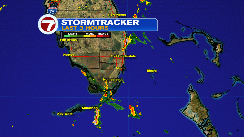
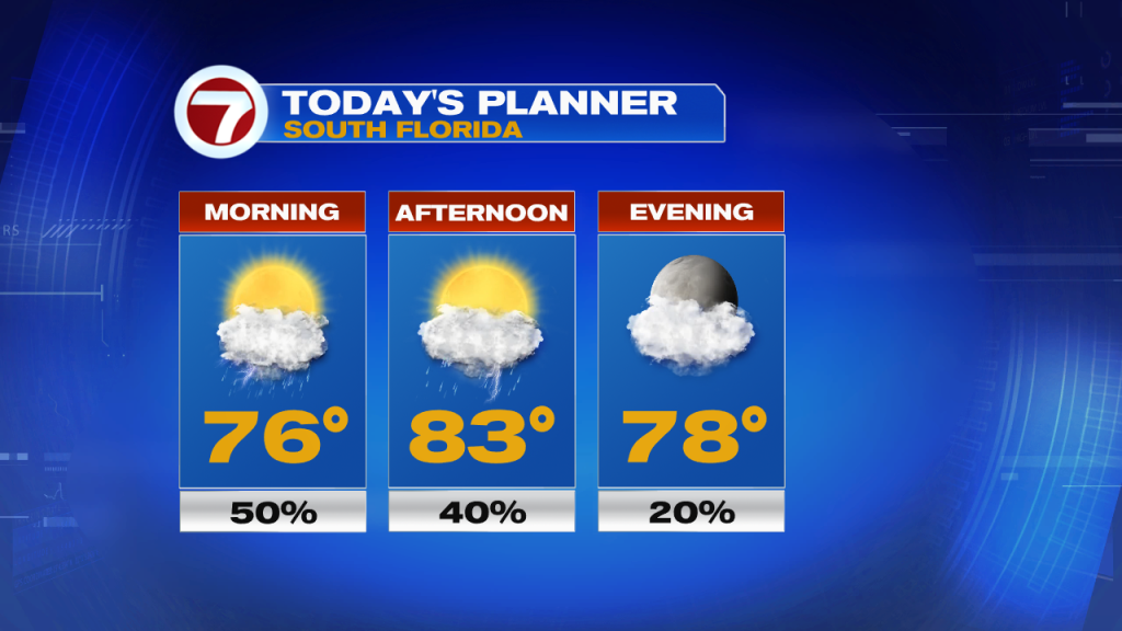
As our weekend comes to a close, a front will be entering Florida but won’t quite reach our area. This will not only leave South Florida on the warm and muggy side of the front but also will help trap any moisture coming in from the Atlantic over our area. This means that scattered showers will be possible today and with a front nearby, isolated thunderstorms cannot be ruled out. As our wind pattern begins to veer a bit more out of the south, our afternoon high temperatures will quickly warm into the mid 80s.
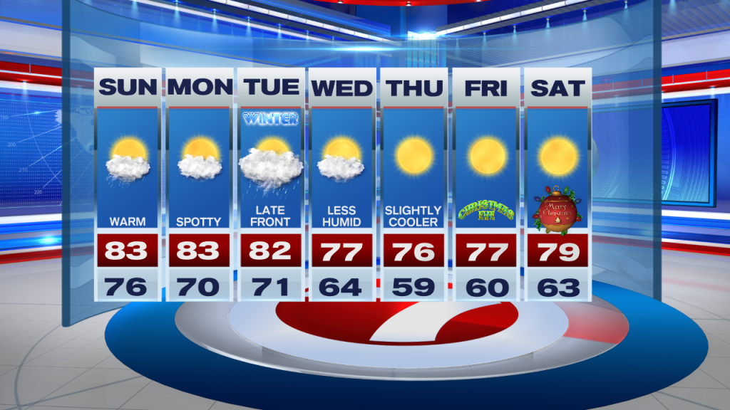
South Florida looks to remain warm and very humid through the start of the upcoming work week. However, I do have some good news that I think many will be pleased with. Our weather models have been consistent in showing a stronger front that finally reaches South Florida by Tuesday (which happens to be the official start of Winter. It just won’t be feeling like Winter,…yet). This will finally bring more of a seasonal feel across South Florida in the days leading into Christmas, with a few cooler mornings starting on Thursday and lingering into Christmas morning.
Have a safe Sunday!
Erika Delgado
Meteorologist
WSVN Channel 7 News
Copyright 2024 Sunbeam Television Corp. All rights reserved. This material may not be published, broadcast, rewritten or redistributed.