Happy Sunday, South Florida!
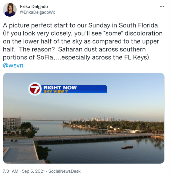
Hopefully everyone had a great start to the weekend despite the showers and thunderstorms that rolled through our area during the afternoon. The good news is that Saturday wasn’t a complete washout. And even better news is that this morning started off rather quiet with clear skies and no rain anywhere across South Florida. If only that would hold up all day!
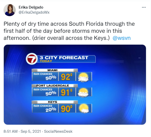
Today looks to remain about the same. With no major change across South Florida, we can expect steamy morning conditions to give way to another round of afternoon thunderstorms that will once again favor the East Coast. That means that if you have any outdoor plans today, it may be best to move them to the first half of the day. Outdoor plans in the afternoon should be moved indoors (or at least keep an umbrella nearby just in case). With a West to Southwest wind in place, our high temperatures will warm quickly into the 90s again.
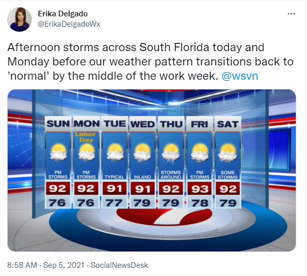
While the Labor Day holiday looks to remain stormy during the afternoon once again, South Florida should begin to notice slightly fewer storms in the forecast as far as coverage is concerned. And by the middle of the work week, a typical weather pattern in South Florida should return where afternoon thunderstorms will once again favor the West Coast of Florida. And after a few days of going back to normal around here, it looks like South Florida MAY go back to these stormy afternoons as we head into the end of next week.
Have a great long weekend!
Erika Delgado
Meteorologist
WSVN Channel 7 News
Copyright 2024 Sunbeam Television Corp. All rights reserved. This material may not be published, broadcast, rewritten or redistributed.