Happy Saturday, South Florida!
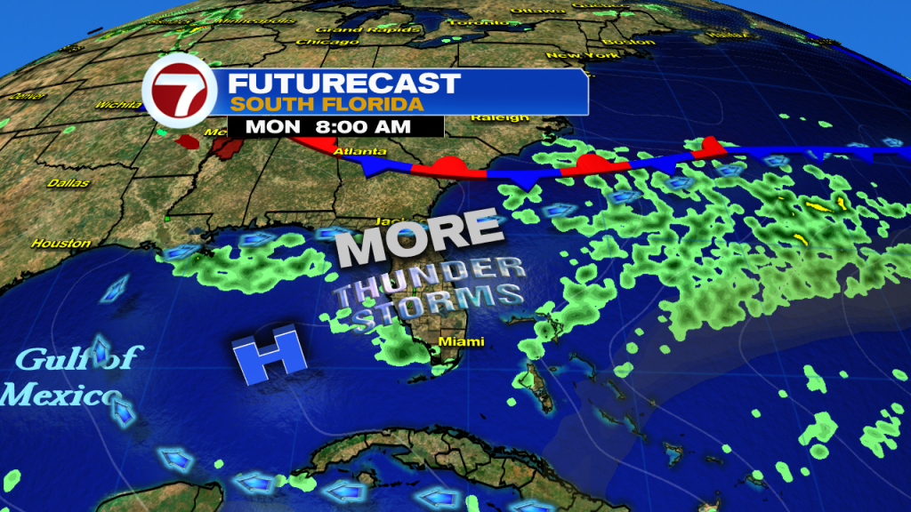
While conditions were picture perfect at the start of the day, don’t let this morning’s sunshine fool you. Another round of heavy rain and numerous thunderstorms expected this afternoon across East Coast metro areas.

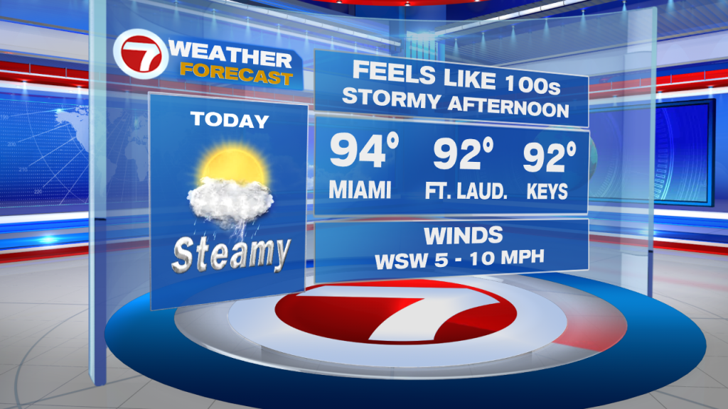
Steamy temperatures and surface moisture will aid in the development of thunderstorms while a West to Southwest steering flow will help push any and all thunderstorms that DO develop towards the ENE. (yes, that means storms will push in our general direction). So be sure to take care of all outdoor errands through the first half of your day. While you should be in the clear until just after lunch time, be sure to have that rain gear with you if you find yourself still out and about during afternoon.
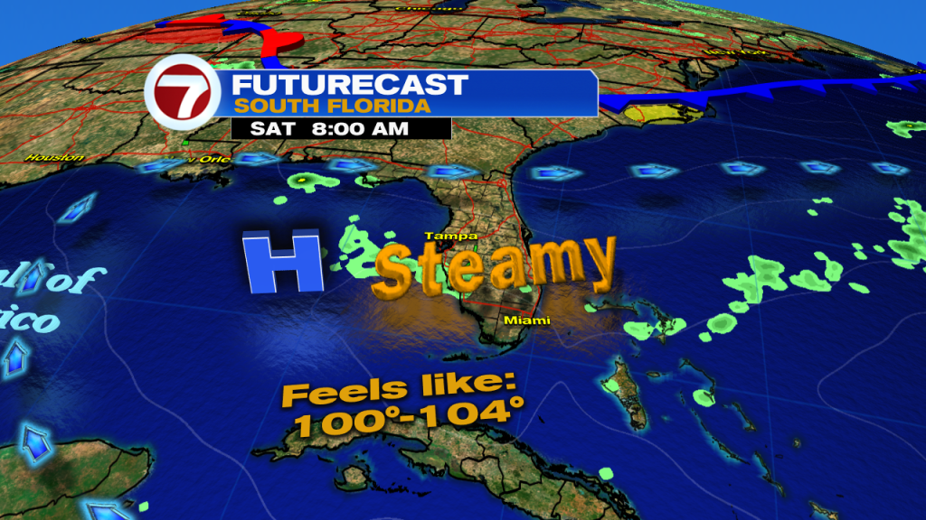

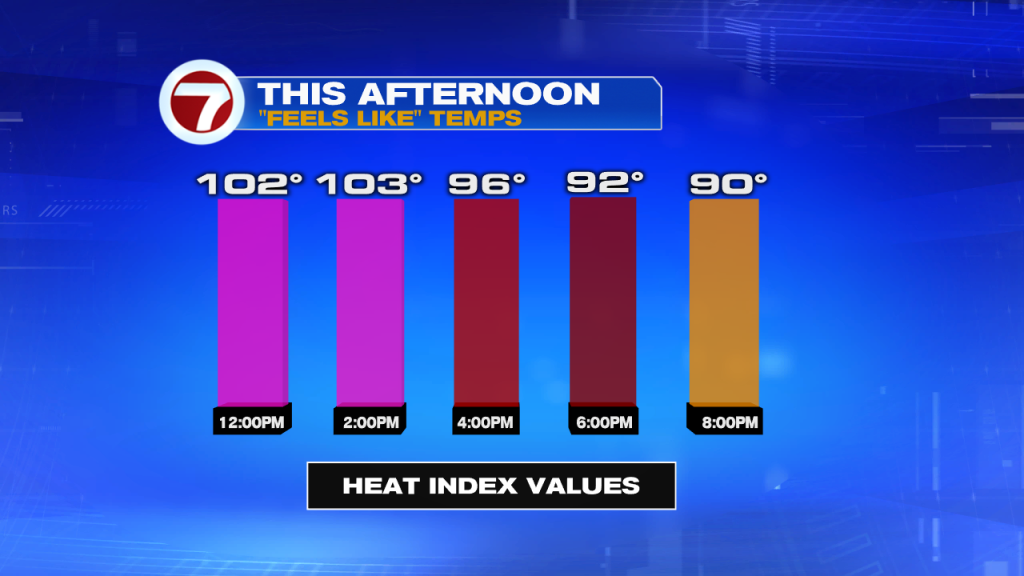
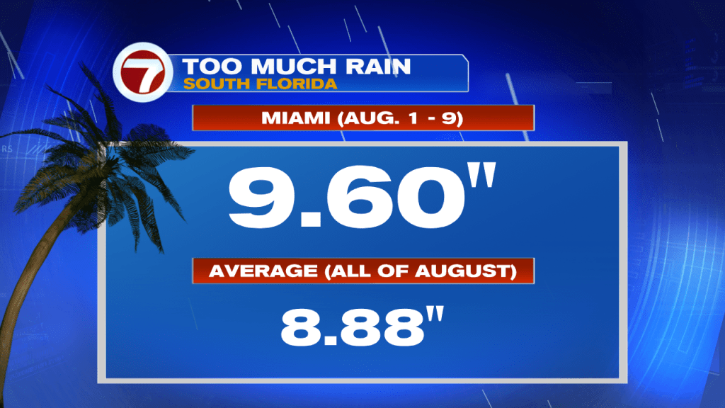
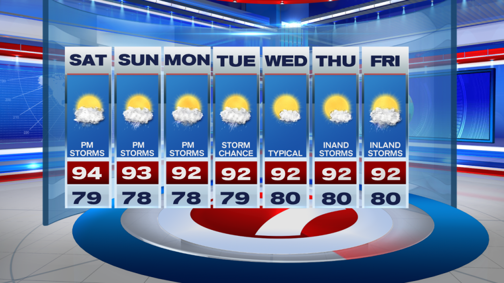
The heat could be a major problem for many across South Florida. As temperatures reach the mid 90s this afternoon, heat indices (the FEELS LIKE temps) will be soaring into the 100s. Flooding could be another issue this afternoon as some spots across South Florida (such as Miami) have already received more than 9.5″ of rain during the first 9 days of August alone! So it is safe to say that today’s rainfall will provide runoff as the ground is already saturated. So if you are driving and find yourself near a flooded street, please do not drive through flooded streets. Always best to TURN AROUND, DON’T DROWN.
Showers should linger into the early evening before quickly fizzling out. So don’t worry about any outdoor plans you might have tonight. Looks like you will be in he clear by then. And just when you’ve had enough of this relentless rain, it looks like a similar stormy setup is expected for the latter part of the weekend AND it looks to linger into the start of the work week, which means Sunday and Monday are forecast to be another wet and stormy one as we head into the afternoon hours.


If the forecast holds together, then Tuesday & Wednesday look to be transitional days before the weather pattern shifts back to a typical one for South Florida by the end of the upcoming work week.

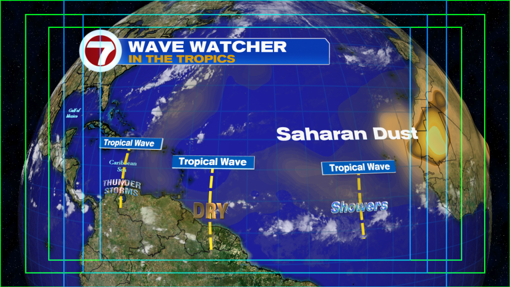
Shifting focus to the Tropics….plenty of dry air and Saharan Dust currently encompasses much of the tropical Atlantic, keeping the few tropical waves out there in check. No tropical cyclone development expected through the next 2-5 days. Now THAT’S that we like like to hear!

Remember to keep that rain gear with you, especially for the afternoon hours!
Erika Delgado
Meteorologist
WSVN Channel 7 News
Copyright 2024 Sunbeam Television Corp. All rights reserved. This material may not be published, broadcast, rewritten or redistributed.