An area of low pressure with a trailing front is making its way through the Deep South, but Mother Nature wants to charge us a fee for any cool air allowed into South Florida. For Friday, she is promising near record heat as our toll while drenching the East Coast along with cooler weather there.
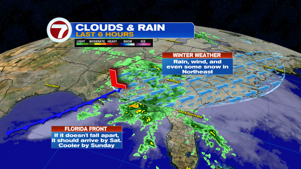
The duo is set to dump plenty of rain from Northern Florida, reaching the Mid Atlantic States and finally New England over the weekend. Some spotty snow may be seen there.
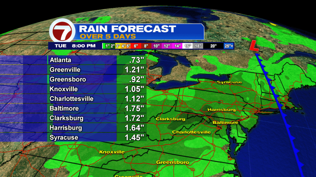
Take a look at some of the rain totals expected, anywhere from three quarters of an inch to better than an inch and a quarter.
Friday Heat
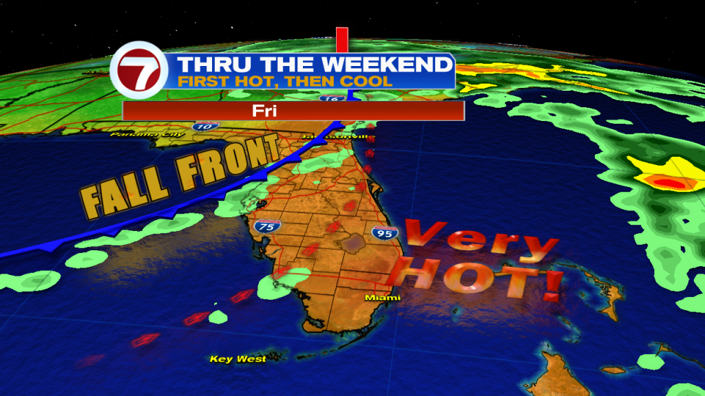
As the front begins to enter the state, the winds ahead of it will come out of the South/Southwest. This will drag in plenty of tropical heat. It will feel more like Summer than Fall.
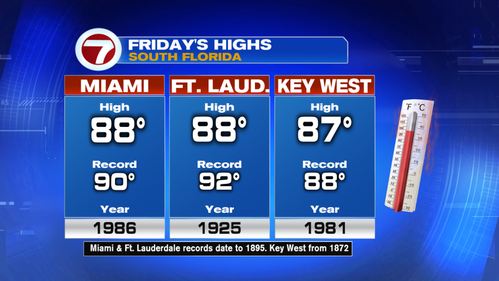
It will be so steamy that our forecast highs could rival records in Miami and Key West!
Cooler Temps
On Saturday, as the front approaches, the temps will still be on the warm side. Some rainfall is possible until the front arrives late in the day.
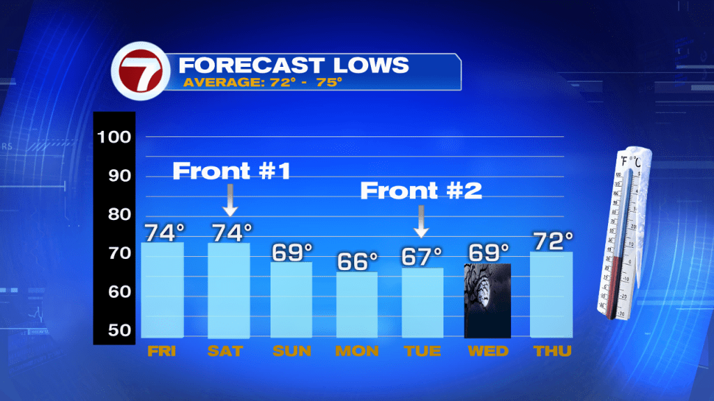
The cooler temps slide in Saturday night, while a secondary push of cool air arrives by early next week, keeping our overnight lows in the 60s through Halloween. Then we go back to hot. And if that doesn’t scare you…..
Tropical Activity
 An area of low pressure in the Mid Atlantic Ocean has an extremely high chance for developing at any time over the next 5 days.
NHC is giving it a 90% chance that it could form in the area highlighted in Red.
It will travel north over the next few days into an area favorable for growth due to light upper winds.

If it does develop, it will remain stuck between high pressure systems to the East and West.
It has only one path to take and that is north into the cold waters of the Northern Atlantic, also known as the Hurricane Graveyard.
Only a concern for Bermuda.