Happy Saturday, South Florida!
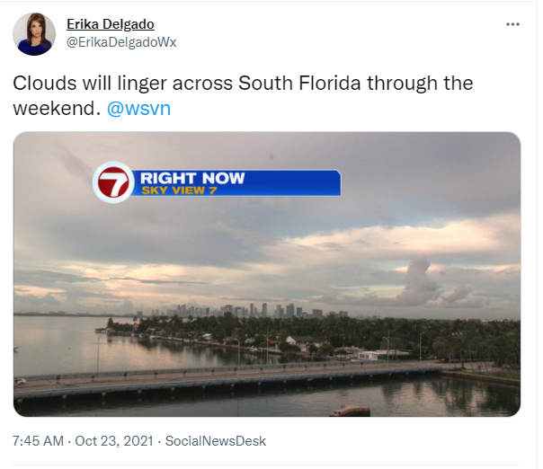
Hopefully everyone had a great week! Our work week started off with very nice conditions, low humidity and beautiful blue skies. But unfortunately Friday brought an end to the nice weather where we saw flooding rainfall across all of South Florida. And unfortunately for us, it looks like we will remain in this soggy and stormy weather pattern. This morning we already woke up to cloudy conditions and a few showers & thunderstorms coming in off the Atlantic and that should continue on & off.
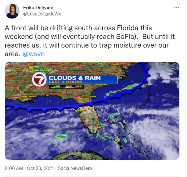
So why was it so rainy and stormy on Friday after so many nice days? Well for one, we have deep tropical moisture pushing into our area from the South and that has helped increase the available moisture for showers and thunderstorms in South Florida. At the same time, we have another front slowly drifting south across our state. Before that front reaches us, it will help trap all of that moisture over our area through the weekend. And even worse, the steering flow (the winds that steer thunderstorms) will remain very light. This means that thunderstorms will not be moving all too quickly.
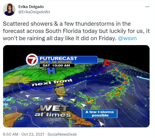
Similar to yesterday, we are expecting a high chance for rain and a few thunderstorms in the forecast. And because of the cloud cover and the high rain chances, our afternoon high temperatures will likely remain in the mid to lower 80s. Of course, that doesn’t mean we are expecting nice conditions with temperatures below average. Because after all, humidity levels will remain very high once again today. With any thunderstorms that do develop, we could see some gusty winds and plenty of lightning in our area. Flooding will once again continue to be a concern since the ground is already saturated from Friday’s rain event.
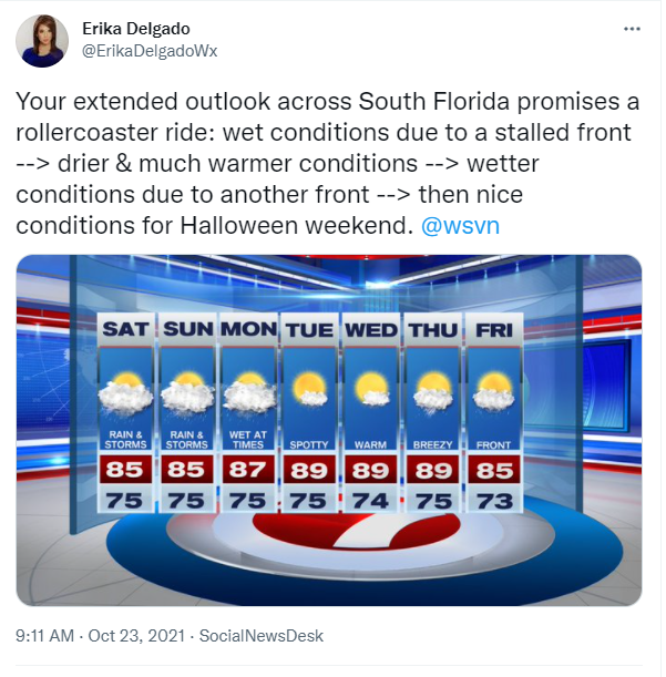
The latter part of the weekend promises no changes and very similar conditions to what we’re expecting today. Mostly cloudy skies, on and off rain (at times heavy rain) and scattered thunderstorms across our area. Gusty winds and lightning will once again accompany any thunderstorms that do develop on Sunday. And because of all the rain we already saw on Friday and the rain we are expecting today, flooding will continue to remain a big concern across South Florida.

The models are suggesting that Monday may still be wet at times. With a front nearby, showers and thunderstorms will continue to be possible and of course the rain may be heavy at times. But then some nice changes look to work back into our area by Tuesday and Wednesday. This is because the front that will be over us through much of the weekend will finally push south of us and allow for some drier air to move in across South Florida. However, by the middle of the workweek our surface winds will once again be out of the South to Southwest and this will allow our temperatures to shoot up into the upper 80s. So after a few soggy and stormy days here in South Florida, we can once again expect more of an early ‘Summer feel’ as far as our temperatures are concerned. As we head into the end of the work week, it looks like another front (and a potentially stronger one at that) may actually reach South Florida before the start of the next weekend.
Have a great weekend!
Erika Delgado – Meteorologist
WSVN Channel 7 News
Copyright 2024 Sunbeam Television Corp. All rights reserved. This material may not be published, broadcast, rewritten or redistributed.