(CNN) — To get an idea of just how drastically lava flows have scorched the areas surrounding Hawaii’s Kilauea volcano, take a look at these satellite images from DigitalGlobe.
Tall trees and lush jungle lined parts Luana Street in Leilani Estate before the lava flows. Now, volcanic rock covers asphalt; homes and the vegetation have turned to ash; and burnt trees lie on their sides like toothpicks.
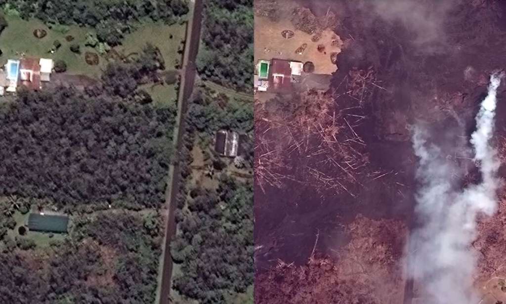
Further east on Hawaii Highway 132, vast swaths of greenery are blistered black as a long scar oozes lava.
As Leilani Avenue curves west, the satellite images shows smoke wafting off a lava flow. It clean through Kaupili Street. Another, much larger lava flow is just dozens of feet away.
A look at the southeastern corner of Leilani Estates shows just how lucky some residents have been in escaping damage. Some houses dotting the landscape are only feet away from the lava’s reach.
This week, the US Geological Survey issued a red alert, meaning that a major eruption of the Kilauea volcano is imminent or underway. They say a phreatic eruption could happen, sending ash plumes as far as 12 miles from the summit crater.
Residents also have to worry about sulfur dioxide gases emitted from the lava flows.
The-CNN-Wire™ & © 2024 Cable News Network, Inc., a Time Warner Company. All rights reserved.