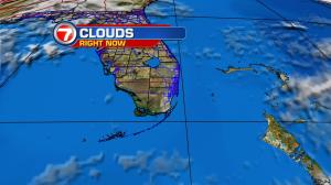
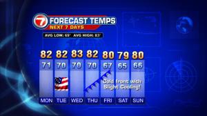
As high pressure strengthens over the eastern states, Florida will feel the effects of surging winds on Monday. The ramp in wind speeds will peak Monday afternoon and through the night, before decreasing on Election Day. Until that happens, gusty conditions are likely. Boating advisories have been issued along with alerts for dangerous rip currents for Florida’s Atlantic beaches. More clouds will also straggle in from the waters… coupled with fast-moving showers in spots (mainly for coastal areas). By the middle of the week, things will settle down and our weather will turn nice and seasonal. Then, the next noteworthy change will come toward the end of the work week. Forecast maps show a cold front moving into Florida and easing southward. If the boundary holds, we may get some slight cooling of about 5 degrees. That should add to comfort levels! You may begin to detect “less humid” and milder air by Veterans Day, on Friday. Stay tuned.