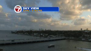
Last week was a sneak preview of summertime in south Florida. This week? It’s classic spring! While temperatures didn’t change much during the time frame, the main difference is related to humidity and rain. We had both (last week) but now neither is a factor. Here’s a look at downtown Miami with a few clouds around sunset.
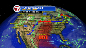
On the big view of the weather map, it’s easy to see that the most quiet section of the country is across the southeast. High pressure will hold a continued grip from the western Atlantic into Florida and the region. Even though we’re getting winds off the ocean, most of the “better moisture” is quite far south. Since we’re along the base of the high, a few minimal showers could rotate from east to west, but most places will stay dry.
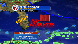
The holiday weekend is almost here and our weather pattern looks very familiar. High pressure will remain in charge (with a front dying to our northeast). The overall set up will last through Memorial Day with warm and breezy conditions, while only modest humidity hangs around. If you’re planning a trip to the beach, there’s a high risk of rip currents (so you may want to avoid getting into the water, to stay safe).